Mcginnis Meadows Reservoir dam

Mcginnis Meadows Reservoir
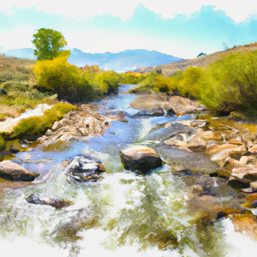
Mcginnis Meadows Reservoir in Colorado is a Federal-owned water resource managed by the USDA Forest Service. Completed in 1944, this earth dam stands at 18 feet high and stretches 250 feet in length, with a storage capacity of 200 acre-feet. The reservoir is primarily used for recreation purposes, offering visitors a tranquil spot for fishing and boating activities.
Situated in Buford, Garfield County, the reservoir is fed by the East Fork Skinny Fish Creek and is regulated by the Colorado Department of Water Resources. With a maximum discharge of 300 cubic feet per second and an uncontrolled spillway width of 10 feet, the dam presents a significant hazard potential, although its overall risk assessment is moderate. The last inspection in August 2017 revealed no specific condition rating, but the dam's emergency action plan and risk management measures are yet to be fully assessed and implemented.
For water resource and climate enthusiasts, Mcginnis Meadows Reservoir offers a fascinating case study in dam management and risk assessment. With its remote location and scenic surroundings, the reservoir provides a valuable recreational resource while posing challenges in maintaining safety and compliance with regulatory standards. Further research and monitoring efforts may be needed to ensure the long-term sustainability of this vital water infrastructure in Colorado.
Plan around the weather
Same NOAA / yr.no feed Snoflo's iOS app uses. Watch the precipitation column on the meteogram -- rain on the basin upstream typically lifts inflow 24-72 hours later.
Next 5 days, hour by hour
Temperature line with weather symbols on top, snow + rain accumulation as columns, humidity as a dotted line.
5-day forecast table
Every 3 hours, broken out across temperature, snow, rain, humidity, and wind. Each cell is colour-coded relative to the column min/max.
| Time | Condition | Temp (°F) | Snow (in) | Rain (in) | Humidity (%) | Wind (mps) | Wind dir |
|---|---|---|---|---|---|---|---|
| Loading detailed forecast… | |||||||
15-day temperature & precipitation
Daily temperatures, snow, and rain projected over the next two weeks.
Nearby streamflow gauges
USGS streamgauges around Mcginnis Meadows Reservoir -- inflows here typically show up in storage 24-72 hours later.
| Streamgauge | Discharge | View |
|---|---|---|
| Yampa River Above Stagecoach Reservoir | 6 cfs | → |
| White River Below North Elk Creek Near Buford | 204 cfs | → |
| Yampa River Below Stagecoach Reservoir | 30 cfs | → |
| Colorado River Near Dotsero | 1,340 cfs | → |
| Eagle River Below Gypsum | 114 cfs | → |
| White River Above Coal Creek | 154 cfs | → |
Make a day of it
Boat launches, lakeside camping, fishing access, and other reservoirs near Mcginnis Meadows Reservoir.
Boat launches
See all →


Campgrounds
See all →


Fishing spots
See all →


River runs
See all →


About Mcginnis Meadows Reservoir
Where does the data for Mcginnis Meadows Reservoir come from?
Structural and regulatory data come from the U.S. Army Corps of Engineers' National Inventory of Dams (NID). Weather forecast comes from NOAA / yr.no -- the same feed Snoflo's iOS app uses.
How often is the report updated?
NID structural data refreshes annually as the Corps publishes updated assessments. The weather forecast refreshes throughout the day.
What does the Significant hazard rating mean?
The Corps of Engineers' hazard potential classification grades probable consequences if the dam fails: High = probable loss of human life; Significant = no probable loss of human life but possible economic loss / environmental damage; Low = no probable loss of human life, only minor economic / environmental losses. See the Dam Data Reference card below for the full definitions.
What's "% of normal"?
The current storage value compared to the historical average storage on this calendar day. 100% = right on average; values above 100% mean above-normal storage (wet year); values below mean below-normal (dry year or drought).
Can I get alerts when storage crosses a threshold?
Yes -- alerts are managed in the Snoflo iOS app. Favorite this dam, set a threshold, and you'll get a push the moment conditions cross.
Dam data reference
Condition Assessment
- Satisfactory
- No existing or potential dam safety deficiencies are recognized. Acceptable performance is expected under all loading conditions (static, hydrologic, seismic) in accordance with the minimum applicable state or federal regulatory criteria or tolerable risk guidelines.
- Fair
- No existing dam safety deficiencies are recognized for normal operating conditions. Rare or extreme hydrologic and/or seismic events may result in a dam safety deficiency. Risk may be in the range to take further action.
- Poor
- A dam safety deficiency is recognized for normal operating conditions which may realistically occur. Remedial action is necessary. POOR may also be used when uncertainties exist as to critical analysis parameters which identify a potential dam safety deficiency.
- Unsatisfactory
- A dam safety deficiency is recognized that requires immediate or emergency remedial action for problem resolution.
- Not Rated
- The dam has not been inspected, is not under state or federal jurisdiction, or has been inspected but, for whatever reason, has not been rated.
Hazard Potential Classification
- High
- Dams assigned the high hazard potential classification are those where failure or mis-operation will probably cause loss of human life.
- Significant
- Dams assigned the significant hazard potential classification are those dams where failure or mis-operation results in no probable loss of human life but can cause economic loss, environmental damage, disruption of lifeline facilities, or impact other concerns. Significant hazard potential classification dams are often located in predominantly rural or agricultural areas but could be in areas with population and significant infrastructure.
- Low
- Dams assigned the low hazard potential classification are those where failure or mis-operation results in no probable loss of human life and low economic and/or environmental losses. Losses are principally limited to the owner's property.
- Undetermined
- Dams for which a downstream hazard potential has not been designated or is not provided.