Snyder Dam

Snyder
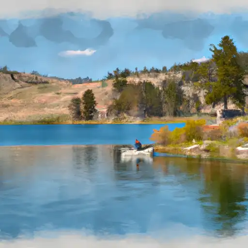
Snyder is a privately owned earth dam located in Park, Wyoming, along an unnamed gulch. Completed in 2000, this irrigation dam stands at a height of 18 feet and has a storage capacity of 150 acre-feet, serving multiple purposes including fish and wildlife pond, flood risk reduction, and irrigation. The dam has a spillway width of 16 feet and is equipped with other controlled outlet gates, with a low hazard potential and a satisfactory condition assessment.
Situated in Congressional District 00, Wyoming, Snyder plays a crucial role in managing water resources in the area, with a drainage area of 3.4 square miles and a maximum discharge of 78 cubic feet per second. Despite being a moderate risk structure, Snyder has not undergone any modifications since its completion and is subject to regular inspections to ensure its continued safety and functionality. With Liz Cheney (R) as the representative for the district, Snyder remains an important asset for water supply and management in the region.
Overall, Snyder stands as a testament to effective water resource management, providing essential services such as irrigation and flood risk reduction. With a low hazard potential and satisfactory condition assessment, this privately owned dam continues to contribute to the sustainable use of water resources in Park, Wyoming, highlighting the importance of maintaining and monitoring infrastructure for climate resilience and water security in the region.
Plan around the weather
Same NOAA / yr.no feed Snoflo's iOS app uses. Watch the precipitation column on the meteogram -- rain on the basin upstream typically lifts inflow 24-72 hours later.
Next 5 days, hour by hour
Temperature line with weather symbols on top, snow + rain accumulation as columns, humidity as a dotted line.
5-day forecast table
Every 3 hours, broken out across temperature, snow, rain, humidity, and wind. Each cell is colour-coded relative to the column min/max.
| Time | Condition | Temp (°F) | Snow (in) | Rain (in) | Humidity (%) | Wind (mps) | Wind dir |
|---|---|---|---|---|---|---|---|
| Loading detailed forecast… | |||||||
15-day temperature & precipitation
Daily temperatures, snow, and rain projected over the next two weeks.
Nearby streamflow gauges
USGS streamgauges around Snyder -- inflows here typically show up in storage 24-72 hours later.
| Streamgauge | Discharge | View |
|---|---|---|
| Greybull River At Meeteetse | 338 cfs | → |
| Shoshone River Below Buffalo Bill Reservoir | 315 cfs | → |
| South Fork Shoshone River Ab Buffalo Bill Res | 641 cfs | → |
| Bighorn River At Basin | 677 cfs | → |
| Shoshone River Near Lovell | 663 cfs | → |
| Bighorn River At Kane | 782 cfs | → |


About Snyder
Where does the data for Snyder come from?
Structural and regulatory data come from the U.S. Army Corps of Engineers' National Inventory of Dams (NID). Weather forecast comes from NOAA / yr.no -- the same feed Snoflo's iOS app uses.
How often is the report updated?
NID structural data refreshes annually as the Corps publishes updated assessments. The weather forecast refreshes throughout the day.
What does the Low hazard rating mean?
The Corps of Engineers' hazard potential classification grades probable consequences if the dam fails: High = probable loss of human life; Significant = no probable loss of human life but possible economic loss / environmental damage; Low = no probable loss of human life, only minor economic / environmental losses. See the Dam Data Reference card below for the full definitions.
What's "% of normal"?
The current storage value compared to the historical average storage on this calendar day. 100% = right on average; values above 100% mean above-normal storage (wet year); values below mean below-normal (dry year or drought).
Can I get alerts when storage crosses a threshold?
Yes -- alerts are managed in the Snoflo iOS app. Favorite this dam, set a threshold, and you'll get a push the moment conditions cross.
Dam data reference
Condition Assessment
- Satisfactory
- No existing or potential dam safety deficiencies are recognized. Acceptable performance is expected under all loading conditions (static, hydrologic, seismic) in accordance with the minimum applicable state or federal regulatory criteria or tolerable risk guidelines.
- Fair
- No existing dam safety deficiencies are recognized for normal operating conditions. Rare or extreme hydrologic and/or seismic events may result in a dam safety deficiency. Risk may be in the range to take further action.
- Poor
- A dam safety deficiency is recognized for normal operating conditions which may realistically occur. Remedial action is necessary. POOR may also be used when uncertainties exist as to critical analysis parameters which identify a potential dam safety deficiency.
- Unsatisfactory
- A dam safety deficiency is recognized that requires immediate or emergency remedial action for problem resolution.
- Not Rated
- The dam has not been inspected, is not under state or federal jurisdiction, or has been inspected but, for whatever reason, has not been rated.
Hazard Potential Classification
- High
- Dams assigned the high hazard potential classification are those where failure or mis-operation will probably cause loss of human life.
- Significant
- Dams assigned the significant hazard potential classification are those dams where failure or mis-operation results in no probable loss of human life but can cause economic loss, environmental damage, disruption of lifeline facilities, or impact other concerns. Significant hazard potential classification dams are often located in predominantly rural or agricultural areas but could be in areas with population and significant infrastructure.
- Low
- Dams assigned the low hazard potential classification are those where failure or mis-operation results in no probable loss of human life and low economic and/or environmental losses. Losses are principally limited to the owner's property.
- Undetermined
- Dams for which a downstream hazard potential has not been designated or is not provided.