Blue Springs East Lake Dam Dam

Blue Springs East Lake Dam
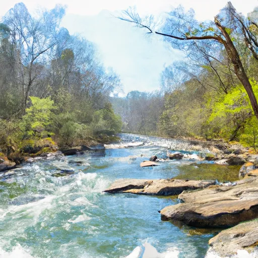
Blue Springs East Lake Dam, located in Ringgold, Georgia, was completed in 1951 for the primary purpose of recreation. This earth dam, with a height of 10.1 feet and a storage capacity of 99 acre-feet, spans 3430 feet along the Blue Spring Branch. Despite being privately owned and not regulated by the state, the dam has a low hazard potential and a moderate risk assessment rating.
The dam features an uncontrolled spillway and outlet gates, making it a vital structure for managing water flow in the area. While the condition assessment is currently unrated, the risk management measures in place ensure the safety and integrity of the dam. With a surface area of 16.4 acres, the dam provides not only recreational opportunities but also serves as a critical component in the local water resource management system.
For water resource and climate enthusiasts, Blue Springs East Lake Dam offers a fascinating glimpse into the intersection of human infrastructure and natural ecosystems. Its construction and management exemplify the balance between recreation and conservation, highlighting the importance of sustainable practices in maintaining a healthy watershed. As discussions around climate change and water scarcity continue to evolve, understanding the role of dams like Blue Springs East Lake Dam becomes increasingly essential in ensuring the long-term resilience of our water resources.
Plan around the weather
Same NOAA / yr.no feed Snoflo's iOS app uses. Watch the precipitation column on the meteogram -- rain on the basin upstream typically lifts inflow 24-72 hours later.
Next 5 days, hour by hour
Temperature line with weather symbols on top, snow + rain accumulation as columns, humidity as a dotted line.
5-day forecast table
Every 3 hours, broken out across temperature, snow, rain, humidity, and wind. Each cell is colour-coded relative to the column min/max.
| Time | Condition | Temp (°F) | Snow (in) | Rain (in) | Humidity (%) | Wind (mps) | Wind dir |
|---|---|---|---|---|---|---|---|
| Loading detailed forecast… | |||||||
15-day temperature & precipitation
Daily temperatures, snow, and rain projected over the next two weeks.
Nearby streamflow gauges
USGS streamgauges around Blue Springs East Lake Dam -- inflows here typically show up in storage 24-72 hours later.
| Streamgauge | Discharge | View |
|---|---|---|
| South Chickamauga Creek Near Chickamauga | 362 cfs | → |
| Lookout Creek Near New England | 40 cfs | → |
| Mill Creek At Dalton | 15 cfs | → |
| Conasauga River Near Eton | 302 cfs | → |
| Conasauga River At Tilton | 369 cfs | → |
| North Chickamauga Cr At Mile Straight | 2 cfs | → |
Make a day of it
Boat launches, lakeside camping, fishing access, and other reservoirs near Blue Springs East Lake Dam.
Boat launches
See all →


Campgrounds
See all →


Fishing spots
See all →


River runs
See all →


More reservoirs
See all →
About Blue Springs East Lake Dam
Where does the data for Blue Springs East Lake Dam come from?
Structural and regulatory data come from the U.S. Army Corps of Engineers' National Inventory of Dams (NID). Weather forecast comes from NOAA / yr.no -- the same feed Snoflo's iOS app uses.
How often is the report updated?
NID structural data refreshes annually as the Corps publishes updated assessments. The weather forecast refreshes throughout the day.
What does the Low hazard rating mean?
The Corps of Engineers' hazard potential classification grades probable consequences if the dam fails: High = probable loss of human life; Significant = no probable loss of human life but possible economic loss / environmental damage; Low = no probable loss of human life, only minor economic / environmental losses. See the Dam Data Reference card below for the full definitions.
What's "% of normal"?
The current storage value compared to the historical average storage on this calendar day. 100% = right on average; values above 100% mean above-normal storage (wet year); values below mean below-normal (dry year or drought).
Can I get alerts when storage crosses a threshold?
Yes -- alerts are managed in the Snoflo iOS app. Favorite this dam, set a threshold, and you'll get a push the moment conditions cross.
Dam data reference
Condition Assessment
- Satisfactory
- No existing or potential dam safety deficiencies are recognized. Acceptable performance is expected under all loading conditions (static, hydrologic, seismic) in accordance with the minimum applicable state or federal regulatory criteria or tolerable risk guidelines.
- Fair
- No existing dam safety deficiencies are recognized for normal operating conditions. Rare or extreme hydrologic and/or seismic events may result in a dam safety deficiency. Risk may be in the range to take further action.
- Poor
- A dam safety deficiency is recognized for normal operating conditions which may realistically occur. Remedial action is necessary. POOR may also be used when uncertainties exist as to critical analysis parameters which identify a potential dam safety deficiency.
- Unsatisfactory
- A dam safety deficiency is recognized that requires immediate or emergency remedial action for problem resolution.
- Not Rated
- The dam has not been inspected, is not under state or federal jurisdiction, or has been inspected but, for whatever reason, has not been rated.
Hazard Potential Classification
- High
- Dams assigned the high hazard potential classification are those where failure or mis-operation will probably cause loss of human life.
- Significant
- Dams assigned the significant hazard potential classification are those dams where failure or mis-operation results in no probable loss of human life but can cause economic loss, environmental damage, disruption of lifeline facilities, or impact other concerns. Significant hazard potential classification dams are often located in predominantly rural or agricultural areas but could be in areas with population and significant infrastructure.
- Low
- Dams assigned the low hazard potential classification are those where failure or mis-operation results in no probable loss of human life and low economic and/or environmental losses. Losses are principally limited to the owner's property.
- Undetermined
- Dams for which a downstream hazard potential has not been designated or is not provided.