Brownlee Dam

Brownlee
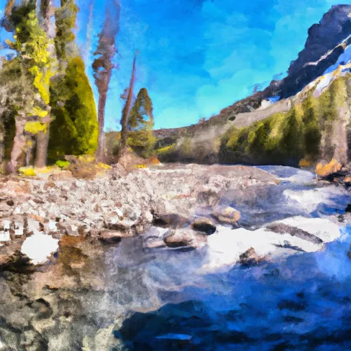
Brownlee Dam, located on the Snake River in Oxbow, Oregon, is a rockfill dam with a primary purpose of hydroelectric power generation. Completed in 1958, it stands at a height of 395 feet and has a storage capacity of 1,470,000 acre-feet. The dam also serves purposes such as flood risk reduction, navigation, and recreation, making it a crucial infrastructure for the region.
Managed by the Federal Energy Regulatory Commission, Brownlee Dam has a controlled spillway and seven Tainter gates for water discharge. With a high hazard potential and a very high risk assessment rating, the dam plays a vital role in water resource management and climate adaptation in the area. Despite its importance, the condition assessment of the dam is currently not available, highlighting the need for ongoing monitoring and maintenance to ensure its safety and functionality.
With its strategic location and multiple functions, Brownlee Dam is a key player in the water resource and climate landscape of Idaho and Oregon. As climate change continues to impact water availability and extreme weather events, the dam's role in flood control, energy production, and wildlife conservation becomes increasingly critical. As such, continued investment in monitoring, maintenance, and risk management measures will be essential to safeguard the dam's operation and the surrounding communities in the face of evolving climate challenges.
Plan around the weather
Same NOAA / yr.no feed Snoflo's iOS app uses. Watch the precipitation column on the meteogram -- rain on the basin upstream typically lifts inflow 24-72 hours later.
Next 5 days, hour by hour
Temperature line with weather symbols on top, snow + rain accumulation as columns, humidity as a dotted line.
5-day forecast table
Every 3 hours, broken out across temperature, snow, rain, humidity, and wind. Each cell is colour-coded relative to the column min/max.
| Time | Condition | Temp (°F) | Snow (in) | Rain (in) | Humidity (%) | Wind (mps) | Wind dir |
|---|---|---|---|---|---|---|---|
| Loading detailed forecast… | |||||||
15-day temperature & precipitation
Daily temperatures, snow, and rain projected over the next two weeks.
Nearby streamflow gauges
USGS streamgauges around Brownlee -- inflows here typically show up in storage 24-72 hours later.
| Streamgauge | Discharge | View |
|---|---|---|
| Weiser River Nr Cambridge Id | 81 cfs | → |
| Snake River At Hells Canyon Dam Id-Or State Line | 19,200 cfs | → |
| Crane Creek At Mouth Nr Weiser Id | 188 cfs | → |
| Nf Payette River At Mccall Id | 57 cfs | → |
| Weiser River Nr Weiser Id | 264 cfs | → |
| Snake River At Weiser Id | 6,520 cfs | → |


About Brownlee
Where does the data for Brownlee come from?
Structural and regulatory data come from the U.S. Army Corps of Engineers' National Inventory of Dams (NID). Weather forecast comes from NOAA / yr.no -- the same feed Snoflo's iOS app uses.
How often is the report updated?
NID structural data refreshes annually as the Corps publishes updated assessments. The weather forecast refreshes throughout the day.
What does the High hazard rating mean?
The Corps of Engineers' hazard potential classification grades probable consequences if the dam fails: High = probable loss of human life; Significant = no probable loss of human life but possible economic loss / environmental damage; Low = no probable loss of human life, only minor economic / environmental losses. See the Dam Data Reference card below for the full definitions.
What's "% of normal"?
The current storage value compared to the historical average storage on this calendar day. 100% = right on average; values above 100% mean above-normal storage (wet year); values below mean below-normal (dry year or drought).
Can I get alerts when storage crosses a threshold?
Yes -- alerts are managed in the Snoflo iOS app. Favorite this dam, set a threshold, and you'll get a push the moment conditions cross.
Dam data reference
Condition Assessment
- Satisfactory
- No existing or potential dam safety deficiencies are recognized. Acceptable performance is expected under all loading conditions (static, hydrologic, seismic) in accordance with the minimum applicable state or federal regulatory criteria or tolerable risk guidelines.
- Fair
- No existing dam safety deficiencies are recognized for normal operating conditions. Rare or extreme hydrologic and/or seismic events may result in a dam safety deficiency. Risk may be in the range to take further action.
- Poor
- A dam safety deficiency is recognized for normal operating conditions which may realistically occur. Remedial action is necessary. POOR may also be used when uncertainties exist as to critical analysis parameters which identify a potential dam safety deficiency.
- Unsatisfactory
- A dam safety deficiency is recognized that requires immediate or emergency remedial action for problem resolution.
- Not Rated
- The dam has not been inspected, is not under state or federal jurisdiction, or has been inspected but, for whatever reason, has not been rated.
Hazard Potential Classification
- High
- Dams assigned the high hazard potential classification are those where failure or mis-operation will probably cause loss of human life.
- Significant
- Dams assigned the significant hazard potential classification are those dams where failure or mis-operation results in no probable loss of human life but can cause economic loss, environmental damage, disruption of lifeline facilities, or impact other concerns. Significant hazard potential classification dams are often located in predominantly rural or agricultural areas but could be in areas with population and significant infrastructure.
- Low
- Dams assigned the low hazard potential classification are those where failure or mis-operation results in no probable loss of human life and low economic and/or environmental losses. Losses are principally limited to the owner's property.
- Undetermined
- Dams for which a downstream hazard potential has not been designated or is not provided.