Cacapon State Park Lake Dam

Cacapon State Park Lake
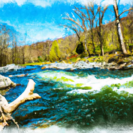
Cacapon State Park Lake, also known as Indian Run (Lower), is a stunning water resource nestled in the heart of West Virginia. Managed by the state and regulated by the Department of Environmental Protection, this recreational lake offers a tranquil escape for water and climate enthusiasts alike. Built in 1937, this rockfill dam stands at a height of 23 feet and has a storage capacity of 64.4 acre-feet, providing ample opportunity for outdoor activities and wildlife appreciation.
With a surface area of 6 acres and a normal storage capacity of 53.2 acre-feet, Cacapon State Park Lake is a popular destination for those seeking a peaceful retreat in nature. The dam's high hazard potential is closely monitored, with inspections conducted regularly to ensure its structural integrity and safety. Surrounded by the North, Middle, and South Forks of a nearby river, this picturesque lake offers a serene setting for fishing, boating, and hiking, making it a must-visit destination for water enthusiasts in the region.
For those interested in exploring the intersection of water resources and climate, Cacapon State Park Lake provides a valuable case study in sustainable recreation management. From its historical significance to its modern-day regulatory oversight, this scenic lake offers a rich tapestry of environmental stewardship practices and recreational opportunities. Whether you're drawn to its tranquil waters or its diverse wildlife habitat, Cacapon State Park Lake is sure to captivate the imagination of water and climate enthusiasts seeking a deeper understanding of our natural world.
Plan around the weather
Same NOAA / yr.no feed Snoflo's iOS app uses. Watch the precipitation column on the meteogram -- rain on the basin upstream typically lifts inflow 24-72 hours later.
Next 5 days, hour by hour
Temperature line with weather symbols on top, snow + rain accumulation as columns, humidity as a dotted line.
5-day forecast table
Every 3 hours, broken out across temperature, snow, rain, humidity, and wind. Each cell is colour-coded relative to the column min/max.
| Time | Condition | Temp (°F) | Snow (in) | Rain (in) | Humidity (%) | Wind (mps) | Wind dir |
|---|---|---|---|---|---|---|---|
| Loading detailed forecast… | |||||||
15-day temperature & precipitation
Daily temperatures, snow, and rain projected over the next two weeks.
Nearby streamflow gauges
USGS streamgauges around Cacapon State Park Lake -- inflows here typically show up in storage 24-72 hours later.
| Streamgauge | Discharge | View |
|---|---|---|
| Cacapon River Near Great Cacapon | 112 cfs | → |
| Potomac River At Paw Paw | 1,290 cfs | → |
| Sideling Hill Creek Near Bellegrove | 10 cfs | → |
| Back Creek Near Jones Springs | 13 cfs | → |
| Town Creek Near Oldtown | 29 cfs | → |
| Potomac River At Hancock | 1,570 cfs | → |
Make a day of it
Boat launches, lakeside camping, fishing access, and other reservoirs near Cacapon State Park Lake.
Boat launches
See all →


Campgrounds
See all →


Fishing spots
See all →


River runs
See all →


About Cacapon State Park Lake
Where does the data for Cacapon State Park Lake come from?
Structural and regulatory data come from the U.S. Army Corps of Engineers' National Inventory of Dams (NID). Weather forecast comes from NOAA / yr.no -- the same feed Snoflo's iOS app uses.
How often is the report updated?
NID structural data refreshes annually as the Corps publishes updated assessments. The weather forecast refreshes throughout the day.
What does the High hazard rating mean?
The Corps of Engineers' hazard potential classification grades probable consequences if the dam fails: High = probable loss of human life; Significant = no probable loss of human life but possible economic loss / environmental damage; Low = no probable loss of human life, only minor economic / environmental losses. See the Dam Data Reference card below for the full definitions.
What's "% of normal"?
The current storage value compared to the historical average storage on this calendar day. 100% = right on average; values above 100% mean above-normal storage (wet year); values below mean below-normal (dry year or drought).
Can I get alerts when storage crosses a threshold?
Yes -- alerts are managed in the Snoflo iOS app. Favorite this dam, set a threshold, and you'll get a push the moment conditions cross.
Dam data reference
Condition Assessment
- Satisfactory
- No existing or potential dam safety deficiencies are recognized. Acceptable performance is expected under all loading conditions (static, hydrologic, seismic) in accordance with the minimum applicable state or federal regulatory criteria or tolerable risk guidelines.
- Fair
- No existing dam safety deficiencies are recognized for normal operating conditions. Rare or extreme hydrologic and/or seismic events may result in a dam safety deficiency. Risk may be in the range to take further action.
- Poor
- A dam safety deficiency is recognized for normal operating conditions which may realistically occur. Remedial action is necessary. POOR may also be used when uncertainties exist as to critical analysis parameters which identify a potential dam safety deficiency.
- Unsatisfactory
- A dam safety deficiency is recognized that requires immediate or emergency remedial action for problem resolution.
- Not Rated
- The dam has not been inspected, is not under state or federal jurisdiction, or has been inspected but, for whatever reason, has not been rated.
Hazard Potential Classification
- High
- Dams assigned the high hazard potential classification are those where failure or mis-operation will probably cause loss of human life.
- Significant
- Dams assigned the significant hazard potential classification are those dams where failure or mis-operation results in no probable loss of human life but can cause economic loss, environmental damage, disruption of lifeline facilities, or impact other concerns. Significant hazard potential classification dams are often located in predominantly rural or agricultural areas but could be in areas with population and significant infrastructure.
- Low
- Dams assigned the low hazard potential classification are those where failure or mis-operation results in no probable loss of human life and low economic and/or environmental losses. Losses are principally limited to the owner's property.
- Undetermined
- Dams for which a downstream hazard potential has not been designated or is not provided.