


Slaughter Flood Control Dam Reservoir Report
Last Updated: May 1, 2026
°F
°F
mph
Wind
%
Humidity
Slaughter Flood Control Dam, located in McGregor, Iowa, is a crucial structure designed by the USDA NRCS to mitigate flood risks along the TR-Mississippi River.
Summary
Completed in 1938, this earth dam stands at 41 feet tall and spans 257 feet, with a storage capacity of 26 acre-feet. Managed by the local government and regulated by the Iowa DNR, the dam plays a key role in protecting the surrounding area from potential flooding events.
Despite being classified as having a high hazard potential, the dam is currently assessed to be in fair condition, with the last inspection conducted in June 2019. Recognized as a vital component in flood risk reduction efforts, Slaughter Flood Control Dam serves as a critical line of defense for the residents of Clayton County, Iowa. With its uncontrolled spillway and rock-soil foundation, the dam continues to be monitored and maintained to ensure its effectiveness in safeguarding the community from the impacts of extreme weather events.
Enthusiasts of water resources and climate resilience will find Slaughter Flood Control Dam to be a fascinating example of engineering ingenuity and strategic infrastructure planning. As part of the St. Paul District's portfolio, this dam stands as a testament to the ongoing efforts to balance the needs of flood control with environmental conservation in the region. With its historical significance and ongoing maintenance efforts, the dam represents a beacon of hope for communities facing the unpredictable challenges of a changing climate.
Regional Streamflow Levels
 Mississippi River At Mcgregor
|
21700cfs |
 Bloody Run Creek Near Marquette
|
32cfs |
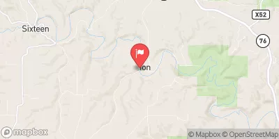 Yellow River At Ion
|
356cfs |
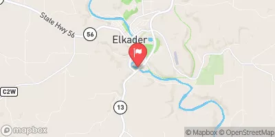 Turkey River Above French Hollow Cr At Elkader
|
1310cfs |
 Turkey River At Garber
|
1980cfs |
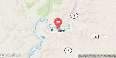 Kickapoo River At Steuben
|
785cfs |
15-Day Long Term Forecast
Year Completed |
1938 |
Dam Length |
257 |
Dam Height |
41 |
River Or Stream |
TR-MISSISSIPPI RIVER |
Primary Dam Type |
Earth |
Drainage Area |
0.16 |
Nid Storage |
26 |
Hazard Potential |
High |
Foundations |
Rock, Soil |
Nid Height |
41 |
Seasonal Comparison
5-Day Hourly Forecast Detail
Dam Data Reference
Condition Assessment
SatisfactoryNo existing or potential dam safety deficiencies are recognized. Acceptable performance is expected under all loading conditions (static, hydrologic, seismic) in accordance with the minimum applicable state or federal regulatory criteria or tolerable risk guidelines.
Fair
No existing dam safety deficiencies are recognized for normal operating conditions. Rare or extreme hydrologic and/or seismic events may result in a dam safety deficiency. Risk may be in the range to take further action. Note: Rare or extreme event is defined by the regulatory agency based on their minimum
Poor A dam safety deficiency is recognized for normal operating conditions which may realistically occur. Remedial action is necessary. POOR may also be used when uncertainties exist as to critical analysis parameters which identify a potential dam safety deficiency. Investigations and studies are necessary.
Unsatisfactory
A dam safety deficiency is recognized that requires immediate or emergency remedial action for problem resolution.
Not Rated
The dam has not been inspected, is not under state or federal jurisdiction, or has been inspected but, for whatever reason, has not been rated.
Not Available
Dams for which the condition assessment is restricted to approved government users.
Hazard Potential Classification
HighDams assigned the high hazard potential classification are those where failure or mis-operation will probably cause loss of human life.
Significant
Dams assigned the significant hazard potential classification are those dams where failure or mis-operation results in no probable loss of human life but can cause economic loss, environment damage, disruption of lifeline facilities, or impact other concerns. Significant hazard potential classification dams are often located in predominantly rural or agricultural areas but could be in areas with population and significant infrastructure.
Low
Dams assigned the low hazard potential classification are those where failure or mis-operation results in no probable loss of human life and low economic and/or environmental losses. Losses are principally limited to the owner's property.
Undetermined
Dams for which a downstream hazard potential has not been designated or is not provided.
Not Available
Dams for which the downstream hazard potential is restricted to approved government users.
Area Campgrounds
 Bloody Run Park
 Bloody Run Campground
 Pikes Peak State Park
 Wyalusing State Park Campground
 Spook Cave Campground
 Yogi Bear Jelly Stone Campground
 Mississippi River -- Campion Landing
River Runs
-
 Western Boundary Of Effigy Mounds National Monument To Boundary Of Effigy Mounds National Monument
-
 The Big Green River
To The River'S Mouth At The Mississippi River
The Big Green River
To The River'S Mouth At The Mississippi River
-
 The "Lower" Dam, Near The Confluence Of Coon Creek To Lane'S Bridge
-
 The Town Of Bluffton To The "Lower" Dam, Near The Confluence Of Coon Creek
-
 Lone Rock
To The Confluence Of The Green And Wisconsin Rivers
Lone Rock
To The Confluence Of The Green And Wisconsin Rivers
-
 The Minnesota-Iowa State Border To Ends Near The Town Of Bluffton, Iowa
 Buck Creek
 Little Paint Creek
 Hickory Creek
 South Cedar Creek
 Mink Creek