Mad Dam

Mad Dam
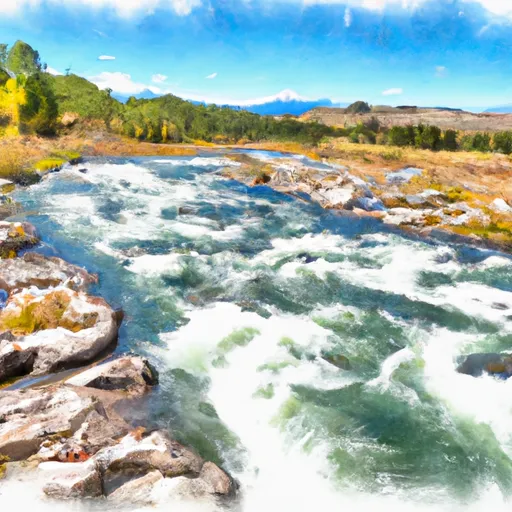
Mad Dam, also known as Loberg Dam, is a private-owned structure located in Judith Basin, Montana, along the TR-ARROW CREEK river. Constructed in 1955 by the USDA NRCS, this earth dam stands at a height of 26 feet with a hydraulic height of 22 feet, serving primarily for irrigation purposes. With a storage capacity of 60 acre-feet, the dam has a low hazard potential and is not currently rated for its condition.
Managed by the DNRC, Mad Dam is subject to state regulations, inspections, and enforcement, ensuring its safety and compliance with standards. Although the dam has not been assessed for its condition recently, it remains a vital part of the local water resource infrastructure. The dam's spillway width of 50 feet and maximum discharge of 300 cubic feet per second contribute to its functionality and efficiency in water management.
For water resource and climate enthusiasts, Mad Dam presents an interesting case study of a privately-owned irrigation dam in Montana. Its historical significance, engineering design, and regulatory oversight provide valuable insights into the intersection of water management, infrastructure development, and environmental stewardship. As the dam continues to play a crucial role in supporting agricultural activities in the region, monitoring its condition and performance remains essential for ensuring the safety and sustainability of water resources in the area.
Plan around the weather
Same NOAA / yr.no feed Snoflo's iOS app uses. Watch the precipitation column on the meteogram -- rain on the basin upstream typically lifts inflow 24-72 hours later.
Next 5 days, hour by hour
Temperature line with weather symbols on top, snow + rain accumulation as columns, humidity as a dotted line.
5-day forecast table
Every 3 hours, broken out across temperature, snow, rain, humidity, and wind. Each cell is colour-coded relative to the column min/max.
| Time | Condition | Temp (°F) | Snow (in) | Rain (in) | Humidity (%) | Wind (mps) | Wind dir |
|---|---|---|---|---|---|---|---|
| Loading detailed forecast… | |||||||
15-day temperature & precipitation
Daily temperatures, snow, and rain projected over the next two weeks.
Nearby streamflow gauges
USGS streamgauges around Mad Dam -- inflows here typically show up in storage 24-72 hours later.
| Streamgauge | Discharge | View |
|---|---|---|
| Belt Creek Near Monarch Mt | 119 cfs | → |
| Missouri River Near Great Falls Mt | 4,420 cfs | → |
| Missouri River At Fort Benton Mt | 4,860 cfs | → |
| Missouri River Near Ulm Mt | 3,320 cfs | → |
| Smith River Near Eden Mt | 123 cfs | → |
| Teton River At Loma Mt | 7 cfs | → |


About Mad Dam
Where does the data for Mad Dam come from?
Structural and regulatory data come from the U.S. Army Corps of Engineers' National Inventory of Dams (NID). Weather forecast comes from NOAA / yr.no -- the same feed Snoflo's iOS app uses.
How often is the report updated?
NID structural data refreshes annually as the Corps publishes updated assessments. The weather forecast refreshes throughout the day.
What does the Low hazard rating mean?
The Corps of Engineers' hazard potential classification grades probable consequences if the dam fails: High = probable loss of human life; Significant = no probable loss of human life but possible economic loss / environmental damage; Low = no probable loss of human life, only minor economic / environmental losses. See the Dam Data Reference card below for the full definitions.
What's "% of normal"?
The current storage value compared to the historical average storage on this calendar day. 100% = right on average; values above 100% mean above-normal storage (wet year); values below mean below-normal (dry year or drought).
Can I get alerts when storage crosses a threshold?
Yes -- alerts are managed in the Snoflo iOS app. Favorite this dam, set a threshold, and you'll get a push the moment conditions cross.
Dam data reference
Condition Assessment
- Satisfactory
- No existing or potential dam safety deficiencies are recognized. Acceptable performance is expected under all loading conditions (static, hydrologic, seismic) in accordance with the minimum applicable state or federal regulatory criteria or tolerable risk guidelines.
- Fair
- No existing dam safety deficiencies are recognized for normal operating conditions. Rare or extreme hydrologic and/or seismic events may result in a dam safety deficiency. Risk may be in the range to take further action.
- Poor
- A dam safety deficiency is recognized for normal operating conditions which may realistically occur. Remedial action is necessary. POOR may also be used when uncertainties exist as to critical analysis parameters which identify a potential dam safety deficiency.
- Unsatisfactory
- A dam safety deficiency is recognized that requires immediate or emergency remedial action for problem resolution.
- Not Rated
- The dam has not been inspected, is not under state or federal jurisdiction, or has been inspected but, for whatever reason, has not been rated.
Hazard Potential Classification
- High
- Dams assigned the high hazard potential classification are those where failure or mis-operation will probably cause loss of human life.
- Significant
- Dams assigned the significant hazard potential classification are those dams where failure or mis-operation results in no probable loss of human life but can cause economic loss, environmental damage, disruption of lifeline facilities, or impact other concerns. Significant hazard potential classification dams are often located in predominantly rural or agricultural areas but could be in areas with population and significant infrastructure.
- Low
- Dams assigned the low hazard potential classification are those where failure or mis-operation results in no probable loss of human life and low economic and/or environmental losses. Losses are principally limited to the owner's property.
- Undetermined
- Dams for which a downstream hazard potential has not been designated or is not provided.