Powell Pond Dam dam

Powell Pond Dam
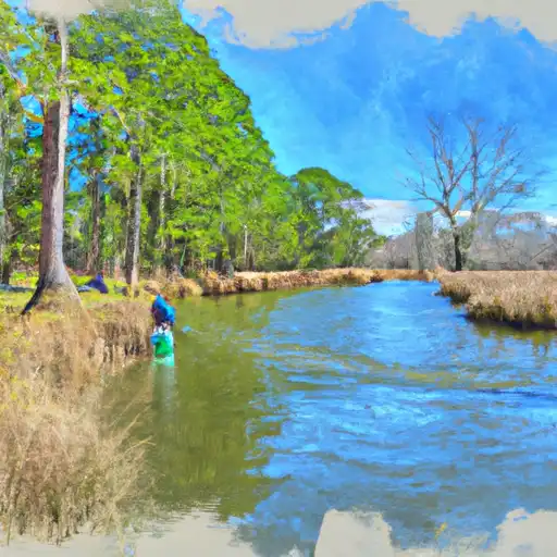
Powell Pond Dam is a private earth dam located in Caldwell, North Carolina, serving primarily for fire protection, stock, and small fish pond purposes. This dam, with a hydraulic height of 21 feet and a structural height of 24 feet, is situated between UT to Zacks Fork Creek (C) and has a storage capacity of 12 acre-feet. Although not regulated by the state, Powell Pond Dam has been inspected and deemed to have a significant hazard potential and fair condition assessment as of May 2013.
Despite lacking certain regulatory oversight, Powell Pond Dam remains a crucial water resource structure in the area, with a surface area of 1.5 acres and drainage area of 40 square miles. The dam, completed at an unknown year, plays a vital role in providing essential water resources for fire protection and supporting local wildlife through its small fish pond function. With a last inspection date in May 2013, efforts to ensure the dam's safety and functionality are ongoing to mitigate potential risks associated with its significant hazard potential.
As water resource and climate enthusiasts, the unique characteristics of Powell Pond Dam, such as its location, purpose, and condition assessment, make it an intriguing structure to monitor and study. The dam's association with the Nashville District of the US Army Corps of Engineers highlights its importance in local water management efforts. With a focus on fire protection and small-scale ecological support, Powell Pond Dam represents a valuable asset in the region's water infrastructure, warranting continued attention and maintenance to ensure its long-term sustainability and safety.
Plan around the weather
Same NOAA / yr.no feed Snoflo's iOS app uses. Watch the precipitation column on the meteogram -- rain on the basin upstream typically lifts inflow 24-72 hours later.
Next 5 days, hour by hour
Temperature line with weather symbols on top, snow + rain accumulation as columns, humidity as a dotted line.
5-day forecast table
Every 3 hours, broken out across temperature, snow, rain, humidity, and wind. Each cell is colour-coded relative to the column min/max.
| Time | Condition | Temp (°F) | Snow (in) | Rain (in) | Humidity (%) | Wind (mps) | Wind dir |
|---|---|---|---|---|---|---|---|
| Loading detailed forecast… | |||||||
15-day temperature & precipitation
Daily temperatures, snow, and rain projected over the next two weeks.
Nearby streamflow gauges
USGS streamgauges around Powell Pond Dam -- inflows here typically show up in storage 24-72 hours later.
| Streamgauge | Discharge | View |
|---|---|---|
| Yadkin River At Patterson | 17 cfs | → |
| Elk Creek At Elkville | 28 cfs | → |
| Johns River At Arneys Store | 277 cfs | → |
| Lower Little River Nr All Healing Springs | 11 cfs | → |
| Henry Fork Near Henry River | 101 cfs | → |
| Linville River Near Nebo | 258 cfs | → |
Make a day of it
Boat launches, lakeside camping, fishing access, and other reservoirs near Powell Pond Dam.
Boat launches
See all →


Campgrounds
See all →


Fishing spots
See all →


River runs
See all →


About Powell Pond Dam
Where does the data for Powell Pond Dam come from?
Structural and regulatory data come from the U.S. Army Corps of Engineers' National Inventory of Dams (NID). Weather forecast comes from NOAA / yr.no -- the same feed Snoflo's iOS app uses.
How often is the report updated?
NID structural data refreshes annually as the Corps publishes updated assessments. The weather forecast refreshes throughout the day.
What does the Significant hazard rating mean?
The Corps of Engineers' hazard potential classification grades probable consequences if the dam fails: High = probable loss of human life; Significant = no probable loss of human life but possible economic loss / environmental damage; Low = no probable loss of human life, only minor economic / environmental losses. See the Dam Data Reference card below for the full definitions.
What's "% of normal"?
The current storage value compared to the historical average storage on this calendar day. 100% = right on average; values above 100% mean above-normal storage (wet year); values below mean below-normal (dry year or drought).
Can I get alerts when storage crosses a threshold?
Yes -- alerts are managed in the Snoflo iOS app. Favorite this dam, set a threshold, and you'll get a push the moment conditions cross.
Dam data reference
Condition Assessment
- Satisfactory
- No existing or potential dam safety deficiencies are recognized. Acceptable performance is expected under all loading conditions (static, hydrologic, seismic) in accordance with the minimum applicable state or federal regulatory criteria or tolerable risk guidelines.
- Fair
- No existing dam safety deficiencies are recognized for normal operating conditions. Rare or extreme hydrologic and/or seismic events may result in a dam safety deficiency. Risk may be in the range to take further action.
- Poor
- A dam safety deficiency is recognized for normal operating conditions which may realistically occur. Remedial action is necessary. POOR may also be used when uncertainties exist as to critical analysis parameters which identify a potential dam safety deficiency.
- Unsatisfactory
- A dam safety deficiency is recognized that requires immediate or emergency remedial action for problem resolution.
- Not Rated
- The dam has not been inspected, is not under state or federal jurisdiction, or has been inspected but, for whatever reason, has not been rated.
Hazard Potential Classification
- High
- Dams assigned the high hazard potential classification are those where failure or mis-operation will probably cause loss of human life.
- Significant
- Dams assigned the significant hazard potential classification are those dams where failure or mis-operation results in no probable loss of human life but can cause economic loss, environmental damage, disruption of lifeline facilities, or impact other concerns. Significant hazard potential classification dams are often located in predominantly rural or agricultural areas but could be in areas with population and significant infrastructure.
- Low
- Dams assigned the low hazard potential classification are those where failure or mis-operation results in no probable loss of human life and low economic and/or environmental losses. Losses are principally limited to the owner's property.
- Undetermined
- Dams for which a downstream hazard potential has not been designated or is not provided.