


M C Whatmore Lake Dam Reservoir Report
Last Updated: May 3, 2026
Nearby: Pine Lake Dam Spruce Lake Dam
°F
°F
mph
Wind
%
Humidity
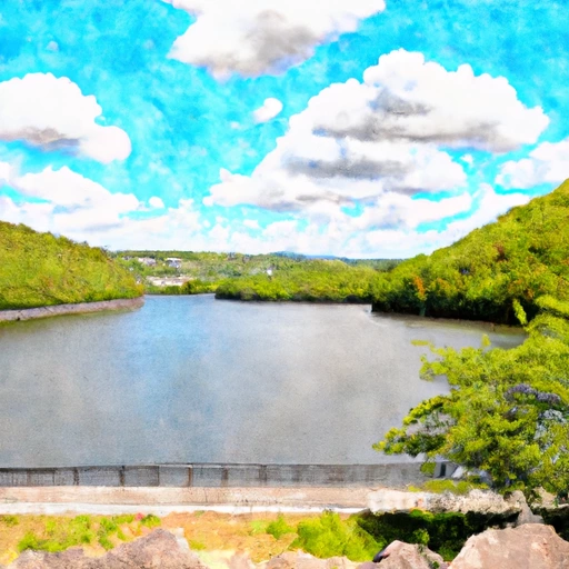
M C Whatmore Lake Dam, located in Grant Corner, Westchester, New York, is a privately-owned earth dam completed in 1964 primarily used for recreational purposes.
Summary
The dam stands at a height of 17 feet and has a length of 140 feet, with a maximum storage capacity of 208 acre-feet. The dam overlooks the scenic TR-Crook Brook and provides a surface area of 26 acres for various water-based activities.
Managed by the New York State Department of Environmental Conservation, the dam is considered to have a significant hazard potential, with a moderate risk assessment rating. Despite not having a condition assessment, the dam is regularly inspected every four years, with the last inspection conducted in November 2019. Additionally, the dam's spillway type is uncontrolled, with a width of 10 feet, and a maximum discharge capacity of 280 cubic feet per second.
Water resource and climate enthusiasts visiting M C Whatmore Lake Dam can enjoy recreational activities while appreciating the engineering marvel of the dam. With its picturesque location and vital role in water management, the dam serves as a reminder of the importance of sustainable water resource management in the face of changing climate patterns.
Regional Streamflow Levels

15-Day Long Term Forecast
Year Completed |
1964 |
Dam Length |
140 |
Dam Height |
17 |
River Or Stream |
TR-CROOK BROOK |
Primary Dam Type |
Earth |
Surface Area |
26 |
Drainage Area |
0.14 |
Nid Storage |
208 |
Hazard Potential |
Significant |
Nid Height |
17 |
Seasonal Comparison
5-Day Hourly Forecast Detail
Dam Data Reference
Condition Assessment
SatisfactoryNo existing or potential dam safety deficiencies are recognized. Acceptable performance is expected under all loading conditions (static, hydrologic, seismic) in accordance with the minimum applicable state or federal regulatory criteria or tolerable risk guidelines.
Fair
No existing dam safety deficiencies are recognized for normal operating conditions. Rare or extreme hydrologic and/or seismic events may result in a dam safety deficiency. Risk may be in the range to take further action. Note: Rare or extreme event is defined by the regulatory agency based on their minimum
Poor A dam safety deficiency is recognized for normal operating conditions which may realistically occur. Remedial action is necessary. POOR may also be used when uncertainties exist as to critical analysis parameters which identify a potential dam safety deficiency. Investigations and studies are necessary.
Unsatisfactory
A dam safety deficiency is recognized that requires immediate or emergency remedial action for problem resolution.
Not Rated
The dam has not been inspected, is not under state or federal jurisdiction, or has been inspected but, for whatever reason, has not been rated.
Not Available
Dams for which the condition assessment is restricted to approved government users.
Hazard Potential Classification
HighDams assigned the high hazard potential classification are those where failure or mis-operation will probably cause loss of human life.
Significant
Dams assigned the significant hazard potential classification are those dams where failure or mis-operation results in no probable loss of human life but can cause economic loss, environment damage, disruption of lifeline facilities, or impact other concerns. Significant hazard potential classification dams are often located in predominantly rural or agricultural areas but could be in areas with population and significant infrastructure.
Low
Dams assigned the low hazard potential classification are those where failure or mis-operation results in no probable loss of human life and low economic and/or environmental losses. Losses are principally limited to the owner's property.
Undetermined
Dams for which a downstream hazard potential has not been designated or is not provided.
Not Available
Dams for which the downstream hazard potential is restricted to approved government users.
Area Campgrounds
| Location | Reservations | Toilets |
|---|---|---|
 Mountain Lakes Park
|
||
 Ward Pound Ridge Reservation
|
||
 Youth Camp I
|
||
 Youth Camp II
|
||
 Youth Camp III
|
||
 Clarence Fahnestock State Park
|
 Greenwood Lk At Awosting Nj
 Wanaque Reservoir At Wanaque Nj
 Lake Kenosia
River Runs
-
 Kent Bridge To Boardman Bridge
-
 Pond Downstream Of Shepaug Reservoir Dam, Marked By Service Road Bridge To Ends In Backwaters Of Lake Lillinonah, Near Roxbury Falls
-
 Begins Downstream Of The Borough Of Bantam, At Stoddard Road Bridge To The Confluence With The Shepaug River
-
 Falls Mountain Road In Canaan, Connecticut To Kent Bridge
-
 Begins Below The Tailrace Of The Lower Collinsville Dam To The Route 187 Bridge
-
 The Confluence With The Nepaug River To A Point 0.2 Miles Below The Lower Collinsville Dam Tailrace
 Ball Pond
 Huntington Pond
 Squantz Pond
 Lake Lillinonah
 Isinglass Reservoir