Cle Elum dam

Cle Elum
Located in Kittitas, Washington, Cle Elum is a federal-owned dam managed by the Bureau of Reclamation for flood risk reduction, irrigation, and recreation purposes. Completed in 1932, this earth dam stands at 165 feet tall and spans 1801 feet across the Cle Elum River. With a storage capacity of 710,000 acre-feet and a surface area of 4812 acres, Cle Elum plays a vital role in water resource management in the region.
The dam's hazard potential is classified as high, emphasizing the importance of regular inspections and emergency preparedness. While the condition assessment is currently not available, the Bureau of Reclamation remains responsible for operations, inspections, and regulatory matters. Cle Elum serves as a key infrastructure for managing flood risks in the area, ensuring the safety and stability of surrounding communities and ecosystems.
With its rich history dating back nearly a century, Cle Elum continues to be a significant feature in the water resource landscape of Washington state. As climate change impacts water availability and patterns, the role of dams like Cle Elum in regulating water flow and mitigating flood risks becomes increasingly crucial. As stewards of this vital infrastructure, ongoing monitoring and maintenance efforts are essential to safeguarding the community and environment from potential hazards.
Plan around the weather
Same NOAA / yr.no feed Snoflo's iOS app uses. Watch the precipitation column on the meteogram -- rain on the basin upstream typically lifts inflow 24-72 hours later.
Next 5 days, hour by hour
Temperature line with weather symbols on top, snow + rain accumulation as columns, humidity as a dotted line.
5-day forecast table
Every 3 hours, broken out across temperature, snow, rain, humidity, and wind. Each cell is colour-coded relative to the column min/max.
| Time | Condition | Temp (°F) | Snow (in) | Rain (in) | Humidity (%) | Wind (mps) | Wind dir |
|---|---|---|---|---|---|---|---|
| Loading detailed forecast… | |||||||
15-day temperature & precipitation
Daily temperatures, snow, and rain projected over the next two weeks.
Nearby streamflow gauges
USGS streamgauges around Cle Elum -- inflows here typically show up in storage 24-72 hours later.
| Streamgauge | Discharge | View |
|---|---|---|
| American River Near Nile | 63 cfs | → |
| Cedar River Below Bear Creek Near Cedar Falls | 24 cfs | → |
| Icicle Creek Above Snow Creek Near Leavenworth | 236 cfs | → |
| Sf Snoqualmie River Ab Alice Creek Near Garcia | 46 cfs | → |
| Greenwater River At Greenwater | 49 cfs | → |
| Cedar River Near Cedar Falls | 39 cfs | → |
Make a day of it
Boat launches, lakeside camping, fishing access, and other reservoirs near Cle Elum.
Boat launches
See all →


Campgrounds
See all →


Fishing spots
See all →
River runs
See all →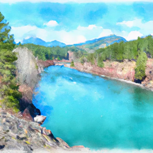


About Cle Elum
Where does the data for Cle Elum come from?
Structural and regulatory data come from the U.S. Army Corps of Engineers' National Inventory of Dams (NID). Weather forecast comes from NOAA / yr.no -- the same feed Snoflo's iOS app uses.
How often is the report updated?
NID structural data refreshes annually as the Corps publishes updated assessments. The weather forecast refreshes throughout the day.
What does the High hazard rating mean?
The Corps of Engineers' hazard potential classification grades probable consequences if the dam fails: High = probable loss of human life; Significant = no probable loss of human life but possible economic loss / environmental damage; Low = no probable loss of human life, only minor economic / environmental losses. See the Dam Data Reference card below for the full definitions.
What's "% of normal"?
The current storage value compared to the historical average storage on this calendar day. 100% = right on average; values above 100% mean above-normal storage (wet year); values below mean below-normal (dry year or drought).
Can I get alerts when storage crosses a threshold?
Yes -- alerts are managed in the Snoflo iOS app. Favorite this dam, set a threshold, and you'll get a push the moment conditions cross.
Dam data reference
Condition Assessment
- Satisfactory
- No existing or potential dam safety deficiencies are recognized. Acceptable performance is expected under all loading conditions (static, hydrologic, seismic) in accordance with the minimum applicable state or federal regulatory criteria or tolerable risk guidelines.
- Fair
- No existing dam safety deficiencies are recognized for normal operating conditions. Rare or extreme hydrologic and/or seismic events may result in a dam safety deficiency. Risk may be in the range to take further action.
- Poor
- A dam safety deficiency is recognized for normal operating conditions which may realistically occur. Remedial action is necessary. POOR may also be used when uncertainties exist as to critical analysis parameters which identify a potential dam safety deficiency.
- Unsatisfactory
- A dam safety deficiency is recognized that requires immediate or emergency remedial action for problem resolution.
- Not Rated
- The dam has not been inspected, is not under state or federal jurisdiction, or has been inspected but, for whatever reason, has not been rated.
Hazard Potential Classification
- High
- Dams assigned the high hazard potential classification are those where failure or mis-operation will probably cause loss of human life.
- Significant
- Dams assigned the significant hazard potential classification are those dams where failure or mis-operation results in no probable loss of human life but can cause economic loss, environmental damage, disruption of lifeline facilities, or impact other concerns. Significant hazard potential classification dams are often located in predominantly rural or agricultural areas but could be in areas with population and significant infrastructure.
- Low
- Dams assigned the low hazard potential classification are those where failure or mis-operation results in no probable loss of human life and low economic and/or environmental losses. Losses are principally limited to the owner's property.
- Undetermined
- Dams for which a downstream hazard potential has not been designated or is not provided.