


Huzzah 1 (Howes Mill Lake) Reservoir Report
Last Updated: May 3, 2026
°F
°F
mph
Wind
%
Humidity
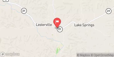
Huzzah 1 (Howes Mill Lake) in Dent, Missouri, is a federal-owned dam managed by the USDA Forest Service.
Summary
Completed in 1901 for recreational purposes, this Earth dam on Huzzah Creek stands at a height of 21 feet and a length of 560 feet, with a storage capacity of 83 acre-feet. Despite its age, the dam remains in moderate condition and poses a high hazard potential.
Located in the St. Louis District, Huzzah 1 is a popular spot for water recreation enthusiasts, offering a surface area of 10 acres and a normal storage capacity of 59 acre-feet. With a maximum discharge of 10 cubic feet per second and an uncontrolled spillway, the dam provides a picturesque setting for outdoor activities. While the dam has not been rated for its condition, regular inspections by the Forest Service help ensure the safety of visitors and the surrounding community.
Although Huzzah 1 has not been modified in recent years, its risk assessment indicates a moderate level of risk. While the dam has not yet had an Emergency Action Plan (EAP) prepared or updated, the Forest Service remains vigilant in monitoring and managing any potential hazards. With its rich history and scenic surroundings, Huzzah 1 is a valuable resource for both recreation and water conservation enthusiasts alike.
Regional Streamflow Levels
15-Day Long Term Forecast
Year Completed |
1901 |
Dam Length |
560 |
Dam Height |
21 |
River Or Stream |
HUZZAH CREEK |
Primary Dam Type |
Earth |
Surface Area |
10 |
Hydraulic Height |
21 |
Drainage Area |
1 |
Nid Storage |
83 |
Structural Height |
15 |
Hazard Potential |
High |
Nid Height |
21 |
Seasonal Comparison
5-Day Hourly Forecast Detail
Dam Data Reference
Condition Assessment
SatisfactoryNo existing or potential dam safety deficiencies are recognized. Acceptable performance is expected under all loading conditions (static, hydrologic, seismic) in accordance with the minimum applicable state or federal regulatory criteria or tolerable risk guidelines.
Fair
No existing dam safety deficiencies are recognized for normal operating conditions. Rare or extreme hydrologic and/or seismic events may result in a dam safety deficiency. Risk may be in the range to take further action. Note: Rare or extreme event is defined by the regulatory agency based on their minimum
Poor A dam safety deficiency is recognized for normal operating conditions which may realistically occur. Remedial action is necessary. POOR may also be used when uncertainties exist as to critical analysis parameters which identify a potential dam safety deficiency. Investigations and studies are necessary.
Unsatisfactory
A dam safety deficiency is recognized that requires immediate or emergency remedial action for problem resolution.
Not Rated
The dam has not been inspected, is not under state or federal jurisdiction, or has been inspected but, for whatever reason, has not been rated.
Not Available
Dams for which the condition assessment is restricted to approved government users.
Hazard Potential Classification
HighDams assigned the high hazard potential classification are those where failure or mis-operation will probably cause loss of human life.
Significant
Dams assigned the significant hazard potential classification are those dams where failure or mis-operation results in no probable loss of human life but can cause economic loss, environment damage, disruption of lifeline facilities, or impact other concerns. Significant hazard potential classification dams are often located in predominantly rural or agricultural areas but could be in areas with population and significant infrastructure.
Low
Dams assigned the low hazard potential classification are those where failure or mis-operation results in no probable loss of human life and low economic and/or environmental losses. Losses are principally limited to the owner's property.
Undetermined
Dams for which a downstream hazard potential has not been designated or is not provided.
Not Available
Dams for which the downstream hazard potential is restricted to approved government users.
Area Campgrounds
| Location | Reservations | Toilets |
|---|---|---|
 Little Scotia Dispersed
|
||
 Ozark Trail Gunstock Hollow
|
||
 Red Bluff
|
||
 Loggers Lake
|
||
 Loggers Lake Recreation Area
|
||
 Sutton Bluff
|
 Clearwater Lake Near Piedmont
 Council Bluff Lake Trail Washington County
River Runs
-
 State Highway 49 Bridge Near Dillard, Missouri To Forest Boundary In Sections 13/24, T38N, R3W
-
 Confluence With Alley Spring (Branch) To Confluence With Current River (Does Not Include River Segment In Gap Between Parkland Units)
-
 Missouri State Highway 17 To Fort Leonard Wood (Army Base)
-
 Northern Boundary Of Fort Leonard Wood To North Section Line Of Sec 31, T36N, R10W
-
 Western Edge Of Ozark National Scenic Riverways To Confluence With Alley Spring (Branch)
-
 Forest Boundary At North Section Line Of Sec 4, T33N, R5E To Forest Boundary At South Section Line Of Sec 35, T32N, R5E
 Timberline Lake
 Parole Lake
 Howell Lake
 Crane Lake Recreation Area