Crystal Springs Campground Campground
Community Reviews
Been here? Share the conditions.
Reviews, ratings & photos are added in the free Snoflo iOS app — rate a spot, tag the conditions, and your visit is verified by location. Add or manage your reviews from the app.
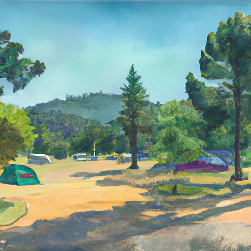
Crystal Springs Campground
Reservations are accepted at Crystal Springs Campground, ensuring that campers have a spot secured for their stay. It is advisable to book in advance, especially during peak seasons, as the campground can get quite busy. The best time to visit Crystal Springs Campground is during the spring and fall when the weather is mild, and the surrounding landscapes are at their most picturesque. However, the campground is open year-round, with limited services available during the winter months.
There are several attractions and activities to enjoy in the camping area. Crystal Springs Campground is situated near a beautiful lake, offering opportunities for fishing and boating. Hiking enthusiasts will also appreciate the nearby trails that lead to stunning viewpoints and natural wonders. It is essential to be cautious of wildlife in the area, particularly bears, and to properly store food to prevent any unwanted encounters. Additionally, campers should be aware of potential fire hazards and follow all fire safety regulations to ensure a safe camping experience.
What's on-site at Crystal Springs Campground
Key facilities Snoflo tracks for this campground. Confirm with the operator before booking -- amenities can change seasonally.
Plan your trip down to the hour
Same weather feed Snoflo's iOS app uses -- updated continuously from NOAA / yr.no.
Next 5 days, hour by hour
Temperature line with weather symbols on top, snow + rain accumulation as columns, humidity as a dotted line.
5-day forecast table
Every 3 hours, broken out across temperature, snow, rain, humidity, and wind. Each cell is colour-coded relative to the column min/max so trends jump out at a glance.
| Time | Condition | Temp (°F) | Snow (in) | Rain (in) | Humidity (%) | Wind (mps) | Wind dir |
|---|---|---|---|---|---|---|---|
| Loading detailed forecast… | |||||||
15-day temperature & precipitation
Daily temperatures, snow, and rain projected over the next two weeks. Hover any point for the full breakdown.
Other campgrounds in the area
Snoflo-tracked campsites within driving distance of Crystal Springs Campground, with reservations status.
| Campground | Reservations | Toilets | View |
|---|---|---|---|
| Crystal Springs - Kings Canyon National Park | ✗ | ✓ | → |
| Azalea - Kings Canyon National Park | ✗ | ✓ | → |
| Azalea Campground | ✗ | ✗ | → |
| Azalea | ✗ | ✗ | → |
| Sunset - Kings Canyon National Park | ✗ | ✓ | → |
Nearby streamflow
USGS streamgauges within reach of Crystal Springs Campground -- pulled live from the National Water Information System.
| Streamgauge | Discharge | View |
|---|---|---|
| Marble Fork Kaweah R Ab Horse C Nr Lodgepole Ca | 1 cfs | → |
| San Joaquin R Bl Friant Ca | 341 cfs | → |
| Sf Tule R Nr Reservation Bndry Nr Porterville Ca | 9 cfs | → |
| Sf Tule R Nr Cholollo Campground Nr Porterville Ca | 8 cfs | → |
| Nf Willow C Nr Sugar Pine Ca | 416 cfs | → |
| Deer C Nr Fountain Springs Ca | 5 cfs | → |
Nearby snow depths
NRCS SNOTEL stations within reach of Crystal Springs Campground -- relevant when planning a shoulder-season or alpine trip.
| SNOTEL station | Snowpack | 24h Snowfall | View |
|---|---|---|---|
| Blackcap Basin Goes | 1.8 in | 0.0 in | → |
| Charlotte Lake | 11.3 in | 0.0 in | → |
| Upper Burnt Corral Meadow | 0.0 in | 0.0 in | → |
| Nohrsc Tamarack Summit | 0.3 in | 0.0 in | → |
| Huntington Lake | 1.1 in | 0.0 in | → |
| Nohrsc Kaiser Point | 175.7 in | 0.0 in | → |
Plan a longer trip
The closest parks, lakes, boat launches, and paddle runs so a camping night can grow into a full weekend.
Parks
- Wilderness Jennie Lakes
- Wilderness Monarch
- Sierra National Forest
- Ledbetter Park
- Willow Court Park
- Miller Brown Park
Boat launches
- Sandy Cove Road Fresno County
- Hume Lake Boat Launch (East Dam)
- Wishon Village, Inc.
- Pine Flat Marina / Lombardo's Lakeview Resort
- Pine Flat Lake (Island Park)
- Pine Flat Lake (Trimmer)
Fishing spots
- Bearskin Creek
- Tenmile Creek
- Hume Lake Fishing Pier (North)
- Hume Lake Fishing Pier (South)
- Hume Lake
- Big Meadows Creek
Points of interest
- General Grant Tree
- Centennial Stump
- Gamlin Cabin
- Trail In Sequoia Tree
- Park Ridge Lookout
- Mcgee Overlook
Paddle runs
- Wilderness Boundary Just Below Tokopah Falls (Boundary Extend 0.25 Mile On Each Side Of River) To Confluence With The Middle Fork Kaweah River
- Wilderness Boundary (Boundary Extend 0.25 Mile On Each Side Of River) To Boundary Of Sequoia & Kings Canyon National Park
- Lake 10,559 (Boundary Extend 0.25 Mile On Each Side Of River) To Wilderness Boundary Just Below Tokopah Falls
- Confluence Of Lone Pine And Hamilton (Deer) Creeks (Boundary Extend 0.25 Mile On Each Side Of River) To Wildernes Boundary
- Atwell Mill Trail Bridge At ~5,800 Ft (Boundary Extends 0.25 Mile On Each Side Of The River.) To Boundary Of Sequoia & Kings Canyon National Park
- Outlet Of Martha Lake (Boundary Extend 0.25 Mile On Each Side Of River) To Northwestern Boundary Of Kings Canyon National Park
Camping essentials & Leave No Trace
- Pack it in, pack it out
- Take all trash, food scraps, and gear back with you to keep campsites clean and protect wildlife.
- Respect wildlife
- Observe animals from a distance, store food securely, and never feed wildlife to maintain natural behavior and safety.
- Know before you go
- Check weather, fire restrictions, trail conditions, and permit requirements to ensure a safe and well-planned trip.
- Minimize campfire impact
- Use established fire rings, keep fires small, fully extinguish them, or opt for a camp stove when fires are restricted.
- Leave what you find
- Preserve natural and cultural features by avoiding removal of plants, rocks, artifacts, or other elements of the environment.
Set push alerts in the Snoflo app
Save Crystal Springs Campground as a favorite, set a custom threshold (precipitation, snowpack, freezing temperatures), and the iOS app will push the moment conditions cross.
About Crystal Springs Campground
Can I make reservations at Crystal Springs Campground?
This campground does not appear to accept reservations -- it's typically first-come, first-served. Arrive early on summer weekends.
How fresh is the weather data on this page?
The hourly forecast updates throughout the day from the NOAA / yr.no public feeds. Streamflow data is pulled live from USGS streamgauges and snowpack from the NRCS SNOTEL network.
What's the best time of year to visit?
Use the 15-day temperature & precipitation outlook on this page to plan -- pick a window with comfortable temperatures and low precipitation. For longer trips, the 5-day hourly meteogram shows snow + rain accumulation hour-by-hour.
How do I get to Crystal Springs Campground?
Tap Directions in the hero above to open driving directions in Google Maps, or Open in map to center the Snoflo interactive map on the campground.
Can I get alerts when conditions change?
Yes -- alerts are managed through the Snoflo iOS app. Favorite this campground, set a threshold (temperature, snowpack, precipitation), and you'll get a push the moment it crosses.
Other campgrounds near here
Snoflo-tracked campgrounds within driving distance of Crystal Springs Campground.