Doane Valley Camp Ground Campground
Community Reviews
Been here? Share the conditions.
Reviews, ratings & photos are added in the free Snoflo iOS app — rate a spot, tag the conditions, and your visit is verified by location. Add or manage your reviews from the app.
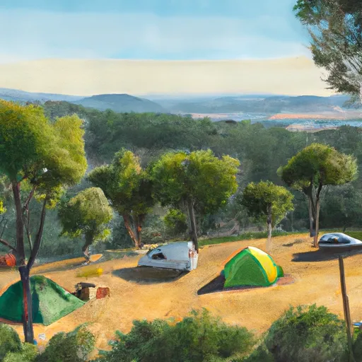
Doane Valley Camp Ground
Reservations for campsites at Doane Valley Campground are accepted, allowing campers to secure their spot in advance. This ensures a stress-free experience and guarantees a camping spot during peak seasons. It is recommended to make reservations well ahead of time, especially during the summer months and holiday weekends when the campground tends to be more crowded.
The best time to visit Doane Valley Campground is during the spring and fall seasons when the weather is mild, offering pleasant temperatures for outdoor activities. Summer can get quite hot, while winter may bring snowfall, limiting access to the campground. It is advisable to check weather conditions before planning a trip.
Campers at Doane Valley should be mindful of the wildlife that inhabits the area and take precautions to ensure their safety. Black bears have been spotted in the vicinity, so it is important to store food securely and maintain a clean campsite to avoid attracting them. Additionally, poison oak is prevalent in the campground's surrounding areas, so campers should be cautious and avoid contact with this plant.
Overall, Doane Valley Campground provides a well-equipped and beautiful camping area for outdoor enthusiasts. Reservations are recommended, and the best time to visit is during the spring and fall. By taking precautions and being mindful of the local wildlife, campers can enjoy a memorable and safe experience in this picturesque California camping destination.
What's on-site at Doane Valley Camp Ground
Key facilities Snoflo tracks for this campground. Confirm with the operator before booking -- amenities can change seasonally.
Plan your trip down to the hour
Same weather feed Snoflo's iOS app uses -- updated continuously from NOAA / yr.no.
Next 5 days, hour by hour
Temperature line with weather symbols on top, snow + rain accumulation as columns, humidity as a dotted line.
5-day forecast table
Every 3 hours, broken out across temperature, snow, rain, humidity, and wind. Each cell is colour-coded relative to the column min/max so trends jump out at a glance.
| Time | Condition | Temp (°F) | Snow (in) | Rain (in) | Humidity (%) | Wind (mps) | Wind dir |
|---|---|---|---|---|---|---|---|
| Loading detailed forecast… | |||||||
15-day temperature & precipitation
Daily temperatures, snow, and rain projected over the next two weeks. Hover any point for the full breakdown.
Other campgrounds in the area
Snoflo-tracked campsites within driving distance of Doane Valley Camp Ground, with reservations status.
| Campground | Reservations | Toilets | View |
|---|---|---|---|
| Fry Creek Campground | ✗ | ✗ | → |
| Fry Creek | ✗ | ✓ | → |
| Observatory Campground - Usfs | ✗ | ✗ | → |
| Observatory | ✗ | ✓ | → |
| Observatory Campground | ✓ | ✗ | → |
Nearby streamflow
USGS streamgauges within reach of Doane Valley Camp Ground -- pulled live from the National Water Information System.
| Streamgauge | Discharge | View |
|---|---|---|
| Temecula C Nr Aguanga Ca | · | → |
| Guejito C Nr San Pasqual Ca | 0 cfs | → |
| Santa Ysabel C Nr Ramona Ca | · | → |
| Santa Margarita R Nr Temecula Ca | 3 cfs | → |
| Rainbow C Nr Fallbrook Ca | 0 cfs | → |
| Santa Gertrudis C Nr Temecula Ca | · | → |
Nearby snow depths
NRCS SNOTEL stations within reach of Doane Valley Camp Ground -- relevant when planning a shoulder-season or alpine trip.
| SNOTEL station | Snowpack | 24h Snowfall | View |
|---|---|---|---|
| Escondido 0.5 Sse | 0.0 in | 0.0 in | → |
| El Cajon 2.8 Sse | 0.0 in | 0.0 in | → |
Plan a longer trip
The closest parks, lakes, boat launches, and paddle runs so a camping night can grow into a full weekend.
Parks
- Palomar Mountain State Park
- Wilderness Agua Tibia
- Wilderness Gardens Park
- Butterfield Country Recreational Vehicle Park
- Beauty Mountain Wilderness
- Robert Adams Community Park
Boat launches
- Vail Lake Boat Ramp
- Highway 76 26439, Santa Ysabel
- Lake Wohlford
- Sutherland Dam Road 21568-21722, Ramona
- Warren Road 37701, Temecula
- Lake Skinner Marina Boat #1
Fishing spots
Points of interest
- Doane Pond
- Weir Historic Site
- Palomar Observatory
- 18-Inch Schmidt Telescope
- 60-Inch Telescope
- Samuel Oschin Telescope
Paddle runs
- Confluence Of Fry And Iron Spring Creeks (E1/2, Sec 3, T10s,R1e To Se1/4 Sec 16, T10s, R2e
- Forest Boundary, Above Zoo Creek Below Spillway (S1/2, Sec 3, T11s, R2e) To La Jolla Indian Reservation Boundary (N1/2, Sec 31, T10s, R2e)
- Santa Margarita River
- Devil Canyon Tributary To San Mateo Creek
- Palm Canyon
Camping essentials & Leave No Trace
- Pack it in, pack it out
- Take all trash, food scraps, and gear back with you to keep campsites clean and protect wildlife.
- Respect wildlife
- Observe animals from a distance, store food securely, and never feed wildlife to maintain natural behavior and safety.
- Know before you go
- Check weather, fire restrictions, trail conditions, and permit requirements to ensure a safe and well-planned trip.
- Minimize campfire impact
- Use established fire rings, keep fires small, fully extinguish them, or opt for a camp stove when fires are restricted.
- Leave what you find
- Preserve natural and cultural features by avoiding removal of plants, rocks, artifacts, or other elements of the environment.
Set push alerts in the Snoflo app
Save Doane Valley Camp Ground as a favorite, set a custom threshold (precipitation, snowpack, freezing temperatures), and the iOS app will push the moment conditions cross.
About Doane Valley Camp Ground
Can I make reservations at Doane Valley Camp Ground?
This campground does not appear to accept reservations -- it's typically first-come, first-served. Arrive early on summer weekends.
How fresh is the weather data on this page?
The hourly forecast updates throughout the day from the NOAA / yr.no public feeds. Streamflow data is pulled live from USGS streamgauges and snowpack from the NRCS SNOTEL network.
What's the best time of year to visit?
Use the 15-day temperature & precipitation outlook on this page to plan -- pick a window with comfortable temperatures and low precipitation. For longer trips, the 5-day hourly meteogram shows snow + rain accumulation hour-by-hour.
How do I get to Doane Valley Camp Ground?
Tap Directions in the hero above to open driving directions in Google Maps, or Open in map to center the Snoflo interactive map on the campground.
Can I get alerts when conditions change?
Yes -- alerts are managed through the Snoflo iOS app. Favorite this campground, set a threshold (temperature, snowpack, precipitation), and you'll get a push the moment it crosses.
Other campgrounds near here
Snoflo-tracked campgrounds within driving distance of Doane Valley Camp Ground.