Fir Cove Campground Campground
Community Reviews
Been here? Share the conditions.
Reviews, ratings & photos are added in the free Snoflo iOS app — rate a spot, tag the conditions, and your visit is verified by location. Add or manage your reviews from the app.
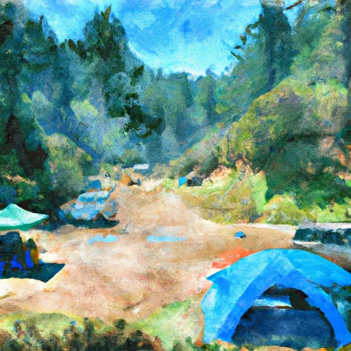
Fir Cove Campground
What's on-site at Fir Cove Campground
Key facilities Snoflo tracks for this campground. Confirm with the operator before booking -- amenities can change seasonally.
Plan your trip down to the hour
Same weather feed Snoflo's iOS app uses -- updated continuously from NOAA / yr.no.
Next 5 days, hour by hour
Temperature line with weather symbols on top, snow + rain accumulation as columns, humidity as a dotted line.
5-day forecast table
Every 3 hours, broken out across temperature, snow, rain, humidity, and wind. Each cell is colour-coded relative to the column min/max so trends jump out at a glance.
| Time | Condition | Temp (°F) | Snow (in) | Rain (in) | Humidity (%) | Wind (mps) | Wind dir |
|---|---|---|---|---|---|---|---|
| Loading detailed forecast… | |||||||
15-day temperature & precipitation
Daily temperatures, snow, and rain projected over the next two weeks. Hover any point for the full breakdown.
Other campgrounds in the area
Snoflo-tracked campsites within driving distance of Fir Cove Campground, with reservations status.
| Campground | Reservations | Toilets | View |
|---|---|---|---|
| Fir Cove | ✓ | ✗ | → |
| Bailey Canyon Campground | ✓ | ✗ | → |
| Bailey Canyon | ✗ | ✓ | → |
| Pickett Peak Campground | ✗ | ✗ | → |
| Fern Campground | ✗ | ✗ | → |
Nearby streamflow
USGS streamgauges within reach of Fir Cove Campground -- pulled live from the National Water Information System.
| Streamgauge | Discharge | View |
|---|---|---|
| Mad R Ab Ruth Res Nr Forest Glen Ca | 2 cfs | → |
| Eel R A Fort Seward Ca | 62 cfs | → |
| Sf Trinity R Bl Hyampom Ca | 93 cfs | → |
| Sf Eel R Nr Miranda Ca | 37 cfs | → |
| Van Duzen R Nr Bridgeville Ca | 11 cfs | → |
| Trinity R Nr Burnt Ranch Ca | 564 cfs | → |
Plan a longer trip
The closest parks, lakes, boat launches, and paddle runs so a camping night can grow into a full weekend.
Parks
- Wilderness Mount Lassic
- Wilderness North Fork
- Trinity National Forest
- Wilderness Chanchelulla
- Humboldt Redwoods State Park
- Six Rivers National Forest
Fishing spots
Points of interest
- Shrine Drive Thru Tree
- Giant Trees
- Lower Blackburn Grade Bridge
- Founders Tree
- Dyerville Giant
- Julia Morgan’S Redwood Grove Estate & Garden Tours
Paddle runs
- Four Tenths Mile Upstream With The Confluence Of Foley Creek Four Tenths Mile Upstream With Confluence With Foley Creek To Trinity Wsr
- Confluence With Smoky Creek To Four Tenths Of A Mile West And Downstream Of Double Cabins Site
- Two Tenth Mile West And Downstream Of Double Cabins Site To Confluence With Smoky Creek
- Butte Creek Trib
- Colman Creek
- Colman Creek Trib
Camping essentials & Leave No Trace
- Pack it in, pack it out
- Take all trash, food scraps, and gear back with you to keep campsites clean and protect wildlife.
- Respect wildlife
- Observe animals from a distance, store food securely, and never feed wildlife to maintain natural behavior and safety.
- Know before you go
- Check weather, fire restrictions, trail conditions, and permit requirements to ensure a safe and well-planned trip.
- Minimize campfire impact
- Use established fire rings, keep fires small, fully extinguish them, or opt for a camp stove when fires are restricted.
- Leave what you find
- Preserve natural and cultural features by avoiding removal of plants, rocks, artifacts, or other elements of the environment.
Set push alerts in the Snoflo app
Save Fir Cove Campground as a favorite, set a custom threshold (precipitation, snowpack, freezing temperatures), and the iOS app will push the moment conditions cross.
About Fir Cove Campground
Can I make reservations at Fir Cove Campground?
Yes -- this campground accepts reservations. Snoflo recommends booking early for peak season; check the operator (Recreation.gov / state park system / private operator) for the booking window and cancellation policy.
How fresh is the weather data on this page?
The hourly forecast updates throughout the day from the NOAA / yr.no public feeds. Streamflow data is pulled live from USGS streamgauges and snowpack from the NRCS SNOTEL network.
What's the best time of year to visit?
Use the 15-day temperature & precipitation outlook on this page to plan -- pick a window with comfortable temperatures and low precipitation. For longer trips, the 5-day hourly meteogram shows snow + rain accumulation hour-by-hour.
How do I get to Fir Cove Campground?
Tap Directions in the hero above to open driving directions in Google Maps, or Open in map to center the Snoflo interactive map on the campground.
Can I get alerts when conditions change?
Yes -- alerts are managed through the Snoflo iOS app. Favorite this campground, set a threshold (temperature, snowpack, precipitation), and you'll get a push the moment it crosses.
Other campgrounds near here
Snoflo-tracked campgrounds within driving distance of Fir Cove Campground.