Girard Ridge Lookout Campground
Community Reviews
Been here? Share the conditions.
Reviews, ratings & photos are added in the free Snoflo iOS app — rate a spot, tag the conditions, and your visit is verified by location. Add or manage your reviews from the app.
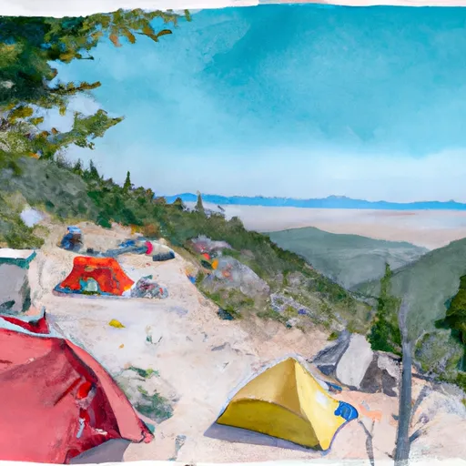
Girard Ridge Lookout
What's on-site at Girard Ridge Lookout
Key facilities Snoflo tracks for this campground. Confirm with the operator before booking -- amenities can change seasonally.
Plan your trip down to the hour
Same weather feed Snoflo's iOS app uses -- updated continuously from NOAA / yr.no.
Next 5 days, hour by hour
Temperature line with weather symbols on top, snow + rain accumulation as columns, humidity as a dotted line.
5-day forecast table
Every 3 hours, broken out across temperature, snow, rain, humidity, and wind. Each cell is colour-coded relative to the column min/max so trends jump out at a glance.
| Time | Condition | Temp (°F) | Snow (in) | Rain (in) | Humidity (%) | Wind (mps) | Wind dir |
|---|---|---|---|---|---|---|---|
| Loading detailed forecast… | |||||||
15-day temperature & precipitation
Daily temperatures, snow, and rain projected over the next two weeks. Hover any point for the full breakdown.
Other campgrounds in the area
Snoflo-tracked campsites within driving distance of Girard Ridge Lookout, with reservations status.
| Campground | Reservations | Toilets | View |
|---|---|---|---|
| Riverside Campground | ✗ | ✗ | → |
| Upper Loop Campground | ✗ | ✗ | → |
| Lower Loop Campground | ✗ | ✗ | → |
| Hiker Biker Campsite | ✗ | ✗ | → |
| Pct Camp | ✗ | ✗ | → |
Nearby streamflow
USGS streamgauges within reach of Girard Ridge Lookout -- pulled live from the National Water Information System.
| Streamgauge | Discharge | View |
|---|---|---|
| Sacramento R A Delta Ca | 248 cfs | → |
| Trinity R Ab Coffee C Nr Trinity Ctr Ca | 27 cfs | → |
| Burney C A Burney Falls Nr Burney Ca | 168 cfs | → |
| Sacramento R A Keswick Ca | 13,200 cfs | → |
| Anderson-Cottonwood Id Cn At Sharon St Redding Ca | 260 cfs | → |
| Trinity R A Lewiston Ca | 450 cfs | → |
Nearby snow depths
NRCS SNOTEL stations within reach of Girard Ridge Lookout -- relevant when planning a shoulder-season or alpine trip.
| SNOTEL station | Snowpack | 24h Snowfall | View |
|---|---|---|---|
| Castle Lake | 9.6 in | 0.0 in | → |
| Highlands Lakes | 18.7 in | 0.0 in | → |
| Nohrsc Slate Creek | 0.8 in | 0.0 in | → |
| Mumbo Basin Raws | 0.0 in | 0.0 in | → |
| Sand Flat | 0.6 in | 0.0 in | → |
| Mt. Eddy | 1.1 in | 0.0 in | → |
Plan a longer trip
The closest parks, lakes, boat launches, and paddle runs so a camping night can grow into a full weekend.
Parks
- Castle Crags State Park
- Wilderness Castle Crags
- Dunsmuir City Park And Botanical Gardens
- Cantara/Ney Springs Wildlife Area
- Shastice Park
- Mt Shasta City Park
Boat launches
- Castle Lake Trail #4w02 Siskiyou County
- Shasta County
- Lake Siskiyou Trail - Delta Segment Siskiyou County
- Antlers Resort & Marina
- Shasta Lake (Antlers)
- Shasta Lake (Hirz Bay)
Fishing spots
Points of interest
- Stonewall Gallery
- 1727 Class M6
- Heritage Junction Museum
- Sisson Museum
- Weed Museum
- Lake Shasta Caverns
Paddle runs
- Headwaters In Russian Wilderness To Wilderness Boundary
- Scott District Boundary To Confluence With Sixmile Creek
- Wilderness Boundary To Forest Road 40n54
- Headwaters At Outlet Of Lower Canyon Creek Lake To Canyon Creek Trailhead At Ripstein Canyon Creek Trailhead At Ripstein
- Confluence Of Tributaries In Sec 6 Near Black Mtn. To Confluence With Blind Horse Creek
- Clear Creek
Camping essentials & Leave No Trace
- Pack it in, pack it out
- Take all trash, food scraps, and gear back with you to keep campsites clean and protect wildlife.
- Respect wildlife
- Observe animals from a distance, store food securely, and never feed wildlife to maintain natural behavior and safety.
- Know before you go
- Check weather, fire restrictions, trail conditions, and permit requirements to ensure a safe and well-planned trip.
- Minimize campfire impact
- Use established fire rings, keep fires small, fully extinguish them, or opt for a camp stove when fires are restricted.
- Leave what you find
- Preserve natural and cultural features by avoiding removal of plants, rocks, artifacts, or other elements of the environment.
Set push alerts in the Snoflo app
Save Girard Ridge Lookout as a favorite, set a custom threshold (precipitation, snowpack, freezing temperatures), and the iOS app will push the moment conditions cross.
About Girard Ridge Lookout
Can I make reservations at Girard Ridge Lookout?
Yes -- this campground accepts reservations. Snoflo recommends booking early for peak season; check the operator (Recreation.gov / state park system / private operator) for the booking window and cancellation policy.
How fresh is the weather data on this page?
The hourly forecast updates throughout the day from the NOAA / yr.no public feeds. Streamflow data is pulled live from USGS streamgauges and snowpack from the NRCS SNOTEL network.
What's the best time of year to visit?
Use the 15-day temperature & precipitation outlook on this page to plan -- pick a window with comfortable temperatures and low precipitation. For longer trips, the 5-day hourly meteogram shows snow + rain accumulation hour-by-hour.
How do I get to Girard Ridge Lookout?
Tap Directions in the hero above to open driving directions in Google Maps, or Open in map to center the Snoflo interactive map on the campground.
Can I get alerts when conditions change?
Yes -- alerts are managed through the Snoflo iOS app. Favorite this campground, set a threshold (temperature, snowpack, precipitation), and you'll get a push the moment it crosses.
Other campgrounds near here
Snoflo-tracked campgrounds within driving distance of Girard Ridge Lookout.