Glenn Camp Campground (Hike Or Bike In 7 Miles) Campground
Community Reviews
Been here? Share the conditions.
Reviews, ratings & photos are added in the free Snoflo iOS app — rate a spot, tag the conditions, and your visit is verified by location. Add or manage your reviews from the app.
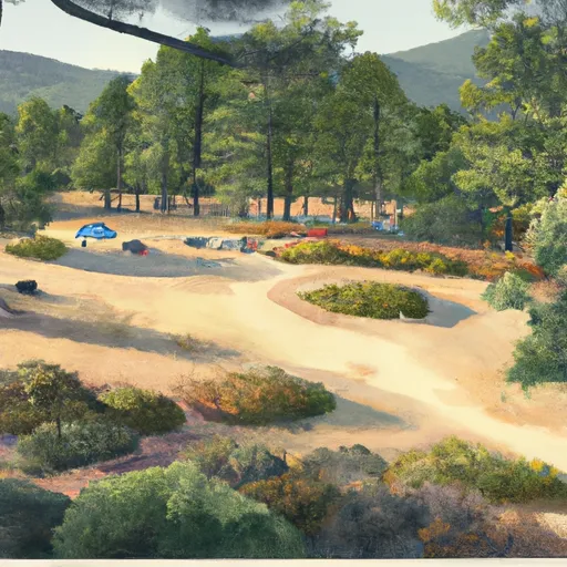
Glenn Camp Campground (Hike Or Bike In 7 Miles)
What's on-site at Glenn Camp Campground (Hike Or Bike In 7 Miles)
Key facilities Snoflo tracks for this campground. Confirm with the operator before booking -- amenities can change seasonally.
Plan your trip down to the hour
Same weather feed Snoflo's iOS app uses -- updated continuously from NOAA / yr.no.
Next 5 days, hour by hour
Temperature line with weather symbols on top, snow + rain accumulation as columns, humidity as a dotted line.
5-day forecast table
Every 3 hours, broken out across temperature, snow, rain, humidity, and wind. Each cell is colour-coded relative to the column min/max so trends jump out at a glance.
| Time | Condition | Temp (°F) | Snow (in) | Rain (in) | Humidity (%) | Wind (mps) | Wind dir |
|---|---|---|---|---|---|---|---|
| Loading detailed forecast… | |||||||
15-day temperature & precipitation
Daily temperatures, snow, and rain projected over the next two weeks. Hover any point for the full breakdown.
Other campgrounds in the area
Snoflo-tracked campsites within driving distance of Glenn Camp Campground (Hike Or Bike In 7 Miles), with reservations status.
| Campground | Reservations | Toilets | View |
|---|---|---|---|
| Glenn Camp | ✗ | ✓ | → |
| Spring Camp Campground | ✓ | ✗ | → |
| Spring Camp | ✗ | ✗ | → |
| Lower Bear Cyn | ✗ | ✗ | → |
| Camp Trask Bsa | ✗ | ✗ | → |
Nearby streamflow
USGS streamgauges within reach of Glenn Camp Campground (Hike Or Bike In 7 Miles) -- pulled live from the National Water Information System.
| Streamgauge | Discharge | View |
|---|---|---|
| San Gabriel R Bl Santa Fe Dam Nr Baldwin Pk Ca | · | → |
| Arroyo Seco Nr Pasadena Ca | 1 cfs | → |
| Big Rock C Nr Valyermo Ca | 13 cfs | → |
| Rio Hondo Ab Whittier Narrows Dam Ca | 1 cfs | → |
| San Gabriel R Ab Whittier Narrows Dam Ca | 28 cfs | → |
| Rio Hondo Bl Whittier Narrows Dam Ca | · | → |
Nearby snow depths
NRCS SNOTEL stations within reach of Glenn Camp Campground (Hike Or Bike In 7 Miles) -- relevant when planning a shoulder-season or alpine trip.
| SNOTEL station | Snowpack | 24h Snowfall | View |
|---|---|---|---|
| Hesperia 1ene | 0.0 in | 0.0 in | → |
| Lake Arrowhead 1.5 Se | 0.0 in | 0.0 in | → |
Plan a longer trip
The closest parks, lakes, boat launches, and paddle runs so a camping night can grow into a full weekend.
Parks
- Wilderness San Gabriel
- Monrovia Canyon Park
- Grand Avenue Park
- Third Street Park
- Monrovia Library Park
- Highland Oaks Park
Boat launches
Fishing spots
- Santa Fe Dam
- Peck Road Park Lake
- Puddingstone Reservoir
- Puddingstone Lake
- Legg Lake
- Garvey Reservoir
Points of interest
- Sturtevant Falls
- Stony Ridge Observatory
- Mount Wilson Observatory
- The "M"
- Lizzies Trail Inn
- Wisteria Vine, Worlds Largest Blossoming Plant
Paddle runs
- Gaging Station Below Spillway Of Cogswell Dam (Ne 1/4, Se 1/4, Sec 19, T2n, R10w) To Confluence With Nf San Gabriel River (Sw 1/4.Sw 1/4, Sec 15, T2n, R9w)
- North Fork - Confluence Of Soldier And Coldbrook Creeks (Se1/4,Sw1/4, Sec) 5, T2n,,R9w To Conflluence With West Fork Of San Gabriel (Sw 1/4,Sw1/4, Sec 17, T2n, R8w)
- Cooper Canyon- Near State Highway 2 (Sw 1/4, Ne 1/4, Sec 16, T3n, R10w To Confluence With Little Rock Creek
- West Fork - Headwaters (Se 1/4, Ne 1/4, Sec 14, T2n, R12w) To Cogswell Reservoir (Ne 1/4, Sw 1/4, Sec 24, T2n, R9w
- Mainstream - Confluence With Cooper Canyon To Confluence Wit South Fork Little Rock Creek
- Mainstream - Headwaters To Confluence With Cooper Canyon
Camping essentials & Leave No Trace
- Pack it in, pack it out
- Take all trash, food scraps, and gear back with you to keep campsites clean and protect wildlife.
- Respect wildlife
- Observe animals from a distance, store food securely, and never feed wildlife to maintain natural behavior and safety.
- Know before you go
- Check weather, fire restrictions, trail conditions, and permit requirements to ensure a safe and well-planned trip.
- Minimize campfire impact
- Use established fire rings, keep fires small, fully extinguish them, or opt for a camp stove when fires are restricted.
- Leave what you find
- Preserve natural and cultural features by avoiding removal of plants, rocks, artifacts, or other elements of the environment.
Set push alerts in the Snoflo app
Save Glenn Camp Campground (Hike Or Bike In 7 Miles) as a favorite, set a custom threshold (precipitation, snowpack, freezing temperatures), and the iOS app will push the moment conditions cross.
About Glenn Camp Campground (Hike Or Bike In 7 Miles)
Can I make reservations at Glenn Camp Campground (Hike Or Bike In 7 Miles)?
This campground does not appear to accept reservations -- it's typically first-come, first-served. Arrive early on summer weekends.
How fresh is the weather data on this page?
The hourly forecast updates throughout the day from the NOAA / yr.no public feeds. Streamflow data is pulled live from USGS streamgauges and snowpack from the NRCS SNOTEL network.
What's the best time of year to visit?
Use the 15-day temperature & precipitation outlook on this page to plan -- pick a window with comfortable temperatures and low precipitation. For longer trips, the 5-day hourly meteogram shows snow + rain accumulation hour-by-hour.
How do I get to Glenn Camp Campground (Hike Or Bike In 7 Miles)?
Tap Directions in the hero above to open driving directions in Google Maps, or Open in map to center the Snoflo interactive map on the campground.
Can I get alerts when conditions change?
Yes -- alerts are managed through the Snoflo iOS app. Favorite this campground, set a threshold (temperature, snowpack, precipitation), and you'll get a push the moment it crosses.
Other campgrounds near here
Snoflo-tracked campgrounds within driving distance of Glenn Camp Campground (Hike Or Bike In 7 Miles).