Hamilton Creek Side Campsite Campground
Community Reviews
Been here? Share the conditions.
Reviews, ratings & photos are added in the free Snoflo iOS app — rate a spot, tag the conditions, and your visit is verified by location. Add or manage your reviews from the app.
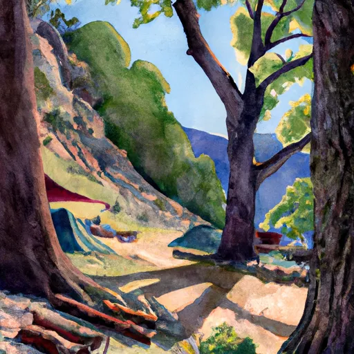
Hamilton Creek Side Campsite
Reservations are required to secure a spot at Hamilton Creek Side Campsite, ensuring that you have a designated space upon arrival. It is advisable to plan ahead and make reservations well in advance, especially during the peak camping season.
The best time to visit Hamilton Creek Side Campsite is during the spring and fall months when the weather is mild and pleasant. These seasons offer the perfect opportunity to explore the surrounding area, enjoy hiking trails, and engage in various outdoor activities. However, it's important to note that the campground can get crowded during weekends and holidays, so arriving early is recommended.
While camping at Hamilton Creek Side Campsite, be cautious of wildlife encounters, such as bears and rattlesnakes, as they are occasionally spotted in the area. Following proper food storage guidelines and staying aware of your surroundings can help ensure a safe and enjoyable camping experience.
What's on-site at Hamilton Creek Side Campsite
Key facilities Snoflo tracks for this campground. Confirm with the operator before booking -- amenities can change seasonally.
Plan your trip down to the hour
Same weather feed Snoflo's iOS app uses -- updated continuously from NOAA / yr.no.
Next 5 days, hour by hour
Temperature line with weather symbols on top, snow + rain accumulation as columns, humidity as a dotted line.
5-day forecast table
Every 3 hours, broken out across temperature, snow, rain, humidity, and wind. Each cell is colour-coded relative to the column min/max so trends jump out at a glance.
| Time | Condition | Temp (°F) | Snow (in) | Rain (in) | Humidity (%) | Wind (mps) | Wind dir |
|---|---|---|---|---|---|---|---|
| Loading detailed forecast… | |||||||
15-day temperature & precipitation
Daily temperatures, snow, and rain projected over the next two weeks. Hover any point for the full breakdown.
Other campgrounds in the area
Snoflo-tracked campsites within driving distance of Hamilton Creek Side Campsite, with reservations status.
| Campground | Reservations | Toilets | View |
|---|---|---|---|
| Hillside Campsite | ✗ | ✗ | → |
| Lakeside Campsites | ✗ | ✗ | → |
| Lakeside Bluff Campsites | ✗ | ✗ | → |
| Bearpaw Meadow High Sierra Camp | ✗ | ✗ | → |
| Log Benches Campsite | ✗ | ✗ | → |
Nearby streamflow
USGS streamgauges within reach of Hamilton Creek Side Campsite -- pulled live from the National Water Information System.
| Streamgauge | Discharge | View |
|---|---|---|
| Marble Fork Kaweah R Ab Horse C Nr Lodgepole Ca | 1 cfs | → |
| Sf Tule R Nr Cholollo Campground Nr Porterville Ca | 8 cfs | → |
| Sf Tule R Nr Reservation Bndry Nr Porterville Ca | 10 cfs | → |
| Deer C Nr Fountain Springs Ca | 5 cfs | → |
| Sf Kern R Nr Onyx Ca | 21 cfs | → |
Nearby snow depths
NRCS SNOTEL stations within reach of Hamilton Creek Side Campsite -- relevant when planning a shoulder-season or alpine trip.
| SNOTEL station | Snowpack | 24h Snowfall | View |
|---|---|---|---|
| Charlotte Lake | 11.3 in | 0.0 in | → |
| Cottonwood Lakes | 0.0 in | 0.0 in | → |
| Nohrsc Casa Vieja Meadows | 169.8 in | 0.0 in | → |
| Beach Meadows | 0.0 in | 0.0 in | → |
| Blackcap Basin Goes | 0.0 in | 0.0 in | → |
| Upper Burnt Corral Meadow | 0.0 in | 0.0 in | → |
Plan a longer trip
The closest parks, lakes, boat launches, and paddle runs so a camping night can grow into a full weekend.
Parks
- Wilderness Jennie Lakes
- Wilderness Monarch
- John Krebs Wilderness (Draft Boundary)
- Sierra National Forest
- Wilderness Sequoia-Kings Canyon
- Sequoia National Park
Boat launches
Fishing spots
Points of interest
Paddle runs
- Confluence Of Lone Pine And Hamilton (Deer) Creeks (Boundary Extend 0.25 Mile On Each Side Of River) To Wildernes Boundary
- Lake 10,559 (Boundary Extend 0.25 Mile On Each Side Of River) To Wilderness Boundary Just Below Tokopah Falls
- Wilderness Boundary Just Below Tokopah Falls (Boundary Extend 0.25 Mile On Each Side Of River) To Confluence With The Middle Fork Kaweah River
- Atwell Mill Trail Bridge At ~5,800 Ft (Boundary Extends 0.25 Mile On Each Side Of The River.) To Boundary Of Sequoia & Kings Canyon National Park
- 8,000 Ft Contour Line (Boundary Extend 0.25 Mile On Each Side Of River) To The Atwell Mill Trail Bridge At ~ 5,800 Ft
- 9,000 Ft Contour Line (Boundary Extend 0.25 Mile On Each Side Of River) To 8,000 Ft Contour Line
Camping essentials & Leave No Trace
- Pack it in, pack it out
- Take all trash, food scraps, and gear back with you to keep campsites clean and protect wildlife.
- Respect wildlife
- Observe animals from a distance, store food securely, and never feed wildlife to maintain natural behavior and safety.
- Know before you go
- Check weather, fire restrictions, trail conditions, and permit requirements to ensure a safe and well-planned trip.
- Minimize campfire impact
- Use established fire rings, keep fires small, fully extinguish them, or opt for a camp stove when fires are restricted.
- Leave what you find
- Preserve natural and cultural features by avoiding removal of plants, rocks, artifacts, or other elements of the environment.
Set push alerts in the Snoflo app
Save Hamilton Creek Side Campsite as a favorite, set a custom threshold (precipitation, snowpack, freezing temperatures), and the iOS app will push the moment conditions cross.
About Hamilton Creek Side Campsite
Can I make reservations at Hamilton Creek Side Campsite?
This campground does not appear to accept reservations -- it's typically first-come, first-served. Arrive early on summer weekends.
How fresh is the weather data on this page?
The hourly forecast updates throughout the day from the NOAA / yr.no public feeds. Streamflow data is pulled live from USGS streamgauges and snowpack from the NRCS SNOTEL network.
What's the best time of year to visit?
Use the 15-day temperature & precipitation outlook on this page to plan -- pick a window with comfortable temperatures and low precipitation. For longer trips, the 5-day hourly meteogram shows snow + rain accumulation hour-by-hour.
How do I get to Hamilton Creek Side Campsite?
Tap Directions in the hero above to open driving directions in Google Maps, or Open in map to center the Snoflo interactive map on the campground.
Can I get alerts when conditions change?
Yes -- alerts are managed through the Snoflo iOS app. Favorite this campground, set a threshold (temperature, snowpack, precipitation), and you'll get a push the moment it crosses.
Other campgrounds near here
Snoflo-tracked campgrounds within driving distance of Hamilton Creek Side Campsite.