Mokelumne River Campground
Community Reviews
Been here? Share the conditions.
Reviews, ratings & photos are added in the free Snoflo iOS app — rate a spot, tag the conditions, and your visit is verified by location. Add or manage your reviews from the app.
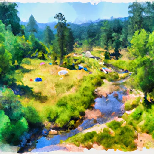
Mokelumne River
Reservations are accepted for this campground, ensuring campers have a guaranteed spot upon arrival. It is recommended to book in advance, especially during peak seasons, to secure a desired campsite.
The best time of year to visit the Mokelumne River camping area is during the spring and fall seasons when the weather is pleasant, and the area is less crowded. During these times, visitors can enjoy various outdoor activities such as fishing, hiking, and wildlife viewing. However, it is advised to check the weather conditions before planning a trip, as summer months can be hot, and winter months may experience heavy rainfall.
While camping at Mokelumne River, campers should be cautious of potential wildlife encounters, including black bears. It is important to store food properly and follow all recommended safety guidelines to minimize any risks. Additionally, campers should be mindful of their surroundings and respectful of the environment, adhering to the principles of Leave No Trace. By doing so, visitors can fully enjoy the natural beauty and tranquility that Mokelumne River camping area has to offer.
What's on-site at Mokelumne River
Key facilities Snoflo tracks for this campground. Confirm with the operator before booking -- amenities can change seasonally.
Plan your trip down to the hour
Same weather feed Snoflo's iOS app uses -- updated continuously from NOAA / yr.no.
Next 5 days, hour by hour
Temperature line with weather symbols on top, snow + rain accumulation as columns, humidity as a dotted line.
5-day forecast table
Every 3 hours, broken out across temperature, snow, rain, humidity, and wind. Each cell is colour-coded relative to the column min/max so trends jump out at a glance.
| Time | Condition | Temp (°F) | Snow (in) | Rain (in) | Humidity (%) | Wind (mps) | Wind dir |
|---|---|---|---|---|---|---|---|
| Loading detailed forecast… | |||||||
15-day temperature & precipitation
Daily temperatures, snow, and rain projected over the next two weeks. Hover any point for the full breakdown.
Other campgrounds in the area
Snoflo-tracked campsites within driving distance of Mokelumne River, with reservations status.
| Campground | Reservations | Toilets | View |
|---|---|---|---|
| Mokelumne | ✗ | ✓ | → |
| Mokelumne Campground | ✓ | ✗ | → |
| Moore Creek | ✓ | ✓ | → |
| White Azalea Campground | ✓ | ✗ | → |
| Bear River South Shore Campground | ✗ | ✗ | → |
Nearby streamflow
USGS streamgauges within reach of Mokelumne River -- pulled live from the National Water Information System.
| Streamgauge | Discharge | View |
|---|---|---|
| Upper Truckee R At S Upper Truckee Rd Nr Meyers Ca | 4 cfs | → |
| Upper Truckee R At Hwy 50 Above Meyers Ca | 9 cfs | → |
| West Fork Carson River At Woodfords | 20 cfs | → |
| E F Carson R Bl Markleeville C Nr Markleevilleca | 77 cfs | → |
| Pilot C Ab Stumpy Meadows Res Ca | 3 cfs | → |
| Up Truckee R A South Lake Tahoe Ca | 11 cfs | → |
Nearby snow depths
NRCS SNOTEL stations within reach of Mokelumne River -- relevant when planning a shoulder-season or alpine trip.
| SNOTEL station | Snowpack | 24h Snowfall | View |
|---|---|---|---|
| Black Springs | 0.0 in | 0.0 in | → |
| Bloods Creek | 0.0 in | 0.0 in | → |
| Nohrsc Silver Lake (Goes) | 33.4 in | 0.0 in | → |
| Nohrsc Elstanislaus Meadow (Goes) | 0.1 in | 0.0 in | → |
| Nohrsc Blue Lakes | 1.0 in | 0.0 in | → |
| Lost Lake Snotel | 0.0 in | 0.0 in | → |
Plan a longer trip
The closest parks, lakes, boat launches, and paddle runs so a camping night can grow into a full weekend.
Parks
- Wilderness Mokelumne
- Eldorado National Forest
- Calaveras Big Trees State Park
- Indian Grinding Rocks State Park
- Mount Zion State Forest
- Wilderness Desolation
Boat launches
Fishing spots
- Salt Springs Reservoir
- Lower Bear River Reservoir
- Bear River Reservoir
- Highland Creek
- Silver Lake (Kirkwood)
- Hobart Creek
Points of interest
- Equipe Hut
- Bjornloppet Hut
- Osborne Ridge Warming Hut
- Calaveras Big Trees State Park Visitor Center
- Campfire Center
- Big Stump
Paddle runs
- Boundary Of Mokelumne Archeological Special Interest Area To Confluence With Mokelumne
- Boundary Of Mokelumne Archeologic Special Interest Area To Confluence With North Fork Mokelumne River
- Boundary Of Mokelumne Archeological Special Interest Area To Confluence With North Fork Mokelumne
- Salt Springs Reservoir Dam To To A Point 1 Mile West Of Bear River Confluence
- Confluence With Cat Creek To One Mile East Of Pipi Campground
- Headwater In Sec 29, T9n,R16e To Confluence With Cat Creek
Camping essentials & Leave No Trace
- Pack it in, pack it out
- Take all trash, food scraps, and gear back with you to keep campsites clean and protect wildlife.
- Respect wildlife
- Observe animals from a distance, store food securely, and never feed wildlife to maintain natural behavior and safety.
- Know before you go
- Check weather, fire restrictions, trail conditions, and permit requirements to ensure a safe and well-planned trip.
- Minimize campfire impact
- Use established fire rings, keep fires small, fully extinguish them, or opt for a camp stove when fires are restricted.
- Leave what you find
- Preserve natural and cultural features by avoiding removal of plants, rocks, artifacts, or other elements of the environment.
Set push alerts in the Snoflo app
Save Mokelumne River as a favorite, set a custom threshold (precipitation, snowpack, freezing temperatures), and the iOS app will push the moment conditions cross.
About Mokelumne River
Can I make reservations at Mokelumne River?
This campground does not appear to accept reservations -- it's typically first-come, first-served. Arrive early on summer weekends.
How fresh is the weather data on this page?
The hourly forecast updates throughout the day from the NOAA / yr.no public feeds. Streamflow data is pulled live from USGS streamgauges and snowpack from the NRCS SNOTEL network.
What's the best time of year to visit?
Use the 15-day temperature & precipitation outlook on this page to plan -- pick a window with comfortable temperatures and low precipitation. For longer trips, the 5-day hourly meteogram shows snow + rain accumulation hour-by-hour.
How do I get to Mokelumne River?
Tap Directions in the hero above to open driving directions in Google Maps, or Open in map to center the Snoflo interactive map on the campground.
Can I get alerts when conditions change?
Yes -- alerts are managed through the Snoflo iOS app. Favorite this campground, set a threshold (temperature, snowpack, precipitation), and you'll get a push the moment it crosses.
Other campgrounds near here
Snoflo-tracked campgrounds within driving distance of Mokelumne River.