Sims Flat Campground Campground
Community Reviews
Been here? Share the conditions.
Reviews, ratings & photos are added in the free Snoflo iOS app — rate a spot, tag the conditions, and your visit is verified by location. Add or manage your reviews from the app.
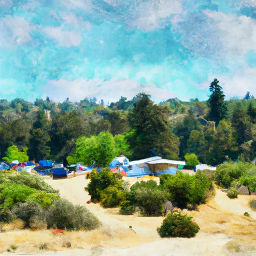
Sims Flat Campground
The campground provides several amenities to enhance the camping experience. It offers spacious campsites with fire rings, picnic tables, and access to clean restroom facilities. Additionally, there are potable water stations available throughout the campground. However, it is important to note that there are no RV hook-ups or showers at this location.
Reservations are accepted at Sims Flat Campground, making it easier for campers to plan their trip in advance. It is advisable to make a reservation, especially during peak seasons, to secure a spot at this popular camping area.
The best time to visit Sims Flat Campground is during the spring and fall seasons when the weather is generally mild and pleasant. Summers can get hot, so it is recommended to bring adequate sun protection and stay hydrated. The area also experiences cold winters, so appropriate gear is necessary if camping during this time.
While camping at Sims Flat Campground, visitors can explore the nearby Trinity River, which offers opportunities for fishing, swimming, and canoeing. Hiking enthusiasts can enjoy scenic trails in the Trinity Alps Wilderness, located close to the campground. It is important to be cautious of wildlife during visits, as the area is home to various animals such as bears and mountain lions. Proper food storage and awareness of surroundings are essential for a safe and enjoyable camping experience.
What's on-site at Sims Flat Campground
Key facilities Snoflo tracks for this campground. Confirm with the operator before booking -- amenities can change seasonally.
Plan your trip down to the hour
Same weather feed Snoflo's iOS app uses -- updated continuously from NOAA / yr.no.
Next 5 days, hour by hour
Temperature line with weather symbols on top, snow + rain accumulation as columns, humidity as a dotted line.
5-day forecast table
Every 3 hours, broken out across temperature, snow, rain, humidity, and wind. Each cell is colour-coded relative to the column min/max so trends jump out at a glance.
| Time | Condition | Temp (°F) | Snow (in) | Rain (in) | Humidity (%) | Wind (mps) | Wind dir |
|---|---|---|---|---|---|---|---|
| Loading detailed forecast… | |||||||
15-day temperature & precipitation
Daily temperatures, snow, and rain projected over the next two weeks. Hover any point for the full breakdown.
Other campgrounds in the area
Snoflo-tracked campsites within driving distance of Sims Flat Campground, with reservations status.
| Campground | Reservations | Toilets | View |
|---|---|---|---|
| Sims Flat | ✗ | ✗ | → |
| Girard Ridge Lookout | ✓ | ✗ | → |
| Castle Crags State Park | ✓ | ✓ | → |
| Riverside Campground | ✗ | ✗ | → |
| Lower Loop Campground | ✗ | ✗ | → |
Nearby streamflow
USGS streamgauges within reach of Sims Flat Campground -- pulled live from the National Water Information System.
| Streamgauge | Discharge | View |
|---|---|---|
| Sacramento R A Delta Ca | 248 cfs | → |
| Trinity R Ab Coffee C Nr Trinity Ctr Ca | 27 cfs | → |
| Sacramento R A Keswick Ca | 13,200 cfs | → |
| Trinity R A Lewiston Ca | 450 cfs | → |
| Rush C Nr Lewiston Ca | 2 cfs | → |
| Anderson-Cottonwood Id Cn At Sharon St Redding Ca | 260 cfs | → |
Nearby snow depths
NRCS SNOTEL stations within reach of Sims Flat Campground -- relevant when planning a shoulder-season or alpine trip.
| SNOTEL station | Snowpack | 24h Snowfall | View |
|---|---|---|---|
| Nohrsc Slate Creek | 0.8 in | 0.0 in | → |
| Highlands Lakes | 18.7 in | 0.0 in | → |
| Castle Lake | 9.6 in | 0.0 in | → |
| Mumbo Basin Raws | 0.0 in | 0.0 in | → |
| Bonanza King | 0.0 in | 0.0 in | → |
| Mt. Eddy | 1.1 in | 0.0 in | → |
Plan a longer trip
The closest parks, lakes, boat launches, and paddle runs so a camping night can grow into a full weekend.
Parks
- Castle Crags State Park
- Wilderness Castle Crags
- Dunsmuir City Park And Botanical Gardens
- Cantara/Ney Springs Wildlife Area
- Mt Shasta City Park
- Shastice Park
Boat launches
- Antlers Resort & Marina
- Castle Lake Trail #4w02 Siskiyou County
- Shasta Lake (Antlers)
- Sugarloaf Resort
- Shasta Lake (Hirz Bay)
- Lake Siskiyou Trail - Delta Segment Siskiyou County
Fishing spots
Camping essentials & Leave No Trace
- Pack it in, pack it out
- Take all trash, food scraps, and gear back with you to keep campsites clean and protect wildlife.
- Respect wildlife
- Observe animals from a distance, store food securely, and never feed wildlife to maintain natural behavior and safety.
- Know before you go
- Check weather, fire restrictions, trail conditions, and permit requirements to ensure a safe and well-planned trip.
- Minimize campfire impact
- Use established fire rings, keep fires small, fully extinguish them, or opt for a camp stove when fires are restricted.
- Leave what you find
- Preserve natural and cultural features by avoiding removal of plants, rocks, artifacts, or other elements of the environment.
Set push alerts in the Snoflo app
Save Sims Flat Campground as a favorite, set a custom threshold (precipitation, snowpack, freezing temperatures), and the iOS app will push the moment conditions cross.
About Sims Flat Campground
Can I make reservations at Sims Flat Campground?
This campground does not appear to accept reservations -- it's typically first-come, first-served. Arrive early on summer weekends.
How fresh is the weather data on this page?
The hourly forecast updates throughout the day from the NOAA / yr.no public feeds. Streamflow data is pulled live from USGS streamgauges and snowpack from the NRCS SNOTEL network.
What's the best time of year to visit?
Use the 15-day temperature & precipitation outlook on this page to plan -- pick a window with comfortable temperatures and low precipitation. For longer trips, the 5-day hourly meteogram shows snow + rain accumulation hour-by-hour.
How do I get to Sims Flat Campground?
Tap Directions in the hero above to open driving directions in Google Maps, or Open in map to center the Snoflo interactive map on the campground.
Can I get alerts when conditions change?
Yes -- alerts are managed through the Snoflo iOS app. Favorite this campground, set a threshold (temperature, snowpack, precipitation), and you'll get a push the moment it crosses.
Other campgrounds near here
Snoflo-tracked campgrounds within driving distance of Sims Flat Campground.