Trail Creek Campground Campground
Community Reviews
Been here? Share the conditions.
Reviews, ratings & photos are added in the free Snoflo iOS app — rate a spot, tag the conditions, and your visit is verified by location. Add or manage your reviews from the app.
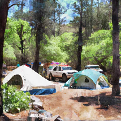
Trail Creek Campground
The campground amenities include flush toilets, campfire rings, and picnic tables. There are 30 campsites available for reservation or first-come-first-serve, with a maximum of 6 people per site. An interesting fact about the area is that it is home to the largest living tree on Earth - the General Sherman Tree.
The best time to visit Trail Creek Campground is during the summer months when the average temperature is around 80°F during the day and 50°F at night. However, visitors should be prepared for cooler temperatures and occasional rain showers. Overall, Trail Creek Campground is a great place to escape the hustle and bustle of city life and enjoy the natural beauty of the Sierra Nevada Mountains.
What's on-site at Trail Creek Campground
Key facilities Snoflo tracks for this campground. Confirm with the operator before booking -- amenities can change seasonally.
Plan your trip down to the hour
Same weather feed Snoflo's iOS app uses -- updated continuously from NOAA / yr.no.
Next 5 days, hour by hour
Temperature line with weather symbols on top, snow + rain accumulation as columns, humidity as a dotted line.
5-day forecast table
Every 3 hours, broken out across temperature, snow, rain, humidity, and wind. Each cell is colour-coded relative to the column min/max so trends jump out at a glance.
| Time | Condition | Temp (°F) | Snow (in) | Rain (in) | Humidity (%) | Wind (mps) | Wind dir |
|---|---|---|---|---|---|---|---|
| Loading detailed forecast… | |||||||
15-day temperature & precipitation
Daily temperatures, snow, and rain projected over the next two weeks. Hover any point for the full breakdown.
Other campgrounds in the area
Snoflo-tracked campsites within driving distance of Trail Creek Campground, with reservations status.
| Campground | Reservations | Toilets | View |
|---|---|---|---|
| Hidden Horse Campground | ✗ | ✗ | → |
| Carter Meadows Campground | ✗ | ✗ | → |
| South Fork Scott River | ✗ | ✗ | → |
| Shadow Creek | ✗ | ✓ | → |
| Shadow Creek Campground | ✗ | ✗ | → |
Nearby streamflow
USGS streamgauges within reach of Trail Creek Campground -- pulled live from the National Water Information System.
| Streamgauge | Discharge | View |
|---|---|---|
| Trinity R Ab Coffee C Nr Trinity Ctr Ca | 28 cfs | → |
| Salmon R A Somes Bar Ca | 269 cfs | → |
| Scott R Nr Fort Jones Ca | 30 cfs | → |
| Klamath R A Orleans | 1,020 cfs | → |
| Nf Trinity R A Helena Ca | 47 cfs | → |
| Trinity R Ab Nf Trinity R Nr Helena Ca | 455 cfs | → |
Nearby snow depths
NRCS SNOTEL stations within reach of Trail Creek Campground -- relevant when planning a shoulder-season or alpine trip.
| SNOTEL station | Snowpack | 24h Snowfall | View |
|---|---|---|---|
| Nohrsc Middle Boulder 3 Snow Course | 0.0 in | 0.0 in | → |
| Big Flat | 0.0 in | 0.0 in | → |
| Nohrsc Scott Mountain | 0.5 in | 0.0 in | → |
| Nohrsc Red Rock Mountain | 0.0 in | 0.0 in | → |
| Bonanza King | 0.0 in | 0.0 in | → |
| Mumbo Basin Raws | 0.0 in | 0.0 in | → |
Plan a longer trip
The closest parks, lakes, boat launches, and paddle runs so a camping night can grow into a full weekend.
Parks
- Wilderness Russian
- Klamath National Forest
- Wilderness Marble Mountain
- Etna City Park
- Wilderness Castle Crags
- Castle Crags State Park
Boat launches
- Jack Ass Creek River Access
- Matthews Creek River Access
- Red Bank River Access
- Methodist Creek River Access
- Saw Pit Flat River Access
- National Forest Development Road 41n08 Siskiyou County
Fishing spots
Paddle runs
- Scott District Boundary To Confluence With Sixmile Creek
- Headwaters In Russian Wilderness To Wilderness Boundary
- Wilderness Boundary To Forest Road 40n54
- Confluence With Sixmile Creek To Confluence With South Fork Salmon River
- Confluence With Blind Horse Creek To Cecilville Bridge
- Confluence Of Tributaries In Sec 6 Near Black Mtn. To Confluence With Blind Horse Creek
Camping essentials & Leave No Trace
- Pack it in, pack it out
- Take all trash, food scraps, and gear back with you to keep campsites clean and protect wildlife.
- Respect wildlife
- Observe animals from a distance, store food securely, and never feed wildlife to maintain natural behavior and safety.
- Know before you go
- Check weather, fire restrictions, trail conditions, and permit requirements to ensure a safe and well-planned trip.
- Minimize campfire impact
- Use established fire rings, keep fires small, fully extinguish them, or opt for a camp stove when fires are restricted.
- Leave what you find
- Preserve natural and cultural features by avoiding removal of plants, rocks, artifacts, or other elements of the environment.
Set push alerts in the Snoflo app
Save Trail Creek Campground as a favorite, set a custom threshold (precipitation, snowpack, freezing temperatures), and the iOS app will push the moment conditions cross.
About Trail Creek Campground
Can I make reservations at Trail Creek Campground?
This campground does not appear to accept reservations -- it's typically first-come, first-served. Arrive early on summer weekends.
How fresh is the weather data on this page?
The hourly forecast updates throughout the day from the NOAA / yr.no public feeds. Streamflow data is pulled live from USGS streamgauges and snowpack from the NRCS SNOTEL network.
What's the best time of year to visit?
Use the 15-day temperature & precipitation outlook on this page to plan -- pick a window with comfortable temperatures and low precipitation. For longer trips, the 5-day hourly meteogram shows snow + rain accumulation hour-by-hour.
How do I get to Trail Creek Campground?
Tap Directions in the hero above to open driving directions in Google Maps, or Open in map to center the Snoflo interactive map on the campground.
Can I get alerts when conditions change?
Yes -- alerts are managed through the Snoflo iOS app. Favorite this campground, set a threshold (temperature, snowpack, precipitation), and you'll get a push the moment it crosses.
Other campgrounds near here
Snoflo-tracked campgrounds within driving distance of Trail Creek Campground.