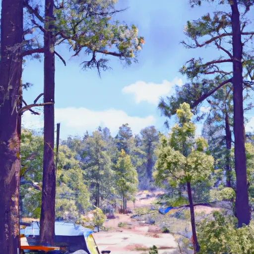
Wench Creek Campground
Community Reviews
Been here? Share the conditions.
Reviews, ratings & photos are added in the free Snoflo iOS app — rate a spot, tag the conditions, and your visit is verified by location. Add or manage your reviews from the app.
Wench Creek
Reservations are not accepted at Wench Creek camping area, making it a first-come, first-served campground. It is advisable to arrive early, especially during peak seasons, to secure a spot. The best time of year to visit this camping area is during the spring and fall when the weather is mild and pleasant. Summers tend to be hot, while winters can bring colder temperatures and occasional snowfall.
While camping at Wench Creek, campers can indulge in various activities such as fishing, hiking, and wildlife observation. The nearby Wench Creek Falls is a popular attraction, providing a beautiful backdrop for photography enthusiasts. It is essential to exercise caution while camping in this area, as wildlife encounters are possible. Be sure to store food properly to avoid attracting animals and follow all safety guidelines provided by park authorities.
What's on-site at Wench Creek
Key facilities Snoflo tracks for this campground. Confirm with the operator before booking -- amenities can change seasonally.
Plan your trip down to the hour
Same weather feed Snoflo's iOS app uses -- updated continuously from NOAA / yr.no.
Next 5 days, hour by hour
Temperature line with weather symbols on top, snow + rain accumulation as columns, humidity as a dotted line.
5-day forecast table
Every 3 hours, broken out across temperature, snow, rain, humidity, and wind. Each cell is colour-coded relative to the column min/max so trends jump out at a glance.
| Time | Condition | Temp (°F) | Snow (in) | Rain (in) | Humidity (%) | Wind (mps) | Wind dir |
|---|---|---|---|---|---|---|---|
| Loading detailed forecast… | |||||||
15-day temperature & precipitation
Daily temperatures, snow, and rain projected over the next two weeks. Hover any point for the full breakdown.
Other campgrounds in the area
Snoflo-tracked campsites within driving distance of Wench Creek, with reservations status.
| Campground | Reservations | Toilets | View |
|---|---|---|---|
| Wench Creek Campground | ✗ | ✗ | → |
| Azalea Cove Campground | ✓ | ✗ | → |
| Yellow Jacket Campground | ✗ | ✗ | → |
| Yellowjacket Campground | ✓ | ✗ | → |
| Big Silver Group Campground | ✗ | ✗ | → |
Nearby streamflow
USGS streamgauges within reach of Wench Creek -- pulled live from the National Water Information System.
| Streamgauge | Discharge | View |
|---|---|---|
| Pilot C Ab Stumpy Meadows Res Ca | 3 cfs | → |
| Pilot C Bl Mutton Canyon Nr Georgetown Ca | 2 cfs | → |
| General C Nr Meeks Bay Ca | 1 cfs | → |
| Upper Truckee R At Hwy 50 Above Meyers Ca | 10 cfs | → |
| Blackwood C Nr Tahoe City Ca | 2 cfs | → |
| Upper Truckee R At S Upper Truckee Rd Nr Meyers Ca | 4 cfs | → |
Nearby snow depths
NRCS SNOTEL stations within reach of Wench Creek -- relevant when planning a shoulder-season or alpine trip.
| SNOTEL station | Snowpack | 24h Snowfall | View |
|---|---|---|---|
| Alpha | 0.0 in | 0.0 in | → |
| Nohrsc Forni Ridge | 1.1 in | 0.0 in | → |
| Nohrsc Rubicon #2 | 0.0 in | 0.0 in | → |
| Rubicon #2 | 0.0 in | 0.0 in | → |
| Nohrsc Echo Peak | 0.0 in | 0.0 in | → |
| Echo Peak | 0.0 in | 0.0 in | → |
Plan a longer trip
The closest parks, lakes, boat launches, and paddle runs so a camping night can grow into a full weekend.
Parks
- Granite Chief Wilderness
- Ed Z'Berg Sugar Pine Point State Park
- Dl Bliss State Park
- Emerald Bay State Park
- Wilderness Desolation
- Washoe Meadows State Park
Boat launches
- Union Valley Reservoir - Peninsula
- Union Valley Rervoir - West Point
- Ice House Reservoir
- Junction Boat Ramp Road El Dorado County
- Dry Lakes Trail El Dorado County
- Loon Lake
Fishing spots
Camping essentials & Leave No Trace
- Pack it in, pack it out
- Take all trash, food scraps, and gear back with you to keep campsites clean and protect wildlife.
- Respect wildlife
- Observe animals from a distance, store food securely, and never feed wildlife to maintain natural behavior and safety.
- Know before you go
- Check weather, fire restrictions, trail conditions, and permit requirements to ensure a safe and well-planned trip.
- Minimize campfire impact
- Use established fire rings, keep fires small, fully extinguish them, or opt for a camp stove when fires are restricted.
- Leave what you find
- Preserve natural and cultural features by avoiding removal of plants, rocks, artifacts, or other elements of the environment.
Set push alerts in the Snoflo app
Save Wench Creek as a favorite, set a custom threshold (precipitation, snowpack, freezing temperatures), and the iOS app will push the moment conditions cross.
About Wench Creek
Can I make reservations at Wench Creek?
Yes -- this campground accepts reservations. Snoflo recommends booking early for peak season; check the operator (Recreation.gov / state park system / private operator) for the booking window and cancellation policy.
How fresh is the weather data on this page?
The hourly forecast updates throughout the day from the NOAA / yr.no public feeds. Streamflow data is pulled live from USGS streamgauges and snowpack from the NRCS SNOTEL network.
What's the best time of year to visit?
Use the 15-day temperature & precipitation outlook on this page to plan -- pick a window with comfortable temperatures and low precipitation. For longer trips, the 5-day hourly meteogram shows snow + rain accumulation hour-by-hour.
How do I get to Wench Creek?
Tap Directions in the hero above to open driving directions in Google Maps, or Open in map to center the Snoflo interactive map on the campground.
Can I get alerts when conditions change?
Yes -- alerts are managed through the Snoflo iOS app. Favorite this campground, set a threshold (temperature, snowpack, precipitation), and you'll get a push the moment it crosses.
Other campgrounds near here
Snoflo-tracked campgrounds within driving distance of Wench Creek.