Lowry
Air Quality: Good
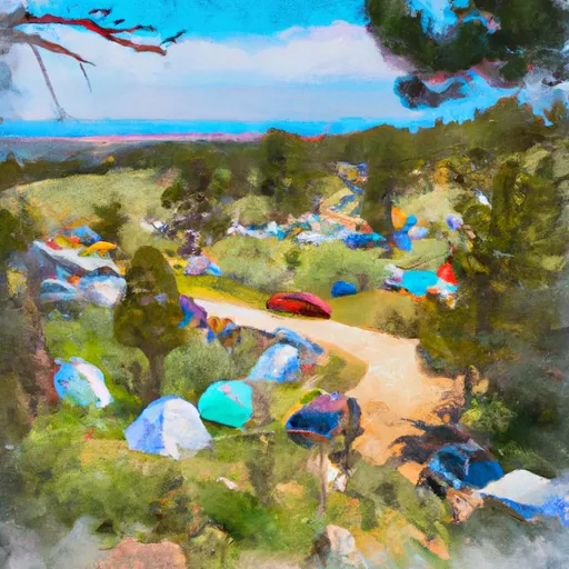
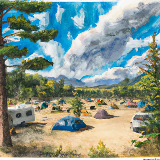
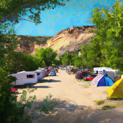
This camping area features
24
reservable
campsites perched at an elevation of
9068ft in the state of Colorado.
If you're headed here today, be sure to check out
travel times and driving directions
before you go.
Remember to reserve your campsite early.
Reserve your campsite now!
High altitude campgrounds like this one can get very cold at night, even during the warm summer months. Remember to pack accordingly.
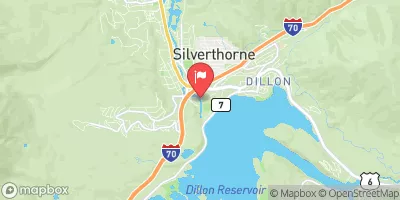
Visitors may find numerous amenities toilets, clean potable drinking water, electric hookups for recreational vehicles (RV's), and a comfy place to pitch a tent. The surrounding area also offers outdoor enthusiasts the simple pleasure of being outside. Check out the map above to view nearby river levels, or head to the interactive map to explore the surrounding area.
Toilets |
Yes |
Dump |
No |
Reservations |
Yes |
Showers |
No |
Drinking-Water |
Yes |
Electric-Hookup |
Yes |
Get Unlimited Access with Snoflo Premium
Know before you go with climate maps, insightful analytics, weather forecasts and more!
Weather Forecast
Areas of Interest
Tenmile Range Peak 1SummitDirections |
A proposal to establish the name Melzer Peak for this feature was submitted by a private citizen in June 1986; this proposal was rejected by the U.S. Board on Geographic Names (USBGN) on 12 February 1987. |
Mount MachebeufSummitDirections |
Named for the first Catholic bishop of Denver, CO., Joseph Machebeuf (CO-T3/092892/p33). |
Shrine Pass Road #709Auto TouringDirections |
This dirt road starts at Vail Pass and ends at the town of Redcliff. It can be traveled in either direction, but for biking it is much easier starting at Vail Pass. This dirt road is passable by all but the lowest passenger cars and is relatively easy for mountain bikers. It offers views of Mount of the Holy Cross in the Sawatch Range, access to the Shrine Mountain Trail, and access to the short, accessible trail to "Julia's Deck."Click here to see a Recreation Quicksheet for this road, complete with directions, description, map, and more. |
Mount Of The Holy Cross Overlook Observation SiteAuto TouringDirections |
This observation deck, also known as Julia's Deck, is accessed by an easy 1/8 mile accessible trail. It provides views of the Mount of the Holy Cross and is often reserved for wedding ceremonies. The small wooden deck has 3 benches for seating and can hold approximately 30 people. The parking area can hold up to 10 vehicles and has a vault toilet. Call the Holy Cross Ranger District to reserve a 2-3 hour time slot during the summer months.Click here for a photo gallery. |
Vail Pass / Tenmile Canyon National Recreation TraBikingDirections |
The Vail Pass / Tenmile Canyon National Recreation Trail begins at Gore Creek Campground and ends at Copper Mtn: This paved trail starts where Bighorn Road ends, follows what used to be old Highway 6 over Vail Pass, and then descends to Copper Mountain. It is a popular biking trail, so be careful to stay on the right side of the trail as bikers descend toward you. |
Gibson Lake Trailhead #633HikingDirections |
TheGibson Lake Trailhead #633 travels in a westerly direction up the Lake Fork drainage. Just below the parking area, you cross the headwaters of the North fork of the South Platte River. The last 1.4 miles drive to the trailhead is rough. |
Pitkin LakeLakeDirections |
Named for Frederick Pitkin, a CO governor before the turn of the century. |
Shelf Lake TrailheadHikingDirections |
For the first one and a half mile, the trail climbs steadily in a north-northwest direction in the Smelter Gulch drainage. The trail then rises at a less rapid rate until treeline at about mile 2.4. The final ¾ mile rises more rapidly in a series of switchbacks up to the shelf on which the lake is located. There are five major stream crossings on the trail. The first two are about 200 feet apart, and are located about 0.7 mile from the trailhead. Above the second major stream crossing, Smelter Gulch stream will be to the left (south) of the trail. At slightly over 1 mile from the trailhead, the trail makes two more stream crossings and the drainage will again be to the left (south) of the trail. At 2.0 miles, you will reach the fifth (and final) major stream crossing. From this point onward to the lake, the drainage is to the right (north) of the trail. As you reach treeline, the trail begins to pass through willows in which there frequently appear to be several trails that come and go. Continue in a north-northwest direction and maintain your elevation if you get confused. As you reach treeline, you will see on your right several series of cascading falls as the terrain steepens. The final stretch of the trail bends left (west) up a steep series of switchbacks on the tundra. In mid-summer, this final stretch of the trail has a spectacular display of wildflowers. Note that the actual trail described above varies somewhat from how it is represented on the topographic quad map. |
Jefferson Lake Picnic AreaPicnickingDirections |
Jefferson Lake PicnicArea isnext to Jefferson Lake. There aresix picnic sites here. Each site is equipped with a grill, a picnic table, and parking for up to two vehicles. |
Boreas Pass Section HouseFire Lookouts/Cabins OvernightDirections |
The section house is located at thesummit of Boreas Pass and in the late 1800s and early 1900s served as the main building for the Denver, South Pacific, and PacificRailroad when it made its way over the pass.This areawas the site of the highest narrow guage railroad in the United States. During the period between 1870 and 1920, a town of 150 people existed at Boreas Pass helping to maintain the railroad and the trains that passed by.Today the Section Houseis restored to its former glory. Visitors may see what life was like in such an unforgiving environment. The section house is staffed July through September by the Forest Service to provide interpretation, and information to visitors.Overnight reservations can be madeduring the winter months at: www.summithuts.org |
Quandary CreekStreamDirections |
A proposal to change the name Quandary Creek to Amie Blanc Creek East was submitted in March 1999. In September 2000, the proposal was rejected by the U.S. Board on Geographic Names (USBGN). |
Vasquez PeakSummitDirections |
Reportedly named for either Louis Vasquez, who built a fort on Clear Creek in 1832, or for his brother Antoine F. Vasquez, an interpreter for Lieutenant Zebulon Pike (Colorado Place Names, Bright, 1993). |
Burning Bear South Trailhead #601BikingDirections |
The Burning Bear South Trailhead provides access to the Burning Bear Trail #601. The trail is a pleasant 5.5 miles,going from Hall Valley (Park County Road 60) to Geneva Creek.Trail is accessible for hikers, horses and biccles. Allow approximately 2 1/2 to 3 hours to hike the entire trail. |
Resolution Road #702Auto TouringDirections |
This dirt road starts at Camp Hale and ends at Ptarmigan Pass: This is an easy graded road to the top of Ptarmigan Pass which is wide and flat. There are wonderful panoramic views here and you may also notice remnants of old buildings and saw mills in this area (they are old saw mills that operated near the turn of the century, and supplied many of the ranches and farms in this area with building supplies). There is room to turn around here and return the way you came.Click here to see a Recreation Quicksheet for this road, complete with directions, description, map, and more. |
Popular Destinations
Campground | Campsites | Reservations | Toilets | Showers | Elevation |
---|---|---|---|---|---|
Horseshoe | 19 | 10,538 ft | |||
Prospector | 107 | 9,105 ft | |||
Pine Cove | 56 | 9,022 ft | |||
Heaton Bay | 81 | 9,072 ft | |||
Sugar Loaf | 11 | 8,989 ft | |||
Blue River | 24 | 8,472 ft | |||
Fourmile | 14 | 10,824 ft | |||
Kite Lake | 5 | 12,043 ft | |||
Selkirk | 15 | 10,488 ft | |||
Willow Creek | 35 | 8,201 ft | |||
Byers Creek | 6 | 9,352 ft | |||
Beaver Creek Unti - Hot Sulphur State Wildlife Area | 10 | 7,592 ft | |||
Peak One | 74 | 9,030 ft | |||
Lowry | 24 | 9,068 ft |
Ski Area | Snowpack | Air Temperature | 5 Day Forecast |
---|---|---|---|
Loveland | 64" | 14° | 2.51" |
Copper Mountain Resort | 52" | 17° | 2.24" |
Vail | 65" | 17° | 3.78" |
Breckenridge Ski Resort | 52" | 17° | 2.24" |
SolVista Basin at Granby Ranch | 69" | 18° | 3.08" |
Ski Cooper | 31" | 17° | 1.19" |
Keystone Resort | 45" | 19° | 1.87" |
Arapahoe Basin | 64" | 14° | 2.51" |
Location | Fish Habitat | Craft Restrictions |
---|---|---|
Trap Lake | Brook Trout, Cutbow Trout, Cutthroat Trout | Wakeless |
Rock Lake & Little Rock Lake - Rmnp | Brook Trout | None |
Laramie Lake | Brook Trout, Cutthroat Trout, Tiger Trout | None |
Shadow Mountain Reservoir | Brook Trout, Brown Trout, Cutthroat Trout | Wakeless |
Silver Dollar Lake | Cutthroat Trout | Electric Motors Only |
Montgomery Reservoir | Cutbow Trout, Rainbow Trout | Non Motorized Hand-Launch |
Cone Lake | None | |
Monarch Lake | Brook Trout, Brown Trout, Rainbow Trout | Non Motorized Hand-Launch |
Cottonwood Lake | ||
Joe Wright Reservoir | Arctic Grayling, Cutthroat Trout, Lake Trout | Wakeless |
Cottonwood Lake (Buena Vista) | Brook Trout, Brown Trout, Cutthroat Trout | |
Black Lakes (Vail) | Rainbow Trout | Non Motorized Hand-Launch |
Curtain Ponds | Brook Trout, Brown Trout, Rainbow Trout | |
Gibson Lake | Brook Trout | Non Motorized Hand-Launch |
Ranger Lakes | ||
Chambers Lake | Brown Trout, Kokanee, Lake Trout | None |
Arrowhead Lake - Rmnp | Greenback Cutthroat | Non Motorized Only |
Murray Lake | Cutthroat Trout | All Boats Allowed |
Officers Gulch Pond | Brook Trout, Rainbow Trout, Tiger Trout | Non Motorized Hand-Launch |
Jefferson Lake | Brook Trout, Brown Trout, Cutthroat Trout | Non Motorized Hand-Launch |
Granby Lake | Brown Trout, Kokanee, Lake Trout | Non Motorized Hand-Launch |
North Michigan Reservoir | Brook Trout, Brown Trout, Rainbow Trout | Electric Motors Only |
Zimmerman Lake | Greenback Cutthroat | Non Motorized Hand-Launch |
Timber Lake - Rmnp | Colorado River Cutthroat, Cutthroat Trout | All Boats Allowed |
Dillon Reservoir | Arctic Char, Brown Trout, Kokanee | Non Motorized Hand-Launch |
Williams Fork Reservoir | Brown Trout, Kokanee, Lake Trout | Non Motorized Hand-Launch |
Shelf Lake | Cutthroat Trout | None |
Square Top Lakes | Non Motorized Hand-Launch | |
Hassell Lake | Brook Trout | None |
Clear Creek Reservoir | Tiger Muskellunge, Brown Trout, Cutthroat Trout, Rainbow Trout | |
Rich Creek | Brook Trout | |
Urad Reservoir - Upper | Brook Trout, Cutbow Trout, Cutthroat Trout | None |
Meadow Creek Reservoir | Brook Trout, Cutthroat Trout, Rainbow Trout | None |
Lost Lake (Cameron Pass) | Rainbow Trout | Non Motorized Hand-Launch |
Antero Reservoir | Brook Trout, Brown Trout, Cutbow Trout | |
Barnes Meadow Reservoir | Cutbow Trout, Cutthroat Trout, Lake Trout | None |
Green Mountain Reservoir | Brown Trout, Cutthroat Trout, Kokanee | None |
Haynach Lakes & Drainage - Rmnp | Yellowstone Cutthroat |
Nearby Snowpack and Streamflow Levels
Streamflow and snowpack data for the watershed
Gauge | Streamflow | Stage |
---|---|---|
Bobtail Creek Near Jones Pass
USGS 09034900 |
1 cfs | 2.2 ft |
Monte Cristo Diversion Near Hoosier Pass
USGS 09041900 |
0 cfs | 0.0 ft |
Williams Fork Below Steelman Creek
USGS 09035500 |
0 cfs | 2.7 ft |
Grand Lake Outlet Blw Chipmunk Ln At Grand Lk
USGS 09014050 |
34 cfs | 8.5 ft |
Tenmile Creek Bl North Tenmile C
USGS 09050100 |
27 cfs | 2.7 ft |
Williams Fork Near Leal
USGS 09036000 |
20 cfs | 1.5 ft |
Blue River Near Dillon
USGS 09046600 |
33 cfs | 4.2 ft |
Joe Wright Creek Below Joe Wright Reservoir
USGS 06746110 |
2 cfs | 1.0 ft |
Clear Creek Near Lawson
USGS 06716500 |
51 cfs | 2.5 ft |
Snake River Near Montezuma
USGS 09047500 |
38 cfs | 1.4 ft |
Snotel Site | Snowpack | 24hr Change |
---|---|---|
Sawtooth
SNOTEL 1251 |
71" | -1" |
Fremont Pass
SNOTEL 485 |
59" | -1" |
Hourglass Lake
SNOTEL 1122 |
44" | 0" |
Hayden Pass
SNOTEL 1102 |
30" | 2" |
Beaver Ck Village
SNOTEL 1041 |
53" | -2" |
Medano Pass
SNOTEL 914 |
22" | -1" |
Cochetopa Pass
SNOTEL 1059 |
25" | -1" |
Independence Pass
SNOTEL 542 |
62" | -1" |
Brooklyn Lake
SNOTEL 367 |
79" | -1" |
High Lonesome
SNOTEL 1187 |
69" | -2" |
Mccoy Park
SNOTEL 1040 |
65" | -2" |
Joe Wright
SNOTEL 551 |
79" | -5" |
Middle Fork Camp
SNOTEL 1014 |
49" | 1" |
Arapaho Ridge
SNOTEL 1030 |
89" | -2" |
Jackwhacker Gulch
SNOTEL 935 |
45" | -1" |
Echo Lake
SNOTEL 936 |
29" | 0" |
Roach
SNOTEL 718 |
63" | -3" |
Niwot
SNOTEL 663 |
43" | -1" |
Elliot Ridge
SNOTEL 1120 |
76" | -3" |
Vail Mountain
SNOTEL 842 |
65" | -1" |
Rawah
SNOTEL 1032 |
51" | -2" |
Cinnabar Park
SNOTEL 1046 |
63" | 1" |
Buckskin Joe
SNOTEL 938 |
31" | 0" |
Grizzly Peak
SNOTEL 505 |
60" | 0" |
Deadman Hill
SNOTEL 438 |
64" | -1" |
Moon Pass
SNOTEL 1124 |
26" | 4" |
Copeland Lake
SNOTEL 412 |
18" | -1" |
Summit Ranch
SNOTEL 802 |
51" | -2" |
Ivanhoe
SNOTEL 547 |
61" | -1" |
Sand Lake
SNOTEL 731 |
97" | -1" |
Kiln
SNOTEL 556 |
52" | -1" |
Zirkel
SNOTEL 1033 |
91" | -2" |
Berthoud Summit
SNOTEL 335 |
66" | -1" |
Hoosier Pass
SNOTEL 531 |
52" | 0" |
Chapman Tunnel
SNOTEL 1101 |
57" | -1" |
Bear Lake
SNOTEL 322 |
68" | -1" |
Black Mountain
SNOTEL 1161 |
43" | -1" |
Med Bow
SNOTEL 1196 |
114" | -2" |
Saint Elmo
SNOTEL 1100 |
53" | -2" |
Willow Creek Pass
SNOTEL 869 |
63" | -1" |
University Camp
SNOTEL 838 |
52" | -1" |
Brumley
SNOTEL 369 |
47" | -1" |
Stillwater Creek
SNOTEL 793 |
39" | 1" |
Long Draw Resv
SNOTEL 1123 |
63" | -3" |
Buffalo Park
SNOTEL 913 |
59" | 0" |
Lynx Pass
SNOTEL 607 |
49" | 0" |
Loveland Basin
SNOTEL 602 |
64" | 0" |
Willow Park
SNOTEL 870 |
75" | -2" |
Porphyry Creek
SNOTEL 701 |
67" | 0" |
Phantom Valley
SNOTEL 688 |
49" | -2" |
Park Cone
SNOTEL 680 |
57" | -1" |
Jones Pass
SNOTEL 970 |
57" | -1" |
South Colony
SNOTEL 773 |
70" | -2" |
South Brush Creek
SNOTEL 772 |
50" | 0" |
Rough And Tumble
SNOTEL 939 |
20" | -1" |
Copper Mountain
SNOTEL 415 |
52" | -2" |