Bakers Hole Campground
Community Reviews
Been here? Share the conditions.
Reviews, ratings & photos are added in the free Snoflo iOS app — rate a spot, tag the conditions, and your visit is verified by location. Add or manage your reviews from the app.
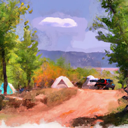
Bakers Hole
Reservations are not accepted at Bakers Hole, as sites are offered on a first-come, first-served basis. It is advisable to arrive early, especially during the peak season, as the campground tends to fill up quickly. The best time to visit Bakers Hole is during the summer months, from June to September, when the weather is warm and suitable for outdoor activities. However, it is recommended to check weather conditions before planning a trip, as Montana's climate can be unpredictable.
While enjoying the camping area, visitors should be aware of potential wildlife encounters. Bakers Hole is known for its bear population, so it is crucial to follow all bear safety guidelines, such as storing food properly and carrying bear spray. Additionally, campers should be cautious around the river, as water levels and currents can change rapidly and pose a risk. Overall, Bakers Hole offers a rustic camping experience with stunning natural surroundings, making it a great destination for outdoor enthusiasts.
What's on-site at Bakers Hole
Key facilities Snoflo tracks for this campground. Confirm with the operator before booking -- amenities can change seasonally.
Plan your trip down to the hour
Same weather feed Snoflo's iOS app uses -- updated continuously from NOAA / yr.no.
Next 5 days, hour by hour
Temperature line with weather symbols on top, snow + rain accumulation as columns, humidity as a dotted line.
5-day forecast table
Every 3 hours, broken out across temperature, snow, rain, humidity, and wind. Each cell is colour-coded relative to the column min/max so trends jump out at a glance.
| Time | Condition | Temp (°F) | Snow (in) | Rain (in) | Humidity (%) | Wind (mps) | Wind dir |
|---|---|---|---|---|---|---|---|
| Loading detailed forecast… | |||||||
15-day temperature & precipitation
Daily temperatures, snow, and rain projected over the next two weeks. Hover any point for the full breakdown.
Other campgrounds in the area
Snoflo-tracked campsites within driving distance of Bakers Hole, with reservations status.
| Campground | Reservations | Toilets | View |
|---|---|---|---|
| Baker's Hole Campground | ✗ | ✗ | → |
| Hideaway Rv Park | ✗ | ✗ | → |
| Under Canvas Glamping | ✗ | ✗ | → |
| Gneiss Creek | ✓ | ✗ | → |
| Rainbow Point Campground | ✓ | ✗ | → |
Nearby streamflow
USGS streamgauges within reach of Bakers Hole -- pulled live from the National Water Information System.
| Streamgauge | Discharge | View |
|---|---|---|
| Madison River Near West Yellowstone Mt | 322 cfs | → |
| Gibbon River At Madison Jct | 98 cfs | → |
| Firehole River Near West Yellowstone Mt | 208 cfs | → |
| Henrys Fork Nr Lake Id | 214 cfs | → |
| Madison River Bl Hebgen Lake Nr Grayling Mt | 1,440 cfs | → |
| Big Springs At Big Springs Id | 128 cfs | → |
Nearby snow depths
NRCS SNOTEL stations within reach of Bakers Hole -- relevant when planning a shoulder-season or alpine trip.
| SNOTEL station | Snowpack | 24h Snowfall | View |
|---|---|---|---|
| West Yellowstone | 0.0 in | 0.0 in | → |
| Nohrsc West Yellowstone | 0.0 in | 0.0 in | → |
| Whiskey Creek | 0.0 in | -1.0 in | → |
| Nohrsc Whiskey Creek | 1.0 in | 0.0 in | → |
| Madison Plateau | 0.0 in | 0.0 in | → |
| Nohrsc Madison Plateau | 0.0 in | 0.0 in | → |
Plan a longer trip
The closest parks, lakes, boat launches, and paddle runs so a camping night can grow into a full weekend.
Parks
- Henrys Lake State Park
- Gallatin National Forest
- Wilderness Lee Metcalf
- Red Rock Lakes National Wildlife Refuge
- Harriman State Park
Boat launches
Fishing spots
- Henry's Lake
- Axolotl Lake
- Blue Danube Lake
- Blue Paradise Lake
- Blair Lake
- Last Chance Fisherman Access
Points of interest
- Union Pacific Pylon
- West Yellowstone Visitor Information Center
- West Entrance Heading Into Park Webcam
- West Entrance Traffic Webcam
- Grizzly & Wolf Discovery Center
- Madison Information Station
Paddle runs
- Unnamed Lake North Of Edwards Lake (And East/West Forks) To Targhee Nf Boundary
- The Junction Of The Firehole And Gibbon Rivers To The Western Yellowstone National Park Boundary
- The Headwaters In The Gallatin Range To Ends Where The River Parallels A Two-Lane Highway
- Begins Where The River Parallels A Two-Lane Highway To The Western Boundary Of Yellowstone National Park
- Coffee Pot
- Hebgen Lake Dam, Sec. 23, T11s, R3e To Gallatin Forest Boundary, Sec. 35, T11s, R2e
Camping essentials & Leave No Trace
- Pack it in, pack it out
- Take all trash, food scraps, and gear back with you to keep campsites clean and protect wildlife.
- Respect wildlife
- Observe animals from a distance, store food securely, and never feed wildlife to maintain natural behavior and safety.
- Know before you go
- Check weather, fire restrictions, trail conditions, and permit requirements to ensure a safe and well-planned trip.
- Minimize campfire impact
- Use established fire rings, keep fires small, fully extinguish them, or opt for a camp stove when fires are restricted.
- Leave what you find
- Preserve natural and cultural features by avoiding removal of plants, rocks, artifacts, or other elements of the environment.
Set push alerts in the Snoflo app
Save Bakers Hole as a favorite, set a custom threshold (precipitation, snowpack, freezing temperatures), and the iOS app will push the moment conditions cross.
About Bakers Hole
Can I make reservations at Bakers Hole?
This campground does not appear to accept reservations -- it's typically first-come, first-served. Arrive early on summer weekends.
How fresh is the weather data on this page?
The hourly forecast updates throughout the day from the NOAA / yr.no public feeds. Streamflow data is pulled live from USGS streamgauges and snowpack from the NRCS SNOTEL network.
What's the best time of year to visit?
Use the 15-day temperature & precipitation outlook on this page to plan -- pick a window with comfortable temperatures and low precipitation. For longer trips, the 5-day hourly meteogram shows snow + rain accumulation hour-by-hour.
How do I get to Bakers Hole?
Tap Directions in the hero above to open driving directions in Google Maps, or Open in map to center the Snoflo interactive map on the campground.
Can I get alerts when conditions change?
Yes -- alerts are managed through the Snoflo iOS app. Favorite this campground, set a threshold (temperature, snowpack, precipitation), and you'll get a push the moment it crosses.
Other campgrounds near here
Snoflo-tracked campgrounds within driving distance of Bakers Hole.