

-
 Snoflo Premium
Get unlimited access to all our content
With no Ad interruptions! - Start Your Free Trial Login with existing account
Hope-Valley
Eden Index
Climate
8.2
•
Recreation
10.0
•
Community
2.3
•
Safeguard
7.3/10
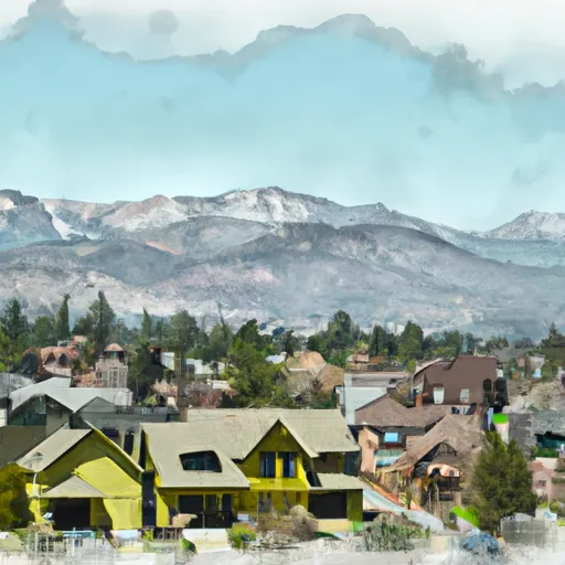
Hope-Valley, California is a picturesque mountainous region located in Alpine County. The area experiences a mild continental climate, characterized by warm summers and cold snowy winters. Summers bring pleasant temperatures, averaging around 75°F, making it an ideal time for outdoor activities. Winters, on the other hand, are snowy with temperatures dropping as low as 15°F, attracting winter sports enthusiasts.
Hope-Valley is blessed with abundant hydrology constituents. The scenic Carson River flows through the valley, providing opportunities for fishing, kayaking, and rafting. The river is home to various trout species, attracting anglers throughout the year. Additionally, several alpine lakes dot the area, offering serene spots for boating and swimming during the summer months.
Outdoor recreation opportunities are abundant in Hope-Valley. The region boasts numerous hiking and biking trails, ranging from easy strolls to challenging routes for experienced adventurers. The Hope Valley Wildlife Area provides excellent wildlife viewing and birdwatching opportunities. During winter, the area transforms into a winter wonderland, attracting skiers, snowboarders, and snowshoers to the nearby Hope Valley Cross Country Ski Resort and other nearby ski resorts.
In conclusion, Hope-Valley, California, offers a beautiful natural environment with a mild climate and abundant hydrology constituents. It is a haven for outdoor enthusiasts, providing a range of recreational activities throughout the year.
What is the Eden Index?
The Snoflo Eden Index serves as a comprehensive rating system for regions, evaluating their desirability through a holistic assessment of climate health, outdoor recreation opportunities, and natural disaster risk, acknowledging the profound impact of these factors on livability and well-being.
Climate Health Indicator (CHI): 8.2
Hope-Valley receives approximately
879mm of rain per year,
with humidity levels near 60%
and air temperatures averaging around
6°C.
Hope-Valley has a plant hardyness factor of
7, meaning
plants and agriculture in this region tend to thrive during the non-winter months.
By considering the ideal temperature range, reliable water supplies, clean air, and stable seasonal rain or snowpacks, the Climate Health Indicator (CHI) underscores the significance of a healthy climate as the foundation for quality living.
A healthy climate is paramount for ensuring a high quality of life and livability in a region, fostering both physical well-being and environmental harmony. This can be characterized by ideal temperatures, reliable access to water supplies, clean air, and consistent seasonal rain or snowpacks.
Weather Forecast
Streamflow Conditions
Carson
Area Rivers
Carson
Snowpack Depths
Carson
Reservoir Storage Capacity
Carson
Groundwater Levels
Recreational Opportunity Index (ROI): 10.0
The Recreational Opportunity Index (ROI) recognizes the value of outdoor recreational options, such as parks, hiking trails, camping sites, and fishing spots, while acknowledging that climate plays a pivotal role in ensuring the comfort and consistency of these experiences.
Access to outdoor recreational opportunities, encompassing activities such as parks, hiking, camping, and fishing, is crucial for overall well-being, and the climate plays a pivotal role in enabling and enhancing these experiences, ensuring that individuals can engage in nature-based activities comfortably and consistently.
Camping Areas
| Campground | Campsites | Reservations | Toilets | Showers | Elevation |
|---|---|---|---|---|---|
| Grover Hot Springs State Park | 76 | 5,879 ft | |||
| Fallen Leaf | 206 | 6,345 ft | |||
| Camp Richardson Complex | 320 | 6,250 ft | |||
| Camp Shelley | None | 6,256 ft | |||
| Hope Valley | 24 | 7,155 ft | |||
| Turtle Rock Park | 28 | 6,057 ft | |||
| Caples Lake | 34 | 7,897 ft | |||
| Nevada Beach | 54 | 6,213 ft | |||
| Campground by the Lake | 170 | 6,256 ft | |||
| El Dorado | None | 6,255 ft |
Nearby Ski Areas
Catastrophe Safeguard Index (CSI):
The Catastrophe Safeguard Index (CSI) recognizes that natural disaster risk, encompassing floods, fires, hurricanes, and tornadoes, can drastically affect safety and the overall appeal of an area.
The level of natural disaster risk in a region significantly affects safety and the overall livability, with climate change amplifying these risks by potentially increasing the frequency and intensity of events like floods, fires, hurricanes, and tornadoes, thereby posing substantial challenges to community resilience and well-being.
Community Resilience Indicator (CRI): 2.3
The Community Resilience Indicator (CRI) recognizes that education, healthcare, and socioeconomics are crucial to the well-being of a region. The CRI acknowledges the profound impact of these elements on residents' overall quality of life. By evaluating educational resources, healthcare accessibility, and economic inclusivity, the index captures the essential aspects that contribute to a thriving community, fostering resident satisfaction, equity, and social cohesion.