

-
 Snoflo Premium
Get unlimited access to all our content
With no Ad interruptions! - Start Your Free Trial Login with existing account
Twain-Harte
Eden Index
Climate
10.0
•
Recreation
5.3
•
Community
3.5
•
Safeguard
6.7/10
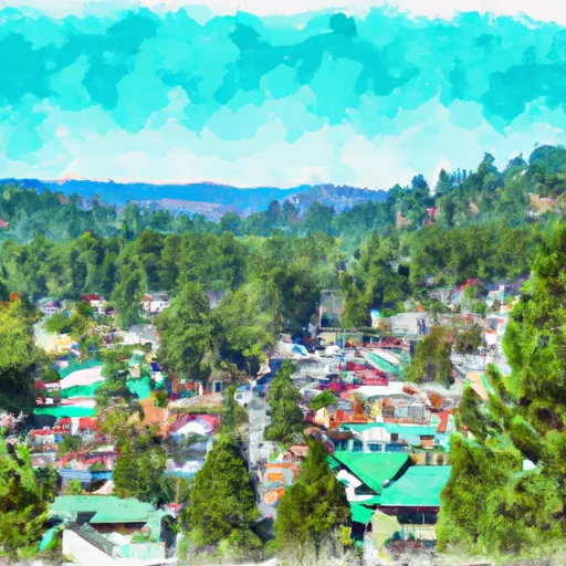
Twain Harte is a charming small town nestled in the Sierra Nevada Mountains of California. Known for its picturesque beauty and serene atmosphere, Twain Harte experiences a Mediterranean climate with warm, dry summers and cool, wet winters. Summers are pleasant, with average temperatures ranging from the mid-70s to low 80s Fahrenheit, making it an ideal destination for outdoor enthusiasts.
The town is surrounded by stunning natural landscapes, including pristine lakes and rivers. Pinecrest Lake, just a short drive away, offers opportunities for swimming, boating, fishing, and hiking. The Stanislaus River, running nearby, is perfect for kayaking, rafting, and fishing. Outdoor enthusiasts can also explore the nearby Emigrant Wilderness, featuring numerous hiking trails and breathtaking vistas.
For those seeking relaxation, Twain Harte boasts a beautiful private lake, which is perfect for swimming and picnicking. Additionally, the town offers a golf course, tennis courts, and several parks for recreational activities.
In conclusion, Twain Harte, with its Mediterranean climate, stunning hydrology constituents, and a variety of outdoor recreation opportunities, is a haven for nature lovers and outdoor enthusiasts seeking a tranquil getaway in the heart of California's Sierra Nevada Mountains.
What is the Eden Index?
The Snoflo Eden Index serves as a comprehensive rating system for regions, evaluating their desirability through a holistic assessment of climate health, outdoor recreation opportunities, and natural disaster risk, acknowledging the profound impact of these factors on livability and well-being.
Climate Health Indicator (CHI): 10.0
Twain-Harte receives approximately
1094mm of rain per year,
with humidity levels near 61%
and air temperatures averaging around
12°C.
Twain-Harte has a plant hardyness factor of
8, meaning
plants and agriculture in this region tend to thrive here all year round.
By considering the ideal temperature range, reliable water supplies, clean air, and stable seasonal rain or snowpacks, the Climate Health Indicator (CHI) underscores the significance of a healthy climate as the foundation for quality living.
A healthy climate is paramount for ensuring a high quality of life and livability in a region, fostering both physical well-being and environmental harmony. This can be characterized by ideal temperatures, reliable access to water supplies, clean air, and consistent seasonal rain or snowpacks.
Weather Forecast
Streamflow Conditions
San Joaquin
Area Rivers
San Joaquin
Snowpack Depths
San Joaquin
Reservoir Storage Capacity
San Joaquin
Groundwater Levels
Recreational Opportunity Index (ROI): 5.3
The Recreational Opportunity Index (ROI) recognizes the value of outdoor recreational options, such as parks, hiking trails, camping sites, and fishing spots, while acknowledging that climate plays a pivotal role in ensuring the comfort and consistency of these experiences.
Access to outdoor recreational opportunities, encompassing activities such as parks, hiking, camping, and fishing, is crucial for overall well-being, and the climate plays a pivotal role in enabling and enhancing these experiences, ensuring that individuals can engage in nature-based activities comfortably and consistently.
Camping Areas
| Campground | Campsites | Reservations | Toilets | Showers | Elevation |
|---|---|---|---|---|---|
| Wa Ka Luu Hep Yoo | 52 | 4,077 ft | |||
| Lodgepole Overflow | 30 | 7,346 ft | |||
| Mokelumne River | 13 | 3,234 ft | |||
| Silvertip | 23 | 7,545 ft | |||
| Moore Creek | 8 | 3,297 ft | |||
| Mokelumne | 13 | 3,240 ft | |||
| Calaveras Big Trees State Park | 129 | 4,485 ft | |||
| Big Meadow | 68 | 6,536 ft | |||
| Boards Crossing | 10 | 3,960 ft | |||
| Stanislaus River | 25 | 6,204 ft |
Nearby Fishing
Nearby Ski Areas
Catastrophe Safeguard Index (CSI):
The Catastrophe Safeguard Index (CSI) recognizes that natural disaster risk, encompassing floods, fires, hurricanes, and tornadoes, can drastically affect safety and the overall appeal of an area.
The level of natural disaster risk in a region significantly affects safety and the overall livability, with climate change amplifying these risks by potentially increasing the frequency and intensity of events like floods, fires, hurricanes, and tornadoes, thereby posing substantial challenges to community resilience and well-being.
Community Resilience Indicator (CRI): 3.5
The Community Resilience Indicator (CRI) recognizes that education, healthcare, and socioeconomics are crucial to the well-being of a region. The CRI acknowledges the profound impact of these elements on residents' overall quality of life. By evaluating educational resources, healthcare accessibility, and economic inclusivity, the index captures the essential aspects that contribute to a thriving community, fostering resident satisfaction, equity, and social cohesion.