Deep Creek river run
Community Reviews
Been here? Share the conditions.
Reviews, ratings & photos are added in the free Snoflo iOS app — rate a spot, tag the conditions, and your visit is verified by location. Add or manage your reviews from the app.
Deep Creek
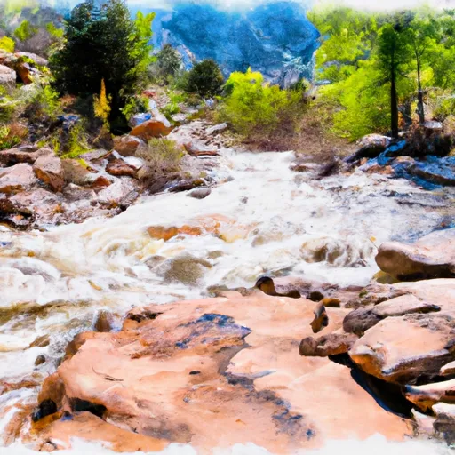
The segment mileage of Deep Creek is approximately seven miles, and it features numerous rapids and obstacles to navigate through. Some of the notable rapids include "S-Turn," "Boxcar," "Rattlesnake," and "The Cauldron." Paddlers must remain alert and aware of their surroundings to navigate through these rapids safely.
To protect the natural environment and ensure the safety of all visitors, there are specific regulations in place for Deep Creek. For instance, all visitors are required to obtain a permit from the Bureau of Land Management before entering the area. Additionally, visitors must follow Leave No Trace principles, meaning that they should not leave any trash or belongings behind.
In conclusion, Deep Creek offers a thrilling whitewater river run to those who are up for the challenge. With its ideal streamflow range, Class III-IV rating, segment mileage, and specific regulations, it is an excellent destination for intermediate to advanced paddlers looking for an adventure.
Plan your run down to the hour
Same weather feed Snoflo's iOS app uses -- updated continuously from NOAA / yr.no. Watch the precipitation column on the meteogram; rain ahead of a run typically lifts flows 12-48 hours later depending on the basin.
Next 5 days, hour by hour
Temperature line with weather symbols on top, snow + rain accumulation as columns, humidity as a dotted line.
5-day forecast table
Every 3 hours, broken out across temperature, snow, rain, humidity, and wind. Each cell is colour-coded relative to the column min/max.
| Time | Condition | Temp (°F) | Snow (in) | Rain (in) | Humidity (%) | Wind (mps) | Wind dir |
|---|---|---|---|---|---|---|---|
| Loading detailed forecast… | |||||||
15-day temperature & precipitation
Daily temperatures, snow, and rain projected over the next two weeks -- the upstream story that drives next week's flows.
Regional streamflow levels
USGS streamgauges around Deep Creek -- useful for spotting upstream pulses and gauging which tributary is contributing what.
| Streamgauge | Discharge | View |
|---|---|---|
| Muddy Creek At Bardine | 215 cfs | → |
| North Fork Gunnison River Near Somerset | 260 cfs | → |
| Hubbard Creek At Highway 133 At Mouth Nr Bowie | 0 cfs | → |
| Hubbard Creek Above Iron Point Gulch Nr Bowie | 6 cfs | → |
| Minnesota Creek Near Paonia | 4 cfs | → |
| E Fork Terror Cr Blw Cottonwood Stomp Nr Bowie | 0 cfs | → |
Plan a longer trip
The closest boat launches, other paddle runs, and campgrounds so a day on the water can grow into a full weekend.
Other river runs
- Bogan Canyon
- South Fork--Headwaters To Beaver Lake
- Crystal Mill Falls
- Waterfall To Confluence
- Maroon Bells/Snowmass Wilderness Boundary To Confluence With South Fork
Campgrounds
- Williams Creek Dispersed Camping Area
- Erickson Springs Campground- Paonia Rd
- Paonia State Park
- Erickson Springs
- Bogan Flats Group Campground
- Bogan Flats
Whitewater safety
- Check the flow before you run
- Use the linked-gauge card and Regional Flow panel above. Class ratings change with flow -- a Class III at low water can become Class IV+ at high water.
- Know your skill ceiling
- Pick runs comfortably below your ceiling. Cold-water and big-water runs raise the consequences of any mistake.
- Wear the right gear
- Helmet, PFD, drysuit / wetsuit when water is below 60°F. Throw bag, knife, and whistle on your person, not in the boat.
- Scout, set safety, and run with a team
- Scout new rapids on foot, set safety with throw bags above the consequence pool, and run with at least one other competent paddler.
- Respect the river
- Strainers, undercuts, low-head dams, and wood can kill at any class rating. When in doubt, portage.
Set push alerts in the Snoflo app
Save Deep Creek as a favorite, set a discharge threshold (e.g. "alert me when flow hits 600 cfs"), and the iOS app pushes the moment the linked gauge crosses.
About Deep Creek
What's the optimal flow for Deep Creek?
The optimal flow depends on the section and the craft. Check the Run Details panel for the linked gauge and current status.
How fresh is the cfs reading on this page?
The linked USGS streamgauge reports continuously (every 15 minutes); Snoflo refreshes throughout the day. Hover the streamflow sparkline to read individual datapoints.
What's the whitewater class?
See the Run Details panel for the class rating Snoflo tracks for this run. Class ratings change with flow -- a Class III at low water can become Class IV in high water.
Where do I put in / take out?
Tap Directions in the hero above to open driving directions to the put-in. For shuttle planning, check the Nearby Boat Launches panel and the river run operator's site.
Can I get alerts when flows hit the optimal range?
Yes -- alerts are managed in the Snoflo iOS app. Favorite this run, set a discharge threshold, and you'll get a push the moment the gauge crosses.
Other runs near here
Snoflo-tracked paddle runs within driving distance of Deep Creek.