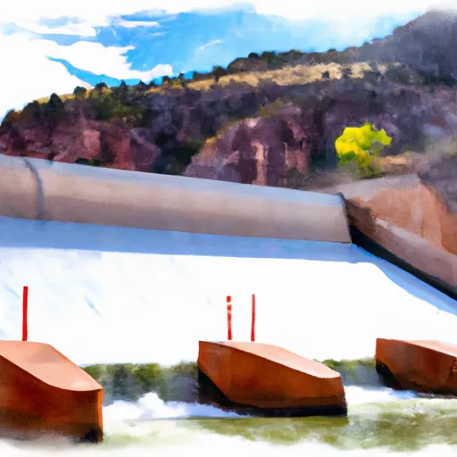
The Forest Service Spillway Boat Ramp Below Flaming Gorge Dam To The Bureau Of Land Management Boat Ramp At Indian Crossing River Run
Community Reviews
Been here? Share the conditions.
Reviews, ratings & photos are added in the free Snoflo iOS app — rate a spot, tag the conditions, and your visit is verified by location. Add or manage your reviews from the app.
The Forest Service Spillway Boat Ramp Below Flaming Gorge Dam To The Bureau Of Land Management Boat Ramp At Indian Crossing
This segment of the river is rated as Class III-IV, with challenging rapids and obstacles, including Hell's Half Mile, an exhilarating Class IV rapid. The total distance of this river run is approximately 44 miles.
There are specific regulations for this area, including a required permit for all river trips, which can be obtained through the Bureau of Land Management. Additionally, all boats must have a fire pan and a portable toilet. Campfires are not allowed, and visitors must pack out all garbage.
Overall, the Whitewater River Run from the Forest Service Spillway Boat Ramp below Flaming Gorge Dam to the Bureau of Land Management Boat Ramp at Indian Crossing offers a thrilling and challenging whitewater experience for experienced kayakers and rafters. It is important to note that this is not a beginner-friendly section of the river and only experienced paddlers should attempt this route.
Plan your run down to the hour
Same weather feed Snoflo's iOS app uses -- updated continuously from NOAA / yr.no. Watch the precipitation column on the meteogram; rain ahead of a run typically lifts flows 12-48 hours later depending on the basin.
Next 5 days, hour by hour
Temperature line with weather symbols on top, snow + rain accumulation as columns, humidity as a dotted line.
5-day forecast table
Every 3 hours, broken out across temperature, snow, rain, humidity, and wind. Each cell is colour-coded relative to the column min/max.
| Time | Condition | Temp (°F) | Snow (in) | Rain (in) | Humidity (%) | Wind (mps) | Wind dir |
|---|---|---|---|---|---|---|---|
| Loading detailed forecast… | |||||||
15-day temperature & precipitation
Daily temperatures, snow, and rain projected over the next two weeks -- the upstream story that drives next week's flows.
Regional streamflow levels
USGS streamgauges around The Forest Service Spillway Boat Ramp Below Flaming Gorge Dam To The Bureau Of Land Management Boat Ramp At Indian Crossing -- useful for spotting upstream pulses and gauging which tributary is contributing what.
| Streamgauge | Discharge | View |
|---|---|---|
| Green River Near Greendale | 1,730 cfs | → |
| Henrys Fork Near Manila | 8 cfs | → |
| Big Brush Creek Abv Red Fleet Res | 9 cfs | → |
| Ashley Cr Abv Sp Nr Vernal Ut | 4 cfs | → |
| Ashley Creek Near Vernal | 62 cfs | → |
| Whiterocks River Near Whiterocks | 136 cfs | → |
Plan a longer trip
The closest boat launches, other paddle runs, and campgrounds so a day on the water can grow into a full weekend.
Boat launches
- Spillway Boat Launch Area
- Cedar Springs Boating Ramp
- Dutch John Marina
- Little Hole Trail Daggett County
- Little Hole Boat Launch Area
- Browns Park Road Daggett County
Campgrounds
- Arch Dam Group Campground
- Deer Run - Flaming Gorge
- Cedar Springs - Flaming Gorge
- Mustang Ridge - Flaming Gorge
- Mustang Ridge Campground
- Dutch John Draw Group Campground
Fishing spots
- Green River Below Flaming Gorge Dam
- Cart Creek
- West Greens Lake Fishing Site
- Crouse Reservoir
- Flaming Gorge Reservoir
- Browne Reservoir
Whitewater safety
- Check the flow before you run
- Use the linked-gauge card and Regional Flow panel above. Class ratings change with flow -- a Class III at low water can become Class IV+ at high water.
- Know your skill ceiling
- Pick runs comfortably below your ceiling. Cold-water and big-water runs raise the consequences of any mistake.
- Wear the right gear
- Helmet, PFD, drysuit / wetsuit when water is below 60°F. Throw bag, knife, and whistle on your person, not in the boat.
- Scout, set safety, and run with a team
- Scout new rapids on foot, set safety with throw bags above the consequence pool, and run with at least one other competent paddler.
- Respect the river
- Strainers, undercuts, low-head dams, and wood can kill at any class rating. When in doubt, portage.
Set push alerts in the Snoflo app
Save The Forest Service Spillway Boat Ramp Below Flaming Gorge Dam To The Bureau Of Land Management Boat Ramp At Indian Crossing as a favorite, set a discharge threshold (e.g. "alert me when flow hits 600 cfs"), and the iOS app pushes the moment the linked gauge crosses.
About The Forest Service Spillway Boat Ramp Below Flaming Gorge Dam To The Bureau Of Land Management Boat Ramp At Indian Crossing
What's the optimal flow for The Forest Service Spillway Boat Ramp Below Flaming Gorge Dam To The Bureau Of Land Management Boat Ramp At Indian Crossing?
The optimal flow depends on the section and the craft. Check the Run Details panel for the linked gauge and current status.
How fresh is the cfs reading on this page?
The linked USGS streamgauge reports continuously (every 15 minutes); Snoflo refreshes throughout the day. Hover the streamflow sparkline to read individual datapoints.
What's the whitewater class?
See the Run Details panel for the class rating Snoflo tracks for this run. Class ratings change with flow -- a Class III at low water can become Class IV in high water.
Where do I put in / take out?
Tap Directions in the hero above to open driving directions to the put-in. For shuttle planning, check the Nearby Boat Launches panel and the river run operator's site.
Can I get alerts when flows hit the optimal range?
Yes -- alerts are managed in the Snoflo iOS app. Favorite this run, set a discharge threshold, and you'll get a push the moment the gauge crosses.
Other runs near here
Snoflo-tracked paddle runs within driving distance of The Forest Service Spillway Boat Ramp Below Flaming Gorge Dam To The Bureau Of Land Management Boat Ramp At Indian Crossing.