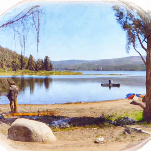
Pit No. 7 Diversion Dam

Pit No. 7 Diversion
Pit No. 7 Diversion, located in Redding, California, is a privately-owned hydroelectric facility on the Pit River. Constructed in 1965, this concrete gravity dam stands at an impressive height of 228 feet and has a storage capacity of 34,100 acre-feet. With a maximum discharge capacity of 11,400 cubic feet per second, the dam plays a crucial role in managing water resources in the region.
Managed by the Federal Energy Regulatory Commission, Pit No. 7 Diversion has a controlled spillway and two Tainter radial gates for water release. Despite its high hazard potential, the dam's condition assessment is not available, highlighting the importance of regular inspections and risk management measures. The facility's Emergency Action Plan is up to date, ensuring preparedness in case of any unforeseen events. With its strategic location and significant role in generating hydroelectric power, Pit No. 7 Diversion stands as a vital asset in California's water infrastructure.
Enthusiasts of water resources and climate change will find Pit No. 7 Diversion a fascinating example of engineering excellence and environmental stewardship. As a key player in water management and renewable energy production, this hydroelectric facility underscores the intricate balance between human development and natural resource conservation. With its impressive design, capacity, and regulatory oversight, Pit No. 7 Diversion serves as a noteworthy case study in sustainable water resource utilization amidst the challenges posed by a changing climate.
Plan around the weather
Same NOAA / yr.no feed Snoflo's iOS app uses. Watch the precipitation column on the meteogram -- rain on the basin upstream typically lifts inflow 24-72 hours later.
Next 5 days, hour by hour
Temperature line with weather symbols on top, snow + rain accumulation as columns, humidity as a dotted line.
5-day forecast table
Every 3 hours, broken out across temperature, snow, rain, humidity, and wind. Each cell is colour-coded relative to the column min/max.
| Time | Condition | Temp (°F) | Snow (in) | Rain (in) | Humidity (%) | Wind (mps) | Wind dir |
|---|---|---|---|---|---|---|---|
| Loading detailed forecast… | |||||||
15-day temperature & precipitation
Daily temperatures, snow, and rain projected over the next two weeks.
Nearby streamflow gauges
USGS streamgauges around Pit No. 7 Diversion -- inflows here typically show up in storage 24-72 hours later.
| Streamgauge | Discharge | View |
|---|---|---|
| Burney C A Burney Falls Nr Burney Ca | 168 cfs | → |
| Sacramento R A Delta Ca | 228 cfs | → |
| Pit R Bl Pit No 1 Ph Nr Fall River Mills Ca | 889 cfs | → |
| Cow C Nr Millville Ca | 23 cfs | → |
| Anderson-Cottonwood Id Cn At Sharon St Redding Ca | 172 cfs | → |
| Sacramento R A Keswick Ca | 13,200 cfs | → |


About Pit No. 7 Diversion
Where does the data for Pit No. 7 Diversion come from?
Structural and regulatory data come from the U.S. Army Corps of Engineers' National Inventory of Dams (NID). Weather forecast comes from NOAA / yr.no -- the same feed Snoflo's iOS app uses.
How often is the report updated?
NID structural data refreshes annually as the Corps publishes updated assessments. The weather forecast refreshes throughout the day.
What does the High hazard rating mean?
The Corps of Engineers' hazard potential classification grades probable consequences if the dam fails: High = probable loss of human life; Significant = no probable loss of human life but possible economic loss / environmental damage; Low = no probable loss of human life, only minor economic / environmental losses. See the Dam Data Reference card below for the full definitions.
What's "% of normal"?
The current storage value compared to the historical average storage on this calendar day. 100% = right on average; values above 100% mean above-normal storage (wet year); values below mean below-normal (dry year or drought).
Can I get alerts when storage crosses a threshold?
Yes -- alerts are managed in the Snoflo iOS app. Favorite this dam, set a threshold, and you'll get a push the moment conditions cross.
Dam data reference
Condition Assessment
- Satisfactory
- No existing or potential dam safety deficiencies are recognized. Acceptable performance is expected under all loading conditions (static, hydrologic, seismic) in accordance with the minimum applicable state or federal regulatory criteria or tolerable risk guidelines.
- Fair
- No existing dam safety deficiencies are recognized for normal operating conditions. Rare or extreme hydrologic and/or seismic events may result in a dam safety deficiency. Risk may be in the range to take further action.
- Poor
- A dam safety deficiency is recognized for normal operating conditions which may realistically occur. Remedial action is necessary. POOR may also be used when uncertainties exist as to critical analysis parameters which identify a potential dam safety deficiency.
- Unsatisfactory
- A dam safety deficiency is recognized that requires immediate or emergency remedial action for problem resolution.
- Not Rated
- The dam has not been inspected, is not under state or federal jurisdiction, or has been inspected but, for whatever reason, has not been rated.
Hazard Potential Classification
- High
- Dams assigned the high hazard potential classification are those where failure or mis-operation will probably cause loss of human life.
- Significant
- Dams assigned the significant hazard potential classification are those dams where failure or mis-operation results in no probable loss of human life but can cause economic loss, environmental damage, disruption of lifeline facilities, or impact other concerns. Significant hazard potential classification dams are often located in predominantly rural or agricultural areas but could be in areas with population and significant infrastructure.
- Low
- Dams assigned the low hazard potential classification are those where failure or mis-operation results in no probable loss of human life and low economic and/or environmental losses. Losses are principally limited to the owner's property.
- Undetermined
- Dams for which a downstream hazard potential has not been designated or is not provided.