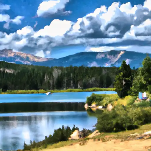
Turquoise Lake At Sugarloaf Dam Near Leadville Co Reservoir
As of July 20, 2026, Turquoise Lake At Sugarloaf Dam Near Leadville Co is holding 91,518 acre-ft of water — 134% of normal storage for this date. Storage data refreshed throughout the day.

Turquoise Lake At Sugarloaf Dam Near Leadville Co
Turquoise Lake, located near Leadville, Colorado, was created in 1869 to support mining operations in the area. Today, it serves as a hydroelectric power source, with water flowing from the lake into the Sugarloaf Dam and through a power plant. The lake is fed by the snowmelt of the surrounding mountains and is used for recreational activities such as camping, fishing, and boating. The surface flow of the lake is regulated by the Bureau of Reclamation, and its water is also used for agricultural irrigation. The lake is surrounded by scenic trails, and visitors can enjoy breathtaking views of the surrounding mountains. Turquoise Lake is a popular destination for tourists and locals alike, as it provides ample opportunities for outdoor activities in a beautiful setting.
Daily levels at Turquoise Lake At Sugarloaf Dam Near Leadville Co
Storage volume, pool elevation, and total release plotted from the operating agency's daily observations.
Storage
acre-ft · code 17
Pool Elevation
ft · code 49
Water surface elevation
feet · code 4
Plan around the weather
Same NOAA / yr.no feed Snoflo's iOS app uses. Watch the precipitation column on the meteogram -- rain on the basin upstream typically lifts inflow 24-72 hours later.
Next 5 days, hour by hour
Temperature line with weather symbols on top, snow + rain accumulation as columns, humidity as a dotted line.
5-day forecast table
Every 3 hours, broken out across temperature, snow, rain, humidity, and wind. Each cell is colour-coded relative to the column min/max.
| Time | Condition | Temp (°F) | Snow (in) | Rain (in) | Humidity (%) | Wind (mps) | Wind dir |
|---|---|---|---|---|---|---|---|
| Loading detailed forecast… | |||||||
15-day temperature & precipitation
Daily temperatures, snow, and rain projected over the next two weeks.
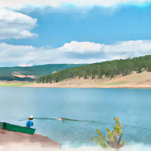
Nearby streamflow gauges
USGS streamgauges around Turquoise Lake At Sugarloaf Dam Near Leadville Co -- inflows here typically show up in storage 24-72 hours later.
| Streamgauge | Discharge | View |
|---|---|---|
| Lake Fork Below Sugar Loaf Reservoir | 4 cfs | → |
| Arkansas River Near Leadville | 10 cfs | → |
| Ef Arkansas R At Us Hiway 24 | 9 cfs | → |
| Halfmoon Creek Near Malta | 7 cfs | → |
| Arkansas River Below Empire Gulch Near Malta | 43 cfs | → |
| Wurtz Ditch Near Tenneessee Pass | 0 cfs | → |


About Turquoise Lake At Sugarloaf Dam Near Leadville Co
Where does the data for Turquoise Lake At Sugarloaf Dam Near Leadville Co come from?
Daily storage, pool elevation, and release rates are sourced from USGS, USBR, and USACE monitoring stations. Weather forecast comes from NOAA / yr.no -- the same feed Snoflo's iOS app uses.
How often is the report updated?
Storage observations are updated daily by the operating agency. The 15-day weather forecast refreshes throughout the day. Snoflo caches and renders the most recent observation -- check the "as of" timestamp on the storage card.
What does the Hazard hazard rating mean?
The Corps of Engineers' hazard potential classification grades probable consequences if the dam fails: High = probable loss of human life; Significant = no probable loss of human life but possible economic loss / environmental damage; Low = no probable loss of human life, only minor economic / environmental losses. See the Dam Data Reference card below for the full definitions.
What's "% of normal"?
The current storage value compared to the historical average storage on this calendar day. 100% = right on average; values above 100% mean above-normal storage (wet year); values below mean below-normal (dry year or drought).
Can I get alerts when storage crosses a threshold?
Yes -- alerts are managed in the Snoflo iOS app. Favorite this reservoir, set a threshold, and you'll get a push the moment conditions cross.