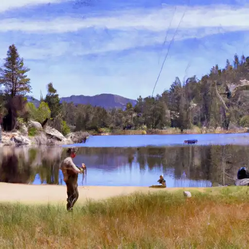
Gem Lake, located in Mono County, California, is a private hydroelectric dam constructed in 1917 by L.R. Jorgensen. The dam stands at a height of 80 feet and has a capacity of 17,228 acre-feet, serving as a vital source of water storage for the surrounding area. With a maximum discharge of 1,700 cubic feet per second, Gem Lake plays a crucial role in regulating water flow and providing hydroelectric power to the region.
The dam's primary purpose is hydroelectric generation, but it also offers recreational opportunities for visitors to enjoy. Situated on Rush Creek, the dam spans 688 feet in length and covers a surface area of 282 acres. Despite its age, Gem Lake Dam is regularly inspected and regulated by both state and federal agencies to ensure its structural integrity and safety. With a high hazard potential and moderate risk assessment, the dam remains a key feature in the water resource management and climate resilience efforts in the area.
Gem Lake Dam is a testament to the intersection of human ingenuity and natural resource management, showcasing the importance of sustainable hydroelectric infrastructure in a changing climate. As water resource and climate enthusiasts, understanding the significance of structures like Gem Lake Dam is crucial in safeguarding our water supply and adapting to environmental challenges. With its rich history and continued utility, Gem Lake Dam stands as a symbol of resilience and innovation in the face of evolving climate conditions.
TUOLUMNE MEADOWS VISITOR CENTER
The Tuolumne Meadows Visitor Center is a must-visit point of interest in California's Yosemite National Park. There are several reasons why it is worth a visit. Firstly, the center provides ...
LEMBERT DOME
Lembert Dome is a breathtaking point of interest located in Tuolumne Meadows within Yosemite National Park, California. The dome is a granite rock formation towering over 8000 feet, and it's ...
WAWONA VISITOR CENTER
The Wawona Visitor Center is a must-see point of interest in California's Yosemite National Park. It offers a wide range of information and resources for visitors, including exhibits, park maps, ...
POTHOLE DOME
Pothole Dome is a popular point of interest located in the Tuolumne Meadows region of Yosemite National Park in California. There are several good reasons to visit this scenic spot. ...
PARSONS MEMORIAL LODGE
Located in the Sierra Nevada mountains in California, Parsons Memorial Lodge is a historic building that offers a glimpse into the history of Yosemite National Park. The lodge was built ...
WASHBURN POINT
Washburn Point is one of the most popular lookout points in Yosemite National Park, California. It is located at an elevation of 7,385 feet and offers panoramic views of Yosemite ...
VALLEY VISITOR CENTER & THEATER
The Valley Visitor Center & Theater is an essential stop for visitors to California's Yosemite National Park. Here are some reasons why: 1. Helpful Information: The Visitor Center provides a ...
TUOLUMNE MEADOWS
Welcome to Tuolumne Meadows, located in Yosemite National Park, California. This breathtaking area offers visitors a chance to experience high-elevation wilderness at its finest. Here are some reasons why you ...
Snoflo Premium
Get unlimited access to all our content
With no Ad interruptions!