Hil7 Dam

Hil7
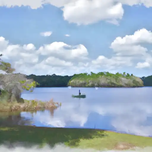
Hil7 is a private dam located in Hillsborough, Florida, specifically in the city of Tampa. This Earth-type dam stands at a height of 13.13 feet and has a length of 4752 feet, with a primary purpose of storing tailings. The dam has a storage capacity of 889.55 acre-feet, with a normal storage level of 264.55 acre-feet and a surface area of 36 acres.
While the dam is regulated by the state of Florida and has state permitting, inspection, and enforcement in place, its hazard potential is currently labeled as undetermined, and its condition assessment is not rated. The Emergency Action Plan (EAP) status and risk assessment for Hil7 are also not available at this time. Despite the lack of detailed information on risk management measures and inundation maps, the dam's location near an unnamed pond and under the jurisdiction of the Jacksonville District indicates the importance of monitoring and maintaining this water resource for the surrounding area.
Investigating further into the safety and maintenance protocols for Hil7, including establishing an updated EAP and risk assessment, could provide valuable insight into the potential risks and management strategies associated with this dam. Water resource and climate enthusiasts may find this data intriguing as they consider the implications of dam infrastructure on water storage, environmental impact, and overall safety in the region.
Plan around the weather
Same NOAA / yr.no feed Snoflo's iOS app uses. Watch the precipitation column on the meteogram -- rain on the basin upstream typically lifts inflow 24-72 hours later.
Next 5 days, hour by hour
Temperature line with weather symbols on top, snow + rain accumulation as columns, humidity as a dotted line.
5-day forecast table
Every 3 hours, broken out across temperature, snow, rain, humidity, and wind. Each cell is colour-coded relative to the column min/max.
| Time | Condition | Temp (°F) | Snow (in) | Rain (in) | Humidity (%) | Wind (mps) | Wind dir |
|---|---|---|---|---|---|---|---|
| Loading detailed forecast… | |||||||
15-day temperature & precipitation
Daily temperatures, snow, and rain projected over the next two weeks.
Nearby streamflow gauges
USGS streamgauges around Hil7 -- inflows here typically show up in storage 24-72 hours later.
| Streamgauge | Discharge | View |
|---|---|---|
| Archie Creek At 78th Street Near Tampa Fl | 1 cfs | → |
| Bullfrog Creek Near Wimauma Fl | 24 cfs | → |
| Delaney Creek Popoff Canal Near Tampa Fl | 0 cfs | → |
| North Archie Creek At Progress Blvd. Near Tampa Fl | 1 cfs | → |
| Alafia River At Riverview Fl | 2,250 cfs | → |
| Delaney Creek Near Tampa Fl | 2 cfs | → |
Make a day of it
Boat launches, lakeside camping, fishing access, and other reservoirs near Hil7.
Boat launches
See all →


Campgrounds
See all →


Fishing spots
See all →


River runs
See all →


More reservoirs
See all →
About Hil7
Where does the data for Hil7 come from?
Structural and regulatory data come from the U.S. Army Corps of Engineers' National Inventory of Dams (NID). Weather forecast comes from NOAA / yr.no -- the same feed Snoflo's iOS app uses.
How often is the report updated?
NID structural data refreshes annually as the Corps publishes updated assessments. The weather forecast refreshes throughout the day.
What does the Undetermined hazard rating mean?
The Corps of Engineers' hazard potential classification grades probable consequences if the dam fails: High = probable loss of human life; Significant = no probable loss of human life but possible economic loss / environmental damage; Low = no probable loss of human life, only minor economic / environmental losses. See the Dam Data Reference card below for the full definitions.
What's "% of normal"?
The current storage value compared to the historical average storage on this calendar day. 100% = right on average; values above 100% mean above-normal storage (wet year); values below mean below-normal (dry year or drought).
Can I get alerts when storage crosses a threshold?
Yes -- alerts are managed in the Snoflo iOS app. Favorite this dam, set a threshold, and you'll get a push the moment conditions cross.
Dam data reference
Condition Assessment
- Satisfactory
- No existing or potential dam safety deficiencies are recognized. Acceptable performance is expected under all loading conditions (static, hydrologic, seismic) in accordance with the minimum applicable state or federal regulatory criteria or tolerable risk guidelines.
- Fair
- No existing dam safety deficiencies are recognized for normal operating conditions. Rare or extreme hydrologic and/or seismic events may result in a dam safety deficiency. Risk may be in the range to take further action.
- Poor
- A dam safety deficiency is recognized for normal operating conditions which may realistically occur. Remedial action is necessary. POOR may also be used when uncertainties exist as to critical analysis parameters which identify a potential dam safety deficiency.
- Unsatisfactory
- A dam safety deficiency is recognized that requires immediate or emergency remedial action for problem resolution.
- Not Rated
- The dam has not been inspected, is not under state or federal jurisdiction, or has been inspected but, for whatever reason, has not been rated.
Hazard Potential Classification
- High
- Dams assigned the high hazard potential classification are those where failure or mis-operation will probably cause loss of human life.
- Significant
- Dams assigned the significant hazard potential classification are those dams where failure or mis-operation results in no probable loss of human life but can cause economic loss, environmental damage, disruption of lifeline facilities, or impact other concerns. Significant hazard potential classification dams are often located in predominantly rural or agricultural areas but could be in areas with population and significant infrastructure.
- Low
- Dams assigned the low hazard potential classification are those where failure or mis-operation results in no probable loss of human life and low economic and/or environmental losses. Losses are principally limited to the owner's property.
- Undetermined
- Dams for which a downstream hazard potential has not been designated or is not provided.