Cedar Hill Lake Dam Dam

Cedar Hill Lake Dam
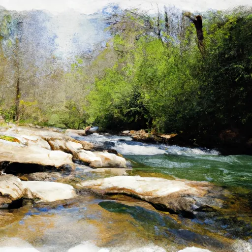
Cedar Hill Lake Dam, also known as Nelson Lake Dam, is a private earth dam located in Gordon, Georgia, along the Robins Creek. Built in 1945 by designer J. H. Reeve, this picturesque dam stands at a height of 25 feet and stretches 355 feet in length, creating a serene lake that covers a surface area of 33 acres. With a primary purpose of recreation, Cedar Hill Lake Dam provides a tranquil setting for water resource and climate enthusiasts to enjoy various outdoor activities.
The dam's capacity includes a storage volume of 542 acre-feet, with a normal storage level of 190 acre-feet, serving as a vital resource for the surrounding community. Despite being classified as having a high hazard potential, Cedar Hill Lake Dam is currently in fair condition as of its last assessment in 2016. While the dam has uncontrolled spillways and outlet gates, it is regulated and inspected by the Georgia Safe Dams Program, ensuring its continued safety and functionality.
For those interested in water resource management and climate resilience, Cedar Hill Lake Dam offers a fascinating case study in private dam ownership and state regulation. Its strategic location in Liberty Cumberland Church, within the Nashville District, highlights the importance of maintaining and monitoring dams for both recreational and safety purposes. As the dam continues to be a valuable asset for the community, ongoing assessments and risk management measures will be essential to safeguarding its integrity for years to come.
Plan around the weather
Same NOAA / yr.no feed Snoflo's iOS app uses. Watch the precipitation column on the meteogram -- rain on the basin upstream typically lifts inflow 24-72 hours later.
Next 5 days, hour by hour
Temperature line with weather symbols on top, snow + rain accumulation as columns, humidity as a dotted line.
5-day forecast table
Every 3 hours, broken out across temperature, snow, rain, humidity, and wind. Each cell is colour-coded relative to the column min/max.
| Time | Condition | Temp (°F) | Snow (in) | Rain (in) | Humidity (%) | Wind (mps) | Wind dir |
|---|---|---|---|---|---|---|---|
| Loading detailed forecast… | |||||||
15-day temperature & precipitation
Daily temperatures, snow, and rain projected over the next two weeks.
Nearby streamflow gauges
USGS streamgauges around Cedar Hill Lake Dam -- inflows here typically show up in storage 24-72 hours later.
| Streamgauge | Discharge | View |
|---|---|---|
| Oostanaula River At Resaca | 729 cfs | → |
| Coosawattee River Near Pine Chapel | 455 cfs | → |
| Oostanaula River Near Rome | 1,030 cfs | → |
| Conasauga River At Tilton | 369 cfs | → |
| Two Run Creek Near Kingston | 11 cfs | → |
| Etowah River Near Kingston | 683 cfs | → |
Make a day of it
Boat launches, lakeside camping, fishing access, and other reservoirs near Cedar Hill Lake Dam.
Boat launches
See all →


Campgrounds
See all →


Fishing spots
See all →


River runs
See all →


About Cedar Hill Lake Dam
Where does the data for Cedar Hill Lake Dam come from?
Structural and regulatory data come from the U.S. Army Corps of Engineers' National Inventory of Dams (NID). Weather forecast comes from NOAA / yr.no -- the same feed Snoflo's iOS app uses.
How often is the report updated?
NID structural data refreshes annually as the Corps publishes updated assessments. The weather forecast refreshes throughout the day.
What does the High hazard rating mean?
The Corps of Engineers' hazard potential classification grades probable consequences if the dam fails: High = probable loss of human life; Significant = no probable loss of human life but possible economic loss / environmental damage; Low = no probable loss of human life, only minor economic / environmental losses. See the Dam Data Reference card below for the full definitions.
What's "% of normal"?
The current storage value compared to the historical average storage on this calendar day. 100% = right on average; values above 100% mean above-normal storage (wet year); values below mean below-normal (dry year or drought).
Can I get alerts when storage crosses a threshold?
Yes -- alerts are managed in the Snoflo iOS app. Favorite this dam, set a threshold, and you'll get a push the moment conditions cross.
Dam data reference
Condition Assessment
- Satisfactory
- No existing or potential dam safety deficiencies are recognized. Acceptable performance is expected under all loading conditions (static, hydrologic, seismic) in accordance with the minimum applicable state or federal regulatory criteria or tolerable risk guidelines.
- Fair
- No existing dam safety deficiencies are recognized for normal operating conditions. Rare or extreme hydrologic and/or seismic events may result in a dam safety deficiency. Risk may be in the range to take further action.
- Poor
- A dam safety deficiency is recognized for normal operating conditions which may realistically occur. Remedial action is necessary. POOR may also be used when uncertainties exist as to critical analysis parameters which identify a potential dam safety deficiency.
- Unsatisfactory
- A dam safety deficiency is recognized that requires immediate or emergency remedial action for problem resolution.
- Not Rated
- The dam has not been inspected, is not under state or federal jurisdiction, or has been inspected but, for whatever reason, has not been rated.
Hazard Potential Classification
- High
- Dams assigned the high hazard potential classification are those where failure or mis-operation will probably cause loss of human life.
- Significant
- Dams assigned the significant hazard potential classification are those dams where failure or mis-operation results in no probable loss of human life but can cause economic loss, environmental damage, disruption of lifeline facilities, or impact other concerns. Significant hazard potential classification dams are often located in predominantly rural or agricultural areas but could be in areas with population and significant infrastructure.
- Low
- Dams assigned the low hazard potential classification are those where failure or mis-operation results in no probable loss of human life and low economic and/or environmental losses. Losses are principally limited to the owner's property.
- Undetermined
- Dams for which a downstream hazard potential has not been designated or is not provided.