Has A Name dam

Has A Name
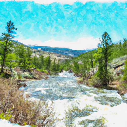
"Has A Name," a privately owned dam located in Fishtail, Montana, serves multiple purposes including fire protection, stock, and small fish pond. Built in 1938, this earth dam stands at a height of 12 feet with a length of 450 feet, providing a storage capacity of 125 acre-feet. Situated on the West Rosebud Creek, this structure is regulated by the Montana Department of Natural Resources and Conservation (DNRC) and is inspected, permitted, and enforced by state agencies.
Despite its low hazard potential, "Has A Name" has not been rated for its condition assessment. The dam's emergency action plan status remains unclear, with no updated information on preparedness, last revision date, or adherence to guidelines. The risk assessment, management measures, and inundation maps are also lacking, raising concerns about the level of readiness in case of an emergency. While the dam is not owned or funded by federal agencies, it falls under the purview of the Mine Safety and Health Administration for regulatory oversight.
Water resource and climate enthusiasts interested in the intricacies of dam infrastructure and management in Montana may find "Has A Name" to be a compelling case study. With its unique location, purpose, and state regulation, this dam offers insights into the intersection of private ownership, public oversight, and environmental stewardship. As efforts to address water resource challenges and adapt to changing climate conditions continue, understanding the complexities of dam operations like "Has A Name" becomes crucial for sustainable water management practices.
Plan around the weather
Same NOAA / yr.no feed Snoflo's iOS app uses. Watch the precipitation column on the meteogram -- rain on the basin upstream typically lifts inflow 24-72 hours later.
Next 5 days, hour by hour
Temperature line with weather symbols on top, snow + rain accumulation as columns, humidity as a dotted line.
5-day forecast table
Every 3 hours, broken out across temperature, snow, rain, humidity, and wind. Each cell is colour-coded relative to the column min/max.
| Time | Condition | Temp (°F) | Snow (in) | Rain (in) | Humidity (%) | Wind (mps) | Wind dir |
|---|---|---|---|---|---|---|---|
| Loading detailed forecast… | |||||||
15-day temperature & precipitation
Daily temperatures, snow, and rain projected over the next two weeks.
Nearby streamflow gauges
USGS streamgauges around Has A Name -- inflows here typically show up in storage 24-72 hours later.
| Streamgauge | Discharge | View |
|---|---|---|
| West Rosebud Creek Near Roscoe Mt | 430 cfs | → |
| Rock Creek Near Red Lodge Mt | 440 cfs | → |
| Red Lodge Cr Ab Cooney Re Nr Boyd Mt | 42 cfs | → |
| Willow Creek Near Boyd Mt | 54 cfs | → |
| Stillwater River Near Absarokee Mt | 1,810 cfs | → |
| Soda Butte Cr At Park Bndry At Silver Gate | 131 cfs | → |
Make a day of it
Boat launches, lakeside camping, fishing access, and other reservoirs near Has A Name.
Boat launches
See all →


Campgrounds
See all →


Fishing spots
See all →


River runs
See all →


About Has A Name
Where does the data for Has A Name come from?
Structural and regulatory data come from the U.S. Army Corps of Engineers' National Inventory of Dams (NID). Weather forecast comes from NOAA / yr.no -- the same feed Snoflo's iOS app uses.
How often is the report updated?
NID structural data refreshes annually as the Corps publishes updated assessments. The weather forecast refreshes throughout the day.
What does the Low hazard rating mean?
The Corps of Engineers' hazard potential classification grades probable consequences if the dam fails: High = probable loss of human life; Significant = no probable loss of human life but possible economic loss / environmental damage; Low = no probable loss of human life, only minor economic / environmental losses. See the Dam Data Reference card below for the full definitions.
What's "% of normal"?
The current storage value compared to the historical average storage on this calendar day. 100% = right on average; values above 100% mean above-normal storage (wet year); values below mean below-normal (dry year or drought).
Can I get alerts when storage crosses a threshold?
Yes -- alerts are managed in the Snoflo iOS app. Favorite this dam, set a threshold, and you'll get a push the moment conditions cross.
Dam data reference
Condition Assessment
- Satisfactory
- No existing or potential dam safety deficiencies are recognized. Acceptable performance is expected under all loading conditions (static, hydrologic, seismic) in accordance with the minimum applicable state or federal regulatory criteria or tolerable risk guidelines.
- Fair
- No existing dam safety deficiencies are recognized for normal operating conditions. Rare or extreme hydrologic and/or seismic events may result in a dam safety deficiency. Risk may be in the range to take further action.
- Poor
- A dam safety deficiency is recognized for normal operating conditions which may realistically occur. Remedial action is necessary. POOR may also be used when uncertainties exist as to critical analysis parameters which identify a potential dam safety deficiency.
- Unsatisfactory
- A dam safety deficiency is recognized that requires immediate or emergency remedial action for problem resolution.
- Not Rated
- The dam has not been inspected, is not under state or federal jurisdiction, or has been inspected but, for whatever reason, has not been rated.
Hazard Potential Classification
- High
- Dams assigned the high hazard potential classification are those where failure or mis-operation will probably cause loss of human life.
- Significant
- Dams assigned the significant hazard potential classification are those dams where failure or mis-operation results in no probable loss of human life but can cause economic loss, environmental damage, disruption of lifeline facilities, or impact other concerns. Significant hazard potential classification dams are often located in predominantly rural or agricultural areas but could be in areas with population and significant infrastructure.
- Low
- Dams assigned the low hazard potential classification are those where failure or mis-operation results in no probable loss of human life and low economic and/or environmental losses. Losses are principally limited to the owner's property.
- Undetermined
- Dams for which a downstream hazard potential has not been designated or is not provided.