Morphy Lake Dam

Morphy Lake Dam
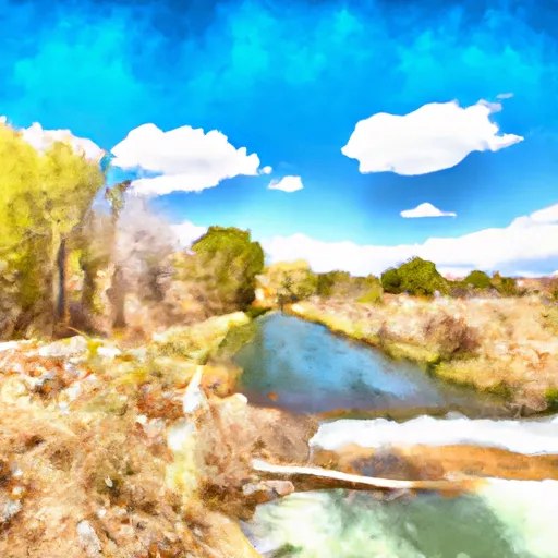
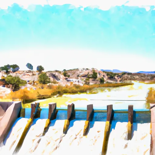
Morphy Lake Dam, also known as Murphy Lake Dam, is a crucial water resource structure located in Mora, New Mexico. Built in 1940 by designer H. E. BEISMAN, this earth dam serves primarily for irrigation purposes, but also supports fish and wildlife pond and recreation activities. With a height of 26.5 feet and a length of 436 feet, the dam has a reservoir storage capacity of 507 acre-feet and covers a surface area of 28 acres.
Situated on the RIO MORPHY-TR stream, Morphy Lake Dam is regulated by the Office of the State Engineer in New Mexico. Despite its significant hazard potential and poor condition assessment, the dam has a moderate risk rating. The spillway type is uncontrolled, and the outlet gates consist of a slide (sluice gate). The dam has undergone regular state inspections, with the last inspection conducted in June 2018. Due to its importance in supporting irrigation and recreational activities, efforts may be needed to ensure the safety and maintenance of Morphy Lake Dam for the community of LEDOUX and beyond.
Overall, Morphy Lake Dam stands as a vital water resource infrastructure in New Mexico, providing essential support for irrigation, fish and wildlife habitat, and recreational activities. As climate change continues to impact water resources, ensuring the safety and proper maintenance of this dam will be crucial for the continued water security and environmental sustainability of the region. Collaboration between local government, regulatory agencies, and stakeholders will be essential in managing the risk associated with this high-hazard dam and maintaining its functionality for future generations of water resource and climate enthusiasts.
Plan around the weather
Same NOAA / yr.no feed Snoflo's iOS app uses. Watch the precipitation column on the meteogram -- rain on the basin upstream typically lifts inflow 24-72 hours later.
Next 5 days, hour by hour
Temperature line with weather symbols on top, snow + rain accumulation as columns, humidity as a dotted line.
5-day forecast table
Every 3 hours, broken out across temperature, snow, rain, humidity, and wind. Each cell is colour-coded relative to the column min/max.
| Time | Condition | Temp (°F) | Snow (in) | Rain (in) | Humidity (%) | Wind (mps) | Wind dir |
|---|---|---|---|---|---|---|---|
| Loading detailed forecast… | |||||||
15-day temperature & precipitation
Daily temperatures, snow, and rain projected over the next two weeks.
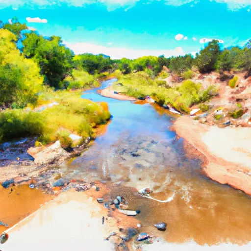
Nearby streamflow gauges
USGS streamgauges around Morphy Lake Dam -- inflows here typically show up in storage 24-72 hours later.
| Streamgauge | Discharge | View |
|---|---|---|
| Mora River At La Cueva | 6 cfs | → |
| Coyote Creek Near Golondrinas | 1 cfs | → |
| Mora River Near Golondrinas | 0 cfs | → |
| Rio Mora Near Terrero | 8 cfs | → |
| Rio Pueblo Nr Penasco | 2 cfs | → |
| Gallinas Creek Near Montezuma | 4 cfs | → |


About Morphy Lake Dam
Where does the data for Morphy Lake Dam come from?
Structural and regulatory data come from the U.S. Army Corps of Engineers' National Inventory of Dams (NID). Weather forecast comes from NOAA / yr.no -- the same feed Snoflo's iOS app uses.
How often is the report updated?
NID structural data refreshes annually as the Corps publishes updated assessments. The weather forecast refreshes throughout the day.
What does the High hazard rating mean?
The Corps of Engineers' hazard potential classification grades probable consequences if the dam fails: High = probable loss of human life; Significant = no probable loss of human life but possible economic loss / environmental damage; Low = no probable loss of human life, only minor economic / environmental losses. See the Dam Data Reference card below for the full definitions.
What's "% of normal"?
The current storage value compared to the historical average storage on this calendar day. 100% = right on average; values above 100% mean above-normal storage (wet year); values below mean below-normal (dry year or drought).
Can I get alerts when storage crosses a threshold?
Yes -- alerts are managed in the Snoflo iOS app. Favorite this dam, set a threshold, and you'll get a push the moment conditions cross.
Dam data reference
Condition Assessment
- Satisfactory
- No existing or potential dam safety deficiencies are recognized. Acceptable performance is expected under all loading conditions (static, hydrologic, seismic) in accordance with the minimum applicable state or federal regulatory criteria or tolerable risk guidelines.
- Fair
- No existing dam safety deficiencies are recognized for normal operating conditions. Rare or extreme hydrologic and/or seismic events may result in a dam safety deficiency. Risk may be in the range to take further action.
- Poor
- A dam safety deficiency is recognized for normal operating conditions which may realistically occur. Remedial action is necessary. POOR may also be used when uncertainties exist as to critical analysis parameters which identify a potential dam safety deficiency.
- Unsatisfactory
- A dam safety deficiency is recognized that requires immediate or emergency remedial action for problem resolution.
- Not Rated
- The dam has not been inspected, is not under state or federal jurisdiction, or has been inspected but, for whatever reason, has not been rated.
Hazard Potential Classification
- High
- Dams assigned the high hazard potential classification are those where failure or mis-operation will probably cause loss of human life.
- Significant
- Dams assigned the significant hazard potential classification are those dams where failure or mis-operation results in no probable loss of human life but can cause economic loss, environmental damage, disruption of lifeline facilities, or impact other concerns. Significant hazard potential classification dams are often located in predominantly rural or agricultural areas but could be in areas with population and significant infrastructure.
- Low
- Dams assigned the low hazard potential classification are those where failure or mis-operation results in no probable loss of human life and low economic and/or environmental losses. Losses are principally limited to the owner's property.
- Undetermined
- Dams for which a downstream hazard potential has not been designated or is not provided.