Mccurdy Dam dam

Mccurdy Dam
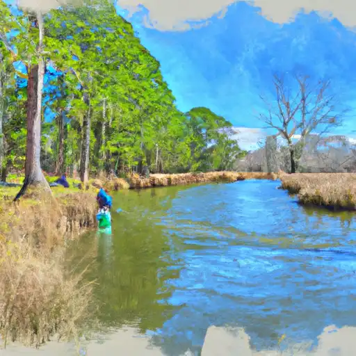
McCurdy Dam, located in Cooleemee, North Carolina, stands as a vital structure for irrigation purposes along the Big Branch-Tr river. Completed in 1986, this earth dam boasts a structural height of 25 feet and a hydraulic height of 21 feet, with a length of 240 feet. The dam has a storage capacity of 23 acre-feet and serves a drainage area of 75 square miles, with a maximum discharge capacity of 166 cubic feet per second.
Managed by a private entity, McCurdy Dam is regulated by the North Carolina Department of Environmental Quality's Dam Safety Program. Despite being classified with a high hazard potential, the dam is currently in fair condition as of its last assessment in January 2020. The dam has a history of periodic inspections with an average frequency of 2 years, ensuring its integrity and safety for the surrounding community. With its crucial role in irrigation and water resource management, McCurdy Dam stands as a significant feature in the local landscape of Alexander County.
Situated within the Wilmington District and owned privately, McCurdy Dam not only serves as a key irrigation source but also plays a crucial role in regulating water flow and ensuring water security in the region. With its strategic location and high hazard potential, ongoing maintenance and oversight are essential to uphold the dam's functionality and safety. As an integral part of the local water infrastructure, McCurdy Dam continues to be a focal point for water resource and climate enthusiasts alike, highlighting the intersection of human engineering and environmental stewardship in managing water resources effectively.
Plan around the weather
Same NOAA / yr.no feed Snoflo's iOS app uses. Watch the precipitation column on the meteogram -- rain on the basin upstream typically lifts inflow 24-72 hours later.
Next 5 days, hour by hour
Temperature line with weather symbols on top, snow + rain accumulation as columns, humidity as a dotted line.
5-day forecast table
Every 3 hours, broken out across temperature, snow, rain, humidity, and wind. Each cell is colour-coded relative to the column min/max.
| Time | Condition | Temp (°F) | Snow (in) | Rain (in) | Humidity (%) | Wind (mps) | Wind dir |
|---|---|---|---|---|---|---|---|
| Loading detailed forecast… | |||||||
15-day temperature & precipitation
Daily temperatures, snow, and rain projected over the next two weeks.
Nearby streamflow gauges
USGS streamgauges around Mccurdy Dam -- inflows here typically show up in storage 24-72 hours later.
| Streamgauge | Discharge | View |
|---|---|---|
| Lower Little River Nr All Healing Springs | 466 cfs | → |
| Yadkin River At Wilkesboro | 838 cfs | → |
| Reddies River At North Wilkesboro | 48 cfs | → |
| Elk Creek At Elkville | 27 cfs | → |
| Hunting Creek Near Harmony | 35 cfs | → |
| Yadkin River At Elkin | 553 cfs | → |
Make a day of it
Boat launches, lakeside camping, fishing access, and other reservoirs near Mccurdy Dam.


Campgrounds
See all →


Fishing spots
See all →


River runs
See all →


More reservoirs
See all →
About Mccurdy Dam
Where does the data for Mccurdy Dam come from?
Structural and regulatory data come from the U.S. Army Corps of Engineers' National Inventory of Dams (NID). Weather forecast comes from NOAA / yr.no -- the same feed Snoflo's iOS app uses.
How often is the report updated?
NID structural data refreshes annually as the Corps publishes updated assessments. The weather forecast refreshes throughout the day.
What does the High hazard rating mean?
The Corps of Engineers' hazard potential classification grades probable consequences if the dam fails: High = probable loss of human life; Significant = no probable loss of human life but possible economic loss / environmental damage; Low = no probable loss of human life, only minor economic / environmental losses. See the Dam Data Reference card below for the full definitions.
What's "% of normal"?
The current storage value compared to the historical average storage on this calendar day. 100% = right on average; values above 100% mean above-normal storage (wet year); values below mean below-normal (dry year or drought).
Can I get alerts when storage crosses a threshold?
Yes -- alerts are managed in the Snoflo iOS app. Favorite this dam, set a threshold, and you'll get a push the moment conditions cross.
Dam data reference
Condition Assessment
- Satisfactory
- No existing or potential dam safety deficiencies are recognized. Acceptable performance is expected under all loading conditions (static, hydrologic, seismic) in accordance with the minimum applicable state or federal regulatory criteria or tolerable risk guidelines.
- Fair
- No existing dam safety deficiencies are recognized for normal operating conditions. Rare or extreme hydrologic and/or seismic events may result in a dam safety deficiency. Risk may be in the range to take further action.
- Poor
- A dam safety deficiency is recognized for normal operating conditions which may realistically occur. Remedial action is necessary. POOR may also be used when uncertainties exist as to critical analysis parameters which identify a potential dam safety deficiency.
- Unsatisfactory
- A dam safety deficiency is recognized that requires immediate or emergency remedial action for problem resolution.
- Not Rated
- The dam has not been inspected, is not under state or federal jurisdiction, or has been inspected but, for whatever reason, has not been rated.
Hazard Potential Classification
- High
- Dams assigned the high hazard potential classification are those where failure or mis-operation will probably cause loss of human life.
- Significant
- Dams assigned the significant hazard potential classification are those dams where failure or mis-operation results in no probable loss of human life but can cause economic loss, environmental damage, disruption of lifeline facilities, or impact other concerns. Significant hazard potential classification dams are often located in predominantly rural or agricultural areas but could be in areas with population and significant infrastructure.
- Low
- Dams assigned the low hazard potential classification are those where failure or mis-operation results in no probable loss of human life and low economic and/or environmental losses. Losses are principally limited to the owner's property.
- Undetermined
- Dams for which a downstream hazard potential has not been designated or is not provided.