Trail Bridge Dam

Trail Bridge
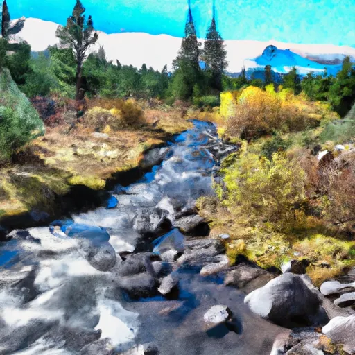
Trail Bridge, located in McKenzie Bridge, Oregon, is a captivating hydroelectric structure designed by the Bechtel Corporation and completed in 1963. This Earth dam stands at an impressive height of 90 feet with a hydraulic height of 80 feet, serving as a vital component for both hydroelectric power generation and recreational activities. With a storage capacity of 2,263 acre-feet and a maximum discharge of 29,000 cubic feet per second, Trail Bridge plays a crucial role in water resource management within the McKenzie River watershed.
Owned by a public utility and regulated by the Federal Energy Regulatory Commission, Trail Bridge boasts a controlled spillway and a Tainter (radial) outlet gate for effective water flow control and safety measures. The dam's hazard potential is classified as high, with a risk assessment rating of very high, highlighting the importance of regular inspections and emergency preparedness. Despite its age, Trail Bridge continues to be a key infrastructure asset in ensuring water supply resilience and energy sustainability in the region.
Trail Bridge stands as a testament to human ingenuity and engineering excellence, blending seamlessly into the natural landscape while harnessing the power of water for multiple purposes. As climate change and water scarcity pose increasing challenges, structures like Trail Bridge play a crucial role in mitigating risks and adapting to a rapidly evolving environment. With its rich history, technical specifications, and strategic location in the heart of Oregon's water resources, Trail Bridge remains a symbol of resilience and innovation in the face of changing climates and growing energy demands.
Plan around the weather
Same NOAA / yr.no feed Snoflo's iOS app uses. Watch the precipitation column on the meteogram -- rain on the basin upstream typically lifts inflow 24-72 hours later.
Next 5 days, hour by hour
Temperature line with weather symbols on top, snow + rain accumulation as columns, humidity as a dotted line.
5-day forecast table
Every 3 hours, broken out across temperature, snow, rain, humidity, and wind. Each cell is colour-coded relative to the column min/max.
| Time | Condition | Temp (°F) | Snow (in) | Rain (in) | Humidity (%) | Wind (mps) | Wind dir |
|---|---|---|---|---|---|---|---|
| Loading detailed forecast… | |||||||
15-day temperature & precipitation
Daily temperatures, snow, and rain projected over the next two weeks.
Nearby streamflow gauges
USGS streamgauges around Trail Bridge -- inflows here typically show up in storage 24-72 hours later.
| Streamgauge | Discharge | View |
|---|---|---|
| Mckenzie R Blw Trail Br Dam Nr Belknap Springs | 621 cfs | → |
| Mckenzie River Bl Payne Cr | 176 cfs | → |
| Smith River Abv Trail Brdg Resv Nr Belknap Springs | 6 cfs | → |
| Smith R Ab Smith R Res Nr Belknap Sprgs | 5 cfs | → |
| Mckenzie River At Outlet Of Clear Lake | 172 cfs | → |
| Lookout Creek Near Blue River | 16 cfs | → |
Make a day of it
Boat launches, lakeside camping, fishing access, and other reservoirs near Trail Bridge.
Boat launches
See all →


Campgrounds
See all →


River runs
See all →


About Trail Bridge
Where does the data for Trail Bridge come from?
Structural and regulatory data come from the U.S. Army Corps of Engineers' National Inventory of Dams (NID). Weather forecast comes from NOAA / yr.no -- the same feed Snoflo's iOS app uses.
How often is the report updated?
NID structural data refreshes annually as the Corps publishes updated assessments. The weather forecast refreshes throughout the day.
What does the High hazard rating mean?
The Corps of Engineers' hazard potential classification grades probable consequences if the dam fails: High = probable loss of human life; Significant = no probable loss of human life but possible economic loss / environmental damage; Low = no probable loss of human life, only minor economic / environmental losses. See the Dam Data Reference card below for the full definitions.
What's "% of normal"?
The current storage value compared to the historical average storage on this calendar day. 100% = right on average; values above 100% mean above-normal storage (wet year); values below mean below-normal (dry year or drought).
Can I get alerts when storage crosses a threshold?
Yes -- alerts are managed in the Snoflo iOS app. Favorite this dam, set a threshold, and you'll get a push the moment conditions cross.
Dam data reference
Condition Assessment
- Satisfactory
- No existing or potential dam safety deficiencies are recognized. Acceptable performance is expected under all loading conditions (static, hydrologic, seismic) in accordance with the minimum applicable state or federal regulatory criteria or tolerable risk guidelines.
- Fair
- No existing dam safety deficiencies are recognized for normal operating conditions. Rare or extreme hydrologic and/or seismic events may result in a dam safety deficiency. Risk may be in the range to take further action.
- Poor
- A dam safety deficiency is recognized for normal operating conditions which may realistically occur. Remedial action is necessary. POOR may also be used when uncertainties exist as to critical analysis parameters which identify a potential dam safety deficiency.
- Unsatisfactory
- A dam safety deficiency is recognized that requires immediate or emergency remedial action for problem resolution.
- Not Rated
- The dam has not been inspected, is not under state or federal jurisdiction, or has been inspected but, for whatever reason, has not been rated.
Hazard Potential Classification
- High
- Dams assigned the high hazard potential classification are those where failure or mis-operation will probably cause loss of human life.
- Significant
- Dams assigned the significant hazard potential classification are those dams where failure or mis-operation results in no probable loss of human life but can cause economic loss, environmental damage, disruption of lifeline facilities, or impact other concerns. Significant hazard potential classification dams are often located in predominantly rural or agricultural areas but could be in areas with population and significant infrastructure.
- Low
- Dams assigned the low hazard potential classification are those where failure or mis-operation results in no probable loss of human life and low economic and/or environmental losses. Losses are principally limited to the owner's property.
- Undetermined
- Dams for which a downstream hazard potential has not been designated or is not provided.