Schwartz Reservoir Dam

Schwartz Reservoir
Schwartz Reservoir, also known as Inda Dam, is a privately owned water resource located in Lane, Oregon. Built in 1958, this Earth type dam serves primarily for irrigation purposes, with a storage capacity of 20 acre-feet and a normal storage level of 19.7 acre-feet. The reservoir covers a surface area of 2.4 acres and is situated on an unnamed tributary to Coyote Creek. With a structural height of 20 feet and a hydraulic height of 14 feet, Schwartz Reservoir plays a significant role in water management in the region.
Managed by the Oregon Water Resources Department, Schwartz Reservoir is subject to state regulations, inspections, and enforcement to ensure its safety and functionality. The dam features a slide (sluice gate) outlet gate for water release and has a hazard potential classified as 'Significant'. The last inspection was conducted in August 2018 with a frequency of every 3 years. While the condition assessment is marked as 'Not Rated', the dam's emergency action plan status, risk assessment, and management measures are currently listed as unavailable, indicating a potential area for improvement in emergency preparedness and risk mitigation strategies.
Located in a remote area with no downstream settlements, Schwartz Reservoir stands as a vital infrastructure for agricultural irrigation in the region. With its historical significance dating back to the mid-20th century, the dam continues to play a crucial role in water resource management and serves as a testament to the importance of sustainable water practices in the face of changing climate conditions.
Plan around the weather
Same NOAA / yr.no feed Snoflo's iOS app uses. Watch the precipitation column on the meteogram -- rain on the basin upstream typically lifts inflow 24-72 hours later.
Next 5 days, hour by hour
Temperature line with weather symbols on top, snow + rain accumulation as columns, humidity as a dotted line.
5-day forecast table
Every 3 hours, broken out across temperature, snow, rain, humidity, and wind. Each cell is colour-coded relative to the column min/max.
| Time | Condition | Temp (°F) | Snow (in) | Rain (in) | Humidity (%) | Wind (mps) | Wind dir |
|---|---|---|---|---|---|---|---|
| Loading detailed forecast… | |||||||
15-day temperature & precipitation
Daily temperatures, snow, and rain projected over the next two weeks.
Nearby streamflow gauges
USGS streamgauges around Schwartz Reservoir -- inflows here typically show up in storage 24-72 hours later.
| Streamgauge | Discharge | View |
|---|---|---|
| Long Tom River Near Noti | 15 cfs | → |
| Long Tom River Near Alvadore | 50 cfs | → |
| Mckenzie River Near Coburg | 1,860 cfs | → |
| Coast Fork Willamette River Near Goshen | 119 cfs | → |
| Mckenzie River Abv Hayden Br | 1,760 cfs | → |
| Mohawk River Near Springfield | 34 cfs | → |
Make a day of it
Boat launches, lakeside camping, fishing access, and other reservoirs near Schwartz Reservoir.
Boat launches
See all →


Campgrounds
See all →


River runs
See all →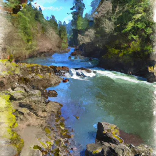


About Schwartz Reservoir
Where does the data for Schwartz Reservoir come from?
Structural and regulatory data come from the U.S. Army Corps of Engineers' National Inventory of Dams (NID). Weather forecast comes from NOAA / yr.no -- the same feed Snoflo's iOS app uses.
How often is the report updated?
NID structural data refreshes annually as the Corps publishes updated assessments. The weather forecast refreshes throughout the day.
What does the Significant hazard rating mean?
The Corps of Engineers' hazard potential classification grades probable consequences if the dam fails: High = probable loss of human life; Significant = no probable loss of human life but possible economic loss / environmental damage; Low = no probable loss of human life, only minor economic / environmental losses. See the Dam Data Reference card below for the full definitions.
What's "% of normal"?
The current storage value compared to the historical average storage on this calendar day. 100% = right on average; values above 100% mean above-normal storage (wet year); values below mean below-normal (dry year or drought).
Can I get alerts when storage crosses a threshold?
Yes -- alerts are managed in the Snoflo iOS app. Favorite this dam, set a threshold, and you'll get a push the moment conditions cross.
Dam data reference
Condition Assessment
- Satisfactory
- No existing or potential dam safety deficiencies are recognized. Acceptable performance is expected under all loading conditions (static, hydrologic, seismic) in accordance with the minimum applicable state or federal regulatory criteria or tolerable risk guidelines.
- Fair
- No existing dam safety deficiencies are recognized for normal operating conditions. Rare or extreme hydrologic and/or seismic events may result in a dam safety deficiency. Risk may be in the range to take further action.
- Poor
- A dam safety deficiency is recognized for normal operating conditions which may realistically occur. Remedial action is necessary. POOR may also be used when uncertainties exist as to critical analysis parameters which identify a potential dam safety deficiency.
- Unsatisfactory
- A dam safety deficiency is recognized that requires immediate or emergency remedial action for problem resolution.
- Not Rated
- The dam has not been inspected, is not under state or federal jurisdiction, or has been inspected but, for whatever reason, has not been rated.
Hazard Potential Classification
- High
- Dams assigned the high hazard potential classification are those where failure or mis-operation will probably cause loss of human life.
- Significant
- Dams assigned the significant hazard potential classification are those dams where failure or mis-operation results in no probable loss of human life but can cause economic loss, environmental damage, disruption of lifeline facilities, or impact other concerns. Significant hazard potential classification dams are often located in predominantly rural or agricultural areas but could be in areas with population and significant infrastructure.
- Low
- Dams assigned the low hazard potential classification are those where failure or mis-operation results in no probable loss of human life and low economic and/or environmental losses. Losses are principally limited to the owner's property.
- Undetermined
- Dams for which a downstream hazard potential has not been designated or is not provided.