Gale Meadows Reservoir Report
Nearby: Gale Meadows Dike Strattonwald
Last Updated: February 25, 2026
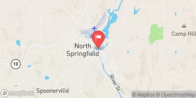
Gale Meadows, located in Londonderry, Vermont, is a state-regulated earth dam built in 1965 by designers Haley & Ward.
Summary
The dam, standing at 30 feet high with a structural height of 33 feet, serves primarily for recreational purposes, providing a storage capacity of 2942 acre-feet. Situated on Mill Brook, the dam has a surface area of 195 acres and drains a 10.27 square mile watershed.
Despite its recreational significance, Gale Meadows poses a significant hazard potential with a poor condition assessment as of June 2017. The dam's last inspection date was in 2017, with an inspection frequency of every 3 years. With a lack of Emergency Action Plan preparedness and risk management measures in place, there are concerns about the safety and resilience of the dam in the face of climate change impacts and extreme weather events.
Given its location in the Windham County, Vermont, Gale Meadows falls under state jurisdiction and regulation by the Department of Environmental Conservation (DEC). With notable deficiencies in its condition assessment and emergency preparedness, water resource and climate enthusiasts may be interested in advocating for improved safety measures and risk management protocols to ensure the long-term sustainability and resilience of this important recreational infrastructure.
°F
°F
mph
Wind
%
Humidity
15-Day Weather Outlook
Year Completed |
1965 |
Dam Length |
300 |
Dam Height |
30 |
River Or Stream |
MILL BROOK |
Primary Dam Type |
Earth |
Surface Area |
195 |
Hydraulic Height |
30 |
Drainage Area |
10.27 |
Nid Storage |
2942 |
Structural Height |
33 |
Hazard Potential |
Significant |
Foundations |
Soil |
Nid Height |
33 |
Seasonal Comparison
5-Day Hourly Forecast Detail
Nearby Streamflow Levels
Dam Data Reference
Condition Assessment
SatisfactoryNo existing or potential dam safety deficiencies are recognized. Acceptable performance is expected under all loading conditions (static, hydrologic, seismic) in accordance with the minimum applicable state or federal regulatory criteria or tolerable risk guidelines.
Fair
No existing dam safety deficiencies are recognized for normal operating conditions. Rare or extreme hydrologic and/or seismic events may result in a dam safety deficiency. Risk may be in the range to take further action. Note: Rare or extreme event is defined by the regulatory agency based on their minimum
Poor A dam safety deficiency is recognized for normal operating conditions which may realistically occur. Remedial action is necessary. POOR may also be used when uncertainties exist as to critical analysis parameters which identify a potential dam safety deficiency. Investigations and studies are necessary.
Unsatisfactory
A dam safety deficiency is recognized that requires immediate or emergency remedial action for problem resolution.
Not Rated
The dam has not been inspected, is not under state or federal jurisdiction, or has been inspected but, for whatever reason, has not been rated.
Not Available
Dams for which the condition assessment is restricted to approved government users.
Hazard Potential Classification
HighDams assigned the high hazard potential classification are those where failure or mis-operation will probably cause loss of human life.
Significant
Dams assigned the significant hazard potential classification are those dams where failure or mis-operation results in no probable loss of human life but can cause economic loss, environment damage, disruption of lifeline facilities, or impact other concerns. Significant hazard potential classification dams are often located in predominantly rural or agricultural areas but could be in areas with population and significant infrastructure.
Low
Dams assigned the low hazard potential classification are those where failure or mis-operation results in no probable loss of human life and low economic and/or environmental losses. Losses are principally limited to the owner's property.
Undetermined
Dams for which a downstream hazard potential has not been designated or is not provided.
Not Available
Dams for which the downstream hazard potential is restricted to approved government users.
Area Campgrounds
| Location | Reservations | Toilets |
|---|---|---|
 Winhall Brook
|
||
 Hapgood Pond Recreation Area
|
||
 Hapgood Pond
|
||
 Jamaica State Park
|
||
 Stratton View Tenting Area
|
||
 North Bourne Pond
|


 Gale Meadows
 Gale Meadow Road Londonderry
 End Of Kendall Farm Road To Confluence With West River
 Headwaters To End Of Kendall Farm Road
 Wilderness Boundary To Confluence With Batten Kill
 Arlington, Vt To Manchester, Vt
 Headwaters To Wilderness Boundary
 Headwaters To First Bridge Upstream On Route 100