Bryan Reservoir Report
Nearby: Schwartz Cadys Falls
Last Updated: February 22, 2026
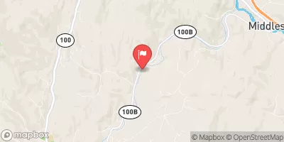
Located in Morristown, Vermont, the Bryan dam is a privately owned structure designed by NRCS for recreational purposes.
Summary
Completed in 1964, this earth-core dam stands at 25 feet high with a length of 584 feet, providing a storage capacity of 47 acre-feet. The dam is situated on Mud Brook-TR, within the Lamoille County region, under the jurisdiction of the Vermont Department of Environmental Conservation.
Maintaining a satisfactory condition assessment as of November 2018, the Bryan dam poses a significant hazard potential due to its structural design and location. With a history of state regulation, permitting, and inspections, the dam's last inspection date was in July 2013, with a regular inspection frequency of every 3 years. Despite meeting guidelines and having an Emergency Action Plan in place, details on risk assessment, inundation maps, and risk management measures are currently unavailable.
In the event of an emergency, it is crucial for stakeholders and water resource enthusiasts to stay informed and updated on the Bryan dam's condition and regulatory status. With its significant hazard potential and satisfactory condition assessment, ongoing monitoring and regular inspections are essential to ensure public safety and mitigate potential risks associated with this recreational water structure.
°F
°F
mph
Wind
%
Humidity
15-Day Weather Outlook
Year Completed |
1964 |
Dam Length |
584 |
Dam Height |
25 |
River Or Stream |
MUD BROOK-TR |
Primary Dam Type |
Earth |
Surface Area |
4 |
Hydraulic Height |
25 |
Drainage Area |
0.41 |
Nid Storage |
47 |
Structural Height |
28 |
Hazard Potential |
Significant |
Foundations |
Soil |
Nid Height |
28 |
Seasonal Comparison
5-Day Hourly Forecast Detail
Nearby Streamflow Levels
Dam Data Reference
Condition Assessment
SatisfactoryNo existing or potential dam safety deficiencies are recognized. Acceptable performance is expected under all loading conditions (static, hydrologic, seismic) in accordance with the minimum applicable state or federal regulatory criteria or tolerable risk guidelines.
Fair
No existing dam safety deficiencies are recognized for normal operating conditions. Rare or extreme hydrologic and/or seismic events may result in a dam safety deficiency. Risk may be in the range to take further action. Note: Rare or extreme event is defined by the regulatory agency based on their minimum
Poor A dam safety deficiency is recognized for normal operating conditions which may realistically occur. Remedial action is necessary. POOR may also be used when uncertainties exist as to critical analysis parameters which identify a potential dam safety deficiency. Investigations and studies are necessary.
Unsatisfactory
A dam safety deficiency is recognized that requires immediate or emergency remedial action for problem resolution.
Not Rated
The dam has not been inspected, is not under state or federal jurisdiction, or has been inspected but, for whatever reason, has not been rated.
Not Available
Dams for which the condition assessment is restricted to approved government users.
Hazard Potential Classification
HighDams assigned the high hazard potential classification are those where failure or mis-operation will probably cause loss of human life.
Significant
Dams assigned the significant hazard potential classification are those dams where failure or mis-operation results in no probable loss of human life but can cause economic loss, environment damage, disruption of lifeline facilities, or impact other concerns. Significant hazard potential classification dams are often located in predominantly rural or agricultural areas but could be in areas with population and significant infrastructure.
Low
Dams assigned the low hazard potential classification are those where failure or mis-operation results in no probable loss of human life and low economic and/or environmental losses. Losses are principally limited to the owner's property.
Undetermined
Dams for which a downstream hazard potential has not been designated or is not provided.
Not Available
Dams for which the downstream hazard potential is restricted to approved government users.
Area Campgrounds
| Location | Reservations | Toilets |
|---|---|---|
 Smugglers Notch State Park
|
||
 Elmore State Park
|
||
 Lake Elmore State Park
|
||
 Underhill State Park
|
||
 Twin Brooks Tenting Area
|
||
 Campsite #24
|


 Bryan
Bryan