


Fishpond Lake Dam Reservoir Report
Last Updated: May 11, 2026
Nearby: Elkhorn Lake Dam Keith Funk
°F
°F
mph
Wind
%
Humidity
Fishpond Lake Dam, also known as Payne Gap Lake, is a rockfill dam located in Letcher, Kentucky, near the city of KONA.
Summary
Built in 1964 by the Division of Flood Control & Water Resources, this dam serves a primary purpose of recreation and is owned by the local government. With a height of 105 feet and a storage capacity of 1400 acre-feet, Fishpond Lake Dam is situated on Fishpond Creek and covers a surface area of 31.6 acres.
Managed by the Kentucky Division of Water, Fishpond Lake Dam is regulated, inspected, and enforced by the state authorities to ensure its safety and compliance with standards. The dam has a spillway width of 20 feet and is classified as having a high hazard potential but is in fair condition as of the last assessment in May 2018. Despite its moderate risk assessment, the dam is regularly inspected every year to maintain its integrity and safety for the surrounding community.
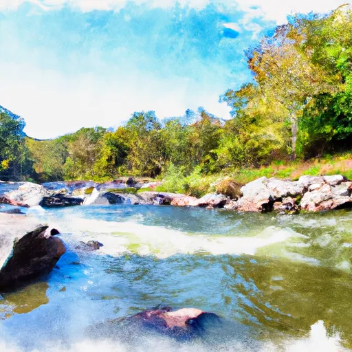
Fishpond Lake Dam offers recreational opportunities for visitors, including fishing, boating, and other water activities. The dam's picturesque setting and the surrounding natural beauty make it a popular destination for water resource and climate enthusiasts seeking to explore the diverse ecosystem of Letcher, Kentucky.
Regional Streamflow Levels

15-Day Long Term Forecast
Year Completed |
1964 |
Dam Length |
385 |
Dam Height |
105 |
River Or Stream |
FISHPOND CREEK |
Primary Dam Type |
Rockfill |
Surface Area |
31.6 |
Drainage Area |
0.56 |
Nid Storage |
1400 |
Hazard Potential |
High |
Nid Height |
105 |
Seasonal Comparison
5-Day Hourly Forecast Detail
Dam Data Reference
Condition Assessment
SatisfactoryNo existing or potential dam safety deficiencies are recognized. Acceptable performance is expected under all loading conditions (static, hydrologic, seismic) in accordance with the minimum applicable state or federal regulatory criteria or tolerable risk guidelines.
Fair
No existing dam safety deficiencies are recognized for normal operating conditions. Rare or extreme hydrologic and/or seismic events may result in a dam safety deficiency. Risk may be in the range to take further action. Note: Rare or extreme event is defined by the regulatory agency based on their minimum
Poor A dam safety deficiency is recognized for normal operating conditions which may realistically occur. Remedial action is necessary. POOR may also be used when uncertainties exist as to critical analysis parameters which identify a potential dam safety deficiency. Investigations and studies are necessary.
Unsatisfactory
A dam safety deficiency is recognized that requires immediate or emergency remedial action for problem resolution.
Not Rated
The dam has not been inspected, is not under state or federal jurisdiction, or has been inspected but, for whatever reason, has not been rated.
Not Available
Dams for which the condition assessment is restricted to approved government users.
Hazard Potential Classification
HighDams assigned the high hazard potential classification are those where failure or mis-operation will probably cause loss of human life.
Significant
Dams assigned the significant hazard potential classification are those dams where failure or mis-operation results in no probable loss of human life but can cause economic loss, environment damage, disruption of lifeline facilities, or impact other concerns. Significant hazard potential classification dams are often located in predominantly rural or agricultural areas but could be in areas with population and significant infrastructure.
Low
Dams assigned the low hazard potential classification are those where failure or mis-operation results in no probable loss of human life and low economic and/or environmental losses. Losses are principally limited to the owner's property.
Undetermined
Dams for which a downstream hazard potential has not been designated or is not provided.
Not Available
Dams for which the downstream hazard potential is restricted to approved government users.
Area Campgrounds
| Location | Reservations | Toilets |
|---|---|---|
 Jack Sutter Campsite
|
||
 Indian Grave Campsite
|
||
 Cane Patch Campground
|
||
 Cane Patch
|
||
 Swindall Campsite
|
||
 Mullins Pond Campsite
|
 Martins Fork Lk At Martins Fk Dam Nr Smith
 Smithsboro Road Perry County
River Runs
-
 Headwaters To Alternative Route 58
-
 State Route 72 Bridge To Confluence With Clinch River
-
 Confluence Of White Branch With Russell Fork (And 1 Mile Upstream On Pound River) To Railroad Bridge Crossing Above Elkhorn City
-
 Fs Route 700 To Confluence With Clinch River
-
 Confluence With Guest River To Confluence With Little Stony Creek