Middleton Dam

Middleton Dam
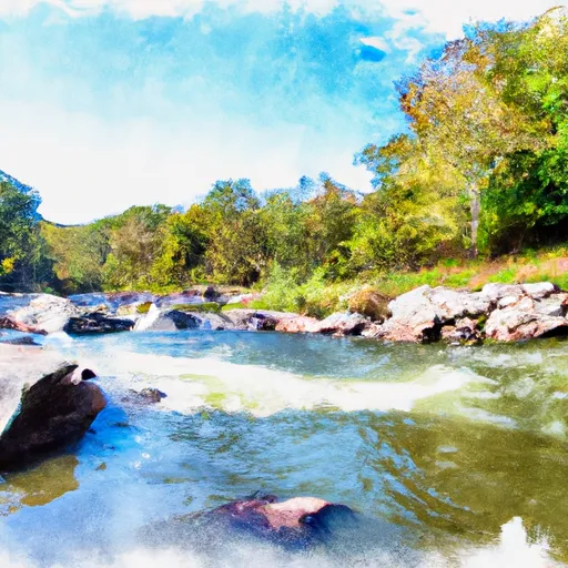
Middleton Dam, located in Lee, Virginia, is a private dam primarily built for recreational purposes on Stone Creek. Standing at a height of 21.9 feet, the dam has a storage capacity of 68 acre-feet and covers a surface area of 7.1 acres. While its hazard potential is currently classified as undetermined and its condition assessment is not rated, the dam is regulated, inspected, and enforced by the Department of Conservation and Recreation in Virginia.
Situated within the Nashville District of the US Army Corps of Engineers, Middleton Dam is overseen by a private entity and has not been modified or assessed for emergency action planning. With a normal storage capacity of 54 acre-feet and a drainage area of 0.7 square miles, the dam plays a crucial role in providing recreational opportunities in the region. Although specific details about its construction year and spillway type are not provided, Middleton Dam remains a significant feature in the local water resource infrastructure, attracting water resource and climate enthusiasts to experience its beauty and functionality firsthand.
As water resource and climate enthusiasts explore Middleton Dam, they can appreciate its earth construction type and the serene surroundings of Lee, Virginia. Despite its undetermined hazard potential, the dam's structural integrity and regulatory oversight ensure the safety of visitors and the surrounding community. With its strategic location and recreational focus, Middleton Dam serves as a valuable asset for water management and outdoor enjoyment in the region, highlighting the importance of sustainable water resource practices and climate-conscious infrastructure development.
Plan around the weather
Same NOAA / yr.no feed Snoflo's iOS app uses. Watch the precipitation column on the meteogram -- rain on the basin upstream typically lifts inflow 24-72 hours later.
Next 5 days, hour by hour
Temperature line with weather symbols on top, snow + rain accumulation as columns, humidity as a dotted line.
5-day forecast table
Every 3 hours, broken out across temperature, snow, rain, humidity, and wind. Each cell is colour-coded relative to the column min/max.
| Time | Condition | Temp (°F) | Snow (in) | Rain (in) | Humidity (%) | Wind (mps) | Wind dir |
|---|---|---|---|---|---|---|---|
| Loading detailed forecast… | |||||||
15-day temperature & precipitation
Daily temperatures, snow, and rain projected over the next two weeks.
Nearby streamflow gauges
USGS streamgauges around Middleton Dam -- inflows here typically show up in storage 24-72 hours later.
| Streamgauge | Discharge | View |
|---|---|---|
| Powell River Near Jonesville | 110 cfs | → |
| Martins Fork Near Smith | 18 cfs | → |
| Martins Fork Above Smith | 7 cfs | → |
| Cumberland River Near Harlan | 132 cfs | → |
| Clinch River Near Looneys Gap | 1,750 cfs | → |
| Poor Fork At Cumberland | 46 cfs | → |


About Middleton Dam
Where does the data for Middleton Dam come from?
Structural and regulatory data come from the U.S. Army Corps of Engineers' National Inventory of Dams (NID). Weather forecast comes from NOAA / yr.no -- the same feed Snoflo's iOS app uses.
How often is the report updated?
NID structural data refreshes annually as the Corps publishes updated assessments. The weather forecast refreshes throughout the day.
What does the Undetermined hazard rating mean?
The Corps of Engineers' hazard potential classification grades probable consequences if the dam fails: High = probable loss of human life; Significant = no probable loss of human life but possible economic loss / environmental damage; Low = no probable loss of human life, only minor economic / environmental losses. See the Dam Data Reference card below for the full definitions.
What's "% of normal"?
The current storage value compared to the historical average storage on this calendar day. 100% = right on average; values above 100% mean above-normal storage (wet year); values below mean below-normal (dry year or drought).
Can I get alerts when storage crosses a threshold?
Yes -- alerts are managed in the Snoflo iOS app. Favorite this dam, set a threshold, and you'll get a push the moment conditions cross.
Dam data reference
Condition Assessment
- Satisfactory
- No existing or potential dam safety deficiencies are recognized. Acceptable performance is expected under all loading conditions (static, hydrologic, seismic) in accordance with the minimum applicable state or federal regulatory criteria or tolerable risk guidelines.
- Fair
- No existing dam safety deficiencies are recognized for normal operating conditions. Rare or extreme hydrologic and/or seismic events may result in a dam safety deficiency. Risk may be in the range to take further action.
- Poor
- A dam safety deficiency is recognized for normal operating conditions which may realistically occur. Remedial action is necessary. POOR may also be used when uncertainties exist as to critical analysis parameters which identify a potential dam safety deficiency.
- Unsatisfactory
- A dam safety deficiency is recognized that requires immediate or emergency remedial action for problem resolution.
- Not Rated
- The dam has not been inspected, is not under state or federal jurisdiction, or has been inspected but, for whatever reason, has not been rated.
Hazard Potential Classification
- High
- Dams assigned the high hazard potential classification are those where failure or mis-operation will probably cause loss of human life.
- Significant
- Dams assigned the significant hazard potential classification are those dams where failure or mis-operation results in no probable loss of human life but can cause economic loss, environmental damage, disruption of lifeline facilities, or impact other concerns. Significant hazard potential classification dams are often located in predominantly rural or agricultural areas but could be in areas with population and significant infrastructure.
- Low
- Dams assigned the low hazard potential classification are those where failure or mis-operation results in no probable loss of human life and low economic and/or environmental losses. Losses are principally limited to the owner's property.
- Undetermined
- Dams for which a downstream hazard potential has not been designated or is not provided.