Hawks Nest Dam

Hawks Nest
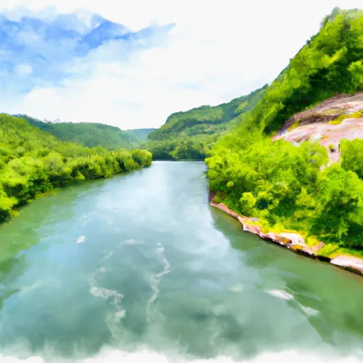
Situated in the picturesque surroundings of Gauley Bridge, West Virginia, Hawks Nest (also known as Gauley Junction Dam) is a private hydroelectric dam on the New River. With a towering height of 85 feet and a hydraulic height of 163 feet, this concrete gravity dam was completed in 1936 and serves multiple purposes including hydroelectric power generation and recreation. The dam boasts a storage capacity of 7,323 acre-feet and a maximum discharge of 335,000 cubic feet per second.
Despite its age, Hawks Nest remains a critical piece of infrastructure, with a high hazard potential and a very high risk assessment rating. The dam's controlled spillway, 700 feet wide, helps manage water flow during peak periods. The dam's roller gates, numbering 14, assist in regulating water levels and releases.
Managed by the Federal Energy Regulatory Commission, Hawks Nest is an integral part of the region's water resource management system. Its stunning location, combined with its historical significance and operational importance, make it a must-visit destination for water resource and climate enthusiasts seeking to appreciate the intersection of nature and engineering.
Plan around the weather
Same NOAA / yr.no feed Snoflo's iOS app uses. Watch the precipitation column on the meteogram -- rain on the basin upstream typically lifts inflow 24-72 hours later.
Next 5 days, hour by hour
Temperature line with weather symbols on top, snow + rain accumulation as columns, humidity as a dotted line.
5-day forecast table
Every 3 hours, broken out across temperature, snow, rain, humidity, and wind. Each cell is colour-coded relative to the column min/max.
| Time | Condition | Temp (°F) | Snow (in) | Rain (in) | Humidity (%) | Wind (mps) | Wind dir |
|---|---|---|---|---|---|---|---|
| Loading detailed forecast… | |||||||
15-day temperature & precipitation
Daily temperatures, snow, and rain projected over the next two weeks.
Nearby streamflow gauges
USGS streamgauges around Hawks Nest -- inflows here typically show up in storage 24-72 hours later.
| Streamgauge | Discharge | View |
|---|---|---|
| Kanawha River At Kanawha Falls | 4,920 cfs | → |
| Gauley River Above Belva | 765 cfs | → |
| Peters Creek Near Lockwood | 34 cfs | → |
| New River At Thurmond | 3,230 cfs | → |
| Meadow River At Nallen | 180 cfs | → |
| Elk River At Clay | 11,200 cfs | → |
Make a day of it
Boat launches, lakeside camping, fishing access, and other reservoirs near Hawks Nest .
Boat launches
See all →


Campgrounds
See all →


River runs
See all →


About Hawks Nest
Where does the data for Hawks Nest come from?
Structural and regulatory data come from the U.S. Army Corps of Engineers' National Inventory of Dams (NID). Weather forecast comes from NOAA / yr.no -- the same feed Snoflo's iOS app uses.
How often is the report updated?
NID structural data refreshes annually as the Corps publishes updated assessments. The weather forecast refreshes throughout the day.
What does the High hazard rating mean?
The Corps of Engineers' hazard potential classification grades probable consequences if the dam fails: High = probable loss of human life; Significant = no probable loss of human life but possible economic loss / environmental damage; Low = no probable loss of human life, only minor economic / environmental losses. See the Dam Data Reference card below for the full definitions.
What's "% of normal"?
The current storage value compared to the historical average storage on this calendar day. 100% = right on average; values above 100% mean above-normal storage (wet year); values below mean below-normal (dry year or drought).
Can I get alerts when storage crosses a threshold?
Yes -- alerts are managed in the Snoflo iOS app. Favorite this dam, set a threshold, and you'll get a push the moment conditions cross.
Dam data reference
Condition Assessment
- Satisfactory
- No existing or potential dam safety deficiencies are recognized. Acceptable performance is expected under all loading conditions (static, hydrologic, seismic) in accordance with the minimum applicable state or federal regulatory criteria or tolerable risk guidelines.
- Fair
- No existing dam safety deficiencies are recognized for normal operating conditions. Rare or extreme hydrologic and/or seismic events may result in a dam safety deficiency. Risk may be in the range to take further action.
- Poor
- A dam safety deficiency is recognized for normal operating conditions which may realistically occur. Remedial action is necessary. POOR may also be used when uncertainties exist as to critical analysis parameters which identify a potential dam safety deficiency.
- Unsatisfactory
- A dam safety deficiency is recognized that requires immediate or emergency remedial action for problem resolution.
- Not Rated
- The dam has not been inspected, is not under state or federal jurisdiction, or has been inspected but, for whatever reason, has not been rated.
Hazard Potential Classification
- High
- Dams assigned the high hazard potential classification are those where failure or mis-operation will probably cause loss of human life.
- Significant
- Dams assigned the significant hazard potential classification are those dams where failure or mis-operation results in no probable loss of human life but can cause economic loss, environmental damage, disruption of lifeline facilities, or impact other concerns. Significant hazard potential classification dams are often located in predominantly rural or agricultural areas but could be in areas with population and significant infrastructure.
- Low
- Dams assigned the low hazard potential classification are those where failure or mis-operation results in no probable loss of human life and low economic and/or environmental losses. Losses are principally limited to the owner's property.
- Undetermined
- Dams for which a downstream hazard potential has not been designated or is not provided.