Watt Avenue, Sacramento Boat Launch
Community Reviews
Been here? Share the conditions.
Reviews, ratings & photos are added in the free Snoflo iOS app — rate a spot, tag the conditions, and your visit is verified by location. Add or manage your reviews from the app.
Watt Avenue, Sacramento
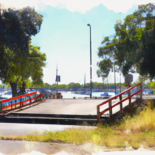
The Watt Avenue boat ramp is open to a variety of watercraft, including motorized boats, kayaks, canoes, and stand-up paddleboards. However, due to the swift currents and rapids in some areas of the American River, it is recommended that boaters exercise caution and only navigate waters that are appropriate for their skill level and vessel type.
As of the latest information available, the Watt Avenue boat ramp is open year-round, with operating hours from sunrise to sunset. There is a fee for launching and parking at the site, with rates varying depending on the time of day, type of watercraft, and length of stay.
Overall, the Watt Avenue boat ramp is a well-maintained and popular launch site that provides convenient access to the American River for boaters of all types. Its location in Sacramento makes it easily accessible from many parts of the city and surrounding areas, making it a popular choice for locals and tourists alike.
Plan your launch down to the hour
Same weather feed Snoflo's iOS app uses -- updated continuously from NOAA / yr.no.
Next 5 days, hour by hour
Temperature line with weather symbols on top, snow + rain accumulation as columns, humidity as a dotted line.
5-day forecast table
Every 3 hours, broken out across temperature, snow, rain, humidity, and wind.
| Time | Condition | Temp (°F) | Snow (in) | Rain (in) | Humidity (%) | Wind (mps) | Wind dir |
|---|---|---|---|---|---|---|---|
| Loading detailed forecast… | |||||||
15-day temperature & precipitation
Daily temperatures, snow, and rain projected over the next two weeks.
Area streamflow levels
USGS streamgauges around Watt Avenue, Sacramento -- the same readings that determine whether your launch is safe and your boat is the right craft.
| Streamgauge | Discharge | View |
|---|---|---|
| Arcade C Nr Del Paso Heights Ca | · | → |
| Morrison C Nr Sacramento Ca | 11 cfs | → |
| American R A Fair Oaks Ca | 4,410 cfs | → |
| Laguna C Nr Elk Grove Ca | 1 cfs | → |
| Sacramento R A Freeport Ca | 18,500 cfs | → |
| Dry C A Vernon St Bridge A Roseville Ca | 159 cfs | → |
Plan a longer trip
The closest paddle runs, fishing spots, and other boat launches so you can extend a day on the water.
Boating safety & etiquette
- Check the conditions before you launch
- Use the streamflow numbers, weather, and wind forecast on this page. High-cfs whitewater requires whitewater-specific craft and skill.
- Wear your life jacket
- Statistically the single biggest survival factor in a boating incident. State law often requires one per passenger.
- File a float plan
- Tell someone on shore your put-in, take-out, and expected return time. Especially for multi-day or remote trips.
- Yield at the ramp
- Prep gear in the parking lot, not on the ramp. Launch and clear quickly so others can use the lane.
- Clean, drain, dry
- Inspect, clean, drain and dry your boat between waters to prevent the spread of aquatic invasive species.
Set push alerts in the Snoflo app
Save Watt Avenue, Sacramento as a favorite, set a discharge threshold or a wind/precipitation alert, and the iOS app will push the moment conditions cross.
About Watt Avenue, Sacramento
Can I launch a motorboat here?
Most Snoflo-tracked launches support motorboats; check the operator for any horsepower restrictions, paddle-only zones, or seasonal closures.
How fresh is the streamflow data?
USGS streamgauges report continuously (every 15 minutes); the table on this page pulls the latest reading at page load.
Is there a fee?
Many federal and state boat launches charge a day-use fee. Check the operator's site before driving out.
What boat is right for these conditions?
Use the nearby streamflow numbers and river-run panel on this page to gauge current conditions. Wider, slower water is friendly for casual paddling and powerboats; high-cfs whitewater requires whitewater-specific craft and skill.
Can I get alerts when conditions change?
Yes -- alerts are managed in the Snoflo iOS app. Favorite this launch, set a threshold (discharge, wind), and you'll get a push the moment it crosses.
Other launches near here
Snoflo-tracked boat launches within driving distance of Watt Avenue, Sacramento.