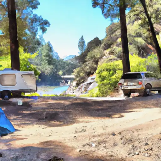
Sonora Bridge campground
Community Reviews
Been here? Share the conditions.
Reviews, ratings & photos are added in the free Snoflo iOS app — rate a spot, tag the conditions, and your visit is verified by location. Add or manage your reviews from the app.
Sonora Bridge
Reservations are not accepted at Sonora Bridge camping area, and sites are available on a first-come, first-served basis. It is recommended to arrive early, especially during peak seasons, to secure a spot. The best time to visit this beautiful camping area is generally during the spring and fall. The weather during these seasons is mild, allowing for a pleasant camping experience. However, it is advisable to check the current weather conditions before planning your trip.
While exploring Sonora Bridge camping area, campers can enjoy various activities such as hiking, fishing, and wildlife viewing. The campground is located near the Tuolumne River, offering opportunities for fishing enthusiasts. It is important to be cautious of potential wildlife encounters and follow guidelines for food storage to avoid attracting animals. Additionally, campers should be aware of any fire restrictions and practice proper fire safety protocols. Overall, Sonora Bridge camping area is a serene and beautiful destination for nature lovers seeking a peaceful camping experience.
What's on-site at Sonora Bridge
Key facilities Snoflo tracks for this campground. Confirm with the operator before booking -- amenities can change seasonally.
Plan your trip down to the hour
Same weather feed Snoflo's iOS app uses -- updated continuously from NOAA / yr.no.
Next 5 days, hour by hour
Temperature line with weather symbols on top, snow + rain accumulation as columns, humidity as a dotted line.
5-day forecast table
Every 3 hours, broken out across temperature, snow, rain, humidity, and wind. Each cell is colour-coded relative to the column min/max so trends jump out at a glance.
| Time | Condition | Temp (°F) | Snow (in) | Rain (in) | Humidity (%) | Wind (mps) | Wind dir |
|---|---|---|---|---|---|---|---|
| Loading detailed forecast… | |||||||
15-day temperature & precipitation
Daily temperatures, snow, and rain projected over the next two weeks. Hover any point for the full breakdown.
Other campgrounds in the area
Snoflo-tracked campsites within driving distance of Sonora Bridge, with reservations status.
| Campground | Reservations | Toilets | View |
|---|---|---|---|
| Sonora Bridge Campground | ✓ | ✗ | → |
| Chris Flat | ✗ | ✓ | → |
| Chris Flat Campground | ✓ | ✗ | → |
| Bootleg Campground | ✓ | ✗ | → |
| Bootleg | ✗ | ✓ | → |
Nearby streamflow
USGS streamgauges within reach of Sonora Bridge -- pulled live from the National Water Information System.
| Streamgauge | Discharge | View |
|---|---|---|
| W Walker R Blw L Walker R Nr Coleville | 153 cfs | → |
| W Walker R Nr Coleville | 149 cfs | → |
| Buckeye C Nr Bridgeport | 41 cfs | → |
| E Walker R Nr Bridgeport | 178 cfs | → |
| Robinson C At Twin Lks Outlet Nr Bridgeport | 100 cfs | → |
| Green Creek Near Bridgeport | 25 cfs | → |
Nearby snow depths
NRCS SNOTEL stations within reach of Sonora Bridge -- relevant when planning a shoulder-season or alpine trip.
| SNOTEL station | Snowpack | 24h Snowfall | View |
|---|---|---|---|
| Nohrsc Summit Meadow | 0.0 in | 0.0 in | → |
| Summit Meadow | 0.0 in | 0.0 in | → |
| Leavitt Meadows | 0.0 in | 0.0 in | → |
| Nohrsc Leavitt Meadows | 0.0 in | 0.0 in | → |
| Nohrsc Willow Flat Snotel | 0.0 in | 0.0 in | → |
| Sonora Pass | 1.0 in | 0.0 in | → |
Plan a longer trip
The closest parks, lakes, boat launches, and paddle runs so a camping night can grow into a full weekend.
Parks
- Toiyabe National Forest
- Wilderness Carson-Iceberg
- Wildlife Area Slinkard / Little Antelope
- Heenan Lake Wildlife Area
- Topaz Lake Park
- Wilderness Wovoka
Boat launches
- Ramp Road Mono County
- Paradise Shore Rv Park
- Annett's Mono Village Fishing Resort
- Highland Lakes
- Topaz Park Road Douglas County
Fishing spots
Points of interest
- Rickey Cabin
- Columns Of The Giants
- Donnell Vista
- Hermit Valley
- Bodie Museum And Visitor Center
- Hangmans Bridge
Paddle runs
- Hoover Wilderness Boundary To Leavitt Meadows Campground
- Headwaters To Confluence With East Carsonriver
- Mill Creek
- Headwater Deadman Creek To Confluence With Middle Fork Stanislaus River
- Headwaters Kennedy Creek To Confluence With Middle Fork Stanislaus
- Source (Tower Lake) Includes Kirkwood Creek, Cascade Creek And Tower Creek To Hoover Wilderness Boundary
Camping essentials & Leave No Trace
- Pack it in, pack it out
- Take all trash, food scraps, and gear back with you to keep campsites clean and protect wildlife.
- Respect wildlife
- Observe animals from a distance, store food securely, and never feed wildlife to maintain natural behavior and safety.
- Know before you go
- Check weather, fire restrictions, trail conditions, and permit requirements to ensure a safe and well-planned trip.
- Minimize campfire impact
- Use established fire rings, keep fires small, fully extinguish them, or opt for a camp stove when fires are restricted.
- Leave what you find
- Preserve natural and cultural features by avoiding removal of plants, rocks, artifacts, or other elements of the environment.
Set push alerts in the Snoflo app
Save Sonora Bridge as a favorite, set a custom threshold (precipitation, snowpack, freezing temperatures), and the iOS app will push the moment conditions cross.
About Sonora Bridge
Can I make reservations at Sonora Bridge?
This campground does not appear to accept reservations -- it's typically first-come, first-served. Arrive early on summer weekends.
How fresh is the weather data on this page?
The hourly forecast updates throughout the day from the NOAA / yr.no public feeds. Streamflow data is pulled live from USGS streamgauges and snowpack from the NRCS SNOTEL network.
What's the best time of year to visit?
Use the 15-day temperature & precipitation outlook on this page to plan -- pick a window with comfortable temperatures and low precipitation. For longer trips, the 5-day hourly meteogram shows snow + rain accumulation hour-by-hour.
How do I get to Sonora Bridge?
Tap Directions in the hero above to open driving directions in Google Maps, or Open in map to center the Snoflo interactive map on the campground.
Can I get alerts when conditions change?
Yes -- alerts are managed through the Snoflo iOS app. Favorite this campground, set a threshold (temperature, snowpack, precipitation), and you'll get a push the moment it crosses.
Other campgrounds near here
Snoflo-tracked campgrounds within driving distance of Sonora Bridge.