Taylorsville Community Campground campground
Community Reviews
Been here? Share the conditions.
Reviews, ratings & photos are added in the free Snoflo iOS app — rate a spot, tag the conditions, and your visit is verified by location. Add or manage your reviews from the app.
Taylorsville Community Campground
The area also boasts several attractions, including the Plumas-Eureka State Park, which offers hiking and biking trails, as well as the historically significant Eureka Mine. Other points of interest include the Bizz Johnson National Recreation Trail and the nearby town of Susanville, which provides visitors with an opportunity to explore local culture and history.
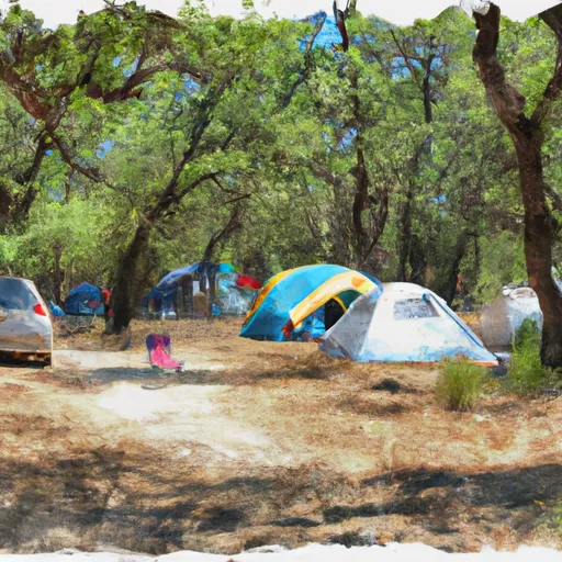
The Taylorsville Community Campground offers a range of amenities, including picnic areas, BBQ grills, and fire rings, making it an ideal camping destination for families and groups of all sizes. The campground is also pet-friendly, ensuring that furry friends can enjoy the great outdoors alongside their owners.
The campground is on a first-come, first-serve basis, with 16 campsites available for visitors looking to enjoy a peaceful retreat. An interesting fact about the area is that it is home to the largest population of bald eagles in California.
The best time to visit Taylorsville Community Campground is during the summer months, with average temperatures ranging from 80-85 degrees Fahrenheit during the day and cooling off to comfortable temperatures in the evening. Visitors can enjoy a range of outdoor activities, including hiking, fishing, and kayaking, while enjoying the natural beauty of the area.
What's on-site at Taylorsville Community Campground
Key facilities Snoflo tracks for this campground. Confirm with the operator before booking -- amenities can change seasonally.
Plan your trip down to the hour
Same weather feed Snoflo's iOS app uses -- updated continuously from NOAA / yr.no.
Next 5 days, hour by hour
Temperature line with weather symbols on top, snow + rain accumulation as columns, humidity as a dotted line.
5-day forecast table
Every 3 hours, broken out across temperature, snow, rain, humidity, and wind. Each cell is colour-coded relative to the column min/max so trends jump out at a glance.
| Time | Condition | Temp (°F) | Snow (in) | Rain (in) | Humidity (%) | Wind (mps) | Wind dir |
|---|---|---|---|---|---|---|---|
| Loading detailed forecast… | |||||||
15-day temperature & precipitation
Daily temperatures, snow, and rain projected over the next two weeks. Hover any point for the full breakdown.
Other campgrounds in the area
Snoflo-tracked campsites within driving distance of Taylorsville Community Campground, with reservations status.
| Campground | Reservations | Toilets | View |
|---|---|---|---|
| Taylorsville County Park | ✗ | ✓ | → |
| Brady's Camp Campground | ✗ | ✗ | → |
| Long Point Group Campground (25 People Per Site) | ✓ | ✗ | → |
| Spanish Creek (Family ) | ✓ | ✓ | → |
| Spanish Creek Campground | ✓ | ✗ | → |
Nearby streamflow
USGS streamgauges within reach of Taylorsville Community Campground -- pulled live from the National Water Information System.
| Streamgauge | Discharge | View |
|---|---|---|
| Spanish C Ab Blackhawk C At Keddie Ca | 36 cfs | → |
| Spanish C A Quincy Ca | 19 cfs | → |
| N Yuba R Bl Goodyears Bar Ca | 175 cfs | → |
| Little Truckee R Bl Div Dam Nr Sierraville Ca | 3 cfs | → |
| Independence C Nr Truckee Ca | 6 cfs | → |
| Butte C Nr Chico Ca | 164 cfs | → |
Nearby snow depths
NRCS SNOTEL stations within reach of Taylorsville Community Campground -- relevant when planning a shoulder-season or alpine trip.
| SNOTEL station | Snowpack | 24h Snowfall | View |
|---|---|---|---|
| Susanville 3.2 Ssw | 0.0 in | 0.0 in | → |
| Nohrsc Harkness Flat Near Chester 8nnw | 0.0 in | 0.0 in | → |
| Doyle Raws | 0.0 in | 0.0 in | → |
| Bull Flat Raws | 0.0 in | 0.0 in | → |
| Nohrsc Meadow Lk Snow Course | 21.2 in | 0.2 in | → |
Plan a longer trip
The closest parks, lakes, boat launches, and paddle runs so a camping night can grow into a full weekend.
Parks
- Cedar Drive
- Wilderness Bucks Lake
- Plumas-Eureka State Park
- Chester Park
- Portola City Park
- Honey Lake Wildlife Area
Boat launches
- Lost Cove Boat Ramp
- Volcanic Legacy Scenic Byway, California
- Lake Cove Resort & Marina
- Lake Haven Resort
- Lake Davis Recreation Area (Lightning Tree)
- Lake Almanor Country Club Recreation Area 1
Fishing spots
- Antelope Lake
- Deerheart Creek
- Mountain Meadows Reservoir
- Antelope Creek
- Goodrich Creek
- Butt Valley Reservoir
Points of interest
- Plumas County Museum
- Bucks Lake Wilderness
- Plumas-Eureka State Park Museum
- Mount. Ararat
- Lassen County Arts Council
- Lassen Historical Museum
Paddle runs
- Pond In Sec 35, T26n, R9e To Confluence With Spanish Creek
- Confluence With Squaw Queen Creek To Confluence With Red Clover Creek
- Sec 17, T25n, R14e To Confluence With Last Chance Creek
- Confluence With East And West Branches Of Nelson Creek To Confluence With Middle Fork Feather Wsr
- Silver Lake To Meadow Valley
- Headwaters To Confluence With Nelson Creek
Camping essentials & Leave No Trace
- Pack it in, pack it out
- Take all trash, food scraps, and gear back with you to keep campsites clean and protect wildlife.
- Respect wildlife
- Observe animals from a distance, store food securely, and never feed wildlife to maintain natural behavior and safety.
- Know before you go
- Check weather, fire restrictions, trail conditions, and permit requirements to ensure a safe and well-planned trip.
- Minimize campfire impact
- Use established fire rings, keep fires small, fully extinguish them, or opt for a camp stove when fires are restricted.
- Leave what you find
- Preserve natural and cultural features by avoiding removal of plants, rocks, artifacts, or other elements of the environment.
Set push alerts in the Snoflo app
Save Taylorsville Community Campground as a favorite, set a custom threshold (precipitation, snowpack, freezing temperatures), and the iOS app will push the moment conditions cross.
About Taylorsville Community Campground
Can I make reservations at Taylorsville Community Campground?
This campground does not appear to accept reservations -- it's typically first-come, first-served. Arrive early on summer weekends.
How fresh is the weather data on this page?
The hourly forecast updates throughout the day from the NOAA / yr.no public feeds. Streamflow data is pulled live from USGS streamgauges and snowpack from the NRCS SNOTEL network.
What's the best time of year to visit?
Use the 15-day temperature & precipitation outlook on this page to plan -- pick a window with comfortable temperatures and low precipitation. For longer trips, the 5-day hourly meteogram shows snow + rain accumulation hour-by-hour.
How do I get to Taylorsville Community Campground?
Tap Directions in the hero above to open driving directions in Google Maps, or Open in map to center the Snoflo interactive map on the campground.
Can I get alerts when conditions change?
Yes -- alerts are managed through the Snoflo iOS app. Favorite this campground, set a threshold (temperature, snowpack, precipitation), and you'll get a push the moment it crosses.
Other campgrounds near here
Snoflo-tracked campgrounds within driving distance of Taylorsville Community Campground.