

-
 Snoflo Premium
Get unlimited access to all our content
With no Ad interruptions! - Start Your Free Trial Login with existing account
Big-Creek
Eden Index
Climate
9.9
•
Recreation
9.3
•
Community
1.1
•
Safeguard
7.5/10
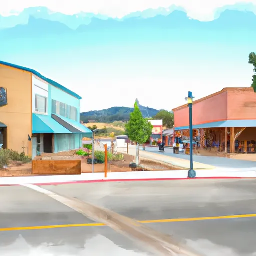
Big Creek is a small community located in the Sierra National Forest of California. The climate in Big Creek is mostly mild, with warm summers and cool winters. The area is known for its vast mountainous terrain and abundant hydrology constituents, including numerous creeks and streams that flow into the San Joaquin River. This makes it an ideal destination for fishing, kayaking, and rafting. Additionally, visitors can enjoy hiking, camping, and mountain biking on the many trails that wind through the forest. The nearby Shaver Lake also provides opportunities for boating and swimming. Overall, Big Creek offers a perfect blend of outdoor recreation opportunities and natural beauty.
What is the Eden Index?
The Snoflo Eden Index serves as a comprehensive rating system for regions, evaluating their desirability through a holistic assessment of climate health, outdoor recreation opportunities, and natural disaster risk, acknowledging the profound impact of these factors on livability and well-being.
Climate Health Indicator (CHI): 9.9
Big-Creek receives approximately
868mm of rain per year,
with humidity levels near 73%
and air temperatures averaging around
12°C.
Big-Creek has a plant hardyness factor of
8, meaning
plants and agriculture in this region tend to thrive here all year round.
By considering the ideal temperature range, reliable water supplies, clean air, and stable seasonal rain or snowpacks, the Climate Health Indicator (CHI) underscores the significance of a healthy climate as the foundation for quality living.
A healthy climate is paramount for ensuring a high quality of life and livability in a region, fostering both physical well-being and environmental harmony. This can be characterized by ideal temperatures, reliable access to water supplies, clean air, and consistent seasonal rain or snowpacks.
Weather Forecast
Streamflow Conditions
San Joaquin
Area Rivers
San Joaquin
Snowpack Depths
San Joaquin
Reservoir Storage Capacity
San Joaquin
Groundwater Levels
Recreational Opportunity Index (ROI): 9.3
The Recreational Opportunity Index (ROI) recognizes the value of outdoor recreational options, such as parks, hiking trails, camping sites, and fishing spots, while acknowledging that climate plays a pivotal role in ensuring the comfort and consistency of these experiences.
Access to outdoor recreational opportunities, encompassing activities such as parks, hiking, camping, and fishing, is crucial for overall well-being, and the climate plays a pivotal role in enabling and enhancing these experiences, ensuring that individuals can engage in nature-based activities comfortably and consistently.
Camping Areas
| Campground | Campsites | Reservations | Toilets | Showers | Elevation |
|---|---|---|---|---|---|
| Buck Meadow | 9 | 6,758 ft | |||
| Choinumni | 36 | 557 ft | |||
| Trimmer - Pine Flat Lake | 10 | 938 ft | |||
| Camp 4 1/2 | 5 | 1,082 ft | |||
| Pine Flat Rec Area | 52 | 586 ft | |||
| Camp 4 - Yosemite National Park | 35 | 1,048 ft | |||
| Bretz | 12 | 3,281 ft | |||
| Gigantea | 11 | 6,358 ft | |||
| Kirch Flat - Pine Flat Lake | 17 | 1,007 ft | |||
| Island Park - Pine Flat Lake | 97 | 1,157 ft |
Nearby Ski Areas
Catastrophe Safeguard Index (CSI):
The Catastrophe Safeguard Index (CSI) recognizes that natural disaster risk, encompassing floods, fires, hurricanes, and tornadoes, can drastically affect safety and the overall appeal of an area.
The level of natural disaster risk in a region significantly affects safety and the overall livability, with climate change amplifying these risks by potentially increasing the frequency and intensity of events like floods, fires, hurricanes, and tornadoes, thereby posing substantial challenges to community resilience and well-being.
Community Resilience Indicator (CRI): 1.1
The Community Resilience Indicator (CRI) recognizes that education, healthcare, and socioeconomics are crucial to the well-being of a region. The CRI acknowledges the profound impact of these elements on residents' overall quality of life. By evaluating educational resources, healthcare accessibility, and economic inclusivity, the index captures the essential aspects that contribute to a thriving community, fostering resident satisfaction, equity, and social cohesion.