

-
 Snoflo Premium
Get unlimited access to all our content
With no Ad interruptions! - Start Your Free Trial Login with existing account
Mazama
Eden Index
Climate
7.5
•
Recreation
5.9
•
Community
•
Safeguard
5.1/10
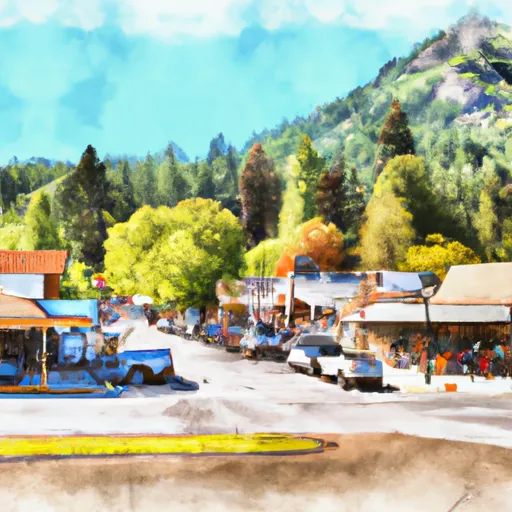
Mazama is a small unincorporated community located in the Methow Valley of north-central Washington. Situated at an elevation of around 2,200 feet, Mazama experiences a continental climate characterized by hot summers and cold winters. Temperatures can range from highs of 90°F (32°C) in summer to lows of 15°F (-9°C) in winter. The area receives an average of 17 inches of precipitation annually, with most falling as snow during the colder months.
Hydrologically, Mazama is surrounded by pristine rivers and streams, including the Methow River, which flows nearby. These water bodies are vital ecosystems supporting various fish species such as trout and salmon, as well as providing recreational opportunities like fishing, swimming, and kayaking.
Mazama is a haven for outdoor enthusiasts, offering a plethora of recreational activities throughout the year. In summer, visitors can enjoy hiking the numerous trails that wind through the surrounding mountains, with breathtaking views of the North Cascades National Park. Mountain biking, horseback riding, and rock climbing are also popular pursuits. During the winter months, Mazama transforms into a winter wonderland, attracting cross-country skiers, snowshoers, and snowmobilers who take advantage of the well-groomed trails and untouched snow-covered landscapes. Overall, Mazama offers a scenic escape for nature lovers and outdoor adventurers seeking a tranquil and thrilling experience in the heart of Washington State.
What is the Eden Index?
The Snoflo Eden Index serves as a comprehensive rating system for regions, evaluating their desirability through a holistic assessment of climate health, outdoor recreation opportunities, and natural disaster risk, acknowledging the profound impact of these factors on livability and well-being.
Climate Health Indicator (CHI): 7.5
Mazama receives approximately
662mm of rain per year,
with humidity levels near 74%
and air temperatures averaging around
6°C.
Mazama has a plant hardyness factor of
5, meaning
plants and agriculture in this region thrive during a short period during spring and early summer. Most
plants will die off during the colder winter months.
By considering the ideal temperature range, reliable water supplies, clean air, and stable seasonal rain or snowpacks, the Climate Health Indicator (CHI) underscores the significance of a healthy climate as the foundation for quality living.
A healthy climate is paramount for ensuring a high quality of life and livability in a region, fostering both physical well-being and environmental harmony. This can be characterized by ideal temperatures, reliable access to water supplies, clean air, and consistent seasonal rain or snowpacks.
Weather Forecast
Streamflow Conditions
Upper Columbia
Area Rivers
Upper Columbia
Snowpack Depths
Upper Columbia
Reservoir Storage Capacity
Upper Columbia
Groundwater Levels
Recreational Opportunity Index (ROI): 5.9
The Recreational Opportunity Index (ROI) recognizes the value of outdoor recreational options, such as parks, hiking trails, camping sites, and fishing spots, while acknowledging that climate plays a pivotal role in ensuring the comfort and consistency of these experiences.
Access to outdoor recreational opportunities, encompassing activities such as parks, hiking, camping, and fishing, is crucial for overall well-being, and the climate plays a pivotal role in enabling and enhancing these experiences, ensuring that individuals can engage in nature-based activities comfortably and consistently.
Camping Areas
| Campground | Campsites | Reservations | Toilets | Showers | Elevation |
|---|---|---|---|---|---|
| Ballard | 7 | 2,526 ft | |||
| Poplar Flat | 21 | 2,985 ft | |||
| Mystery | 5 | 2,812 ft | |||
| Roads End | 4 | 3,710 ft | |||
| Klipchuck | 46 | 2,955 ft | |||
| Early Winters | 14 | 2,196 ft | |||
| Lone Fir | 27 | 3,618 ft | |||
| Purple Point | 7 | 1,193 ft | |||
| Blackpine Lake | 24 | 4,093 ft | |||
| River Bend | 5 | 2,656 ft |
Nearby Ski Areas
Catastrophe Safeguard Index (CSI):
The Catastrophe Safeguard Index (CSI) recognizes that natural disaster risk, encompassing floods, fires, hurricanes, and tornadoes, can drastically affect safety and the overall appeal of an area.
The level of natural disaster risk in a region significantly affects safety and the overall livability, with climate change amplifying these risks by potentially increasing the frequency and intensity of events like floods, fires, hurricanes, and tornadoes, thereby posing substantial challenges to community resilience and well-being.
Community Resilience Indicator (CRI):
The Community Resilience Indicator (CRI) recognizes that education, healthcare, and socioeconomics are crucial to the well-being of a region. The CRI acknowledges the profound impact of these elements on residents' overall quality of life. By evaluating educational resources, healthcare accessibility, and economic inclusivity, the index captures the essential aspects that contribute to a thriving community, fostering resident satisfaction, equity, and social cohesion.