

-
 Snoflo Premium
Get unlimited access to all our content
With no Ad interruptions! - Start Your Free Trial Login with existing account
Methow
Eden Index
Climate
8.2
•
Recreation
3.4
•
Community
•
Safeguard
4.5/10
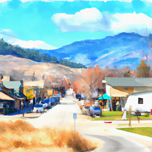
Methow, Washington is a small town located in Okanogan County in the north-central part of the state. It is known for its stunning natural beauty and diverse outdoor recreation opportunities. The climate in Methow is classified as semi-arid, with hot, dry summers and cold winters. The area receives relatively low precipitation, making it ideal for outdoor activities throughout the year.
The Methow River is a prominent hydrological feature in the area, offering ample opportunities for fishing, floating, and kayaking. The river is home to a variety of fish species, including trout and salmon, attracting anglers from near and far. Additionally, there are numerous streams and creeks that flow through the Methow Valley, providing further opportunities for water-based recreation.
Outdoor enthusiasts flock to Methow for its extensive trail system. In the summer, visitors can enjoy hiking and mountain biking on the numerous trails that wind through the surrounding mountains and forests. The Methow Valley is also a popular destination for cross-country skiing and snowshoeing during the winter months, with groomed trails spanning over 120 miles.
Overall, Methow, Washington offers a splendid climate, picturesque waterways, and abundant outdoor recreation opportunities, making it a haven for nature lovers and adventurers alike.
What is the Eden Index?
The Snoflo Eden Index serves as a comprehensive rating system for regions, evaluating their desirability through a holistic assessment of climate health, outdoor recreation opportunities, and natural disaster risk, acknowledging the profound impact of these factors on livability and well-being.
Climate Health Indicator (CHI): 8.2
Methow receives approximately
359mm of rain per year,
with humidity levels near 64%
and air temperatures averaging around
9°C.
Methow has a plant hardyness factor of
6, meaning
plants and agriculture in this region thrive during a short period during spring and early summer. Most
plants will die off during the colder winter months.
By considering the ideal temperature range, reliable water supplies, clean air, and stable seasonal rain or snowpacks, the Climate Health Indicator (CHI) underscores the significance of a healthy climate as the foundation for quality living.
A healthy climate is paramount for ensuring a high quality of life and livability in a region, fostering both physical well-being and environmental harmony. This can be characterized by ideal temperatures, reliable access to water supplies, clean air, and consistent seasonal rain or snowpacks.
Weather Forecast
Streamflow Conditions
Upper Columbia
Area Rivers
Upper Columbia
Snowpack Depths
Upper Columbia
Reservoir Storage Capacity
Upper Columbia
Groundwater Levels
Recreational Opportunity Index (ROI): 3.4
The Recreational Opportunity Index (ROI) recognizes the value of outdoor recreational options, such as parks, hiking trails, camping sites, and fishing spots, while acknowledging that climate plays a pivotal role in ensuring the comfort and consistency of these experiences.
Access to outdoor recreational opportunities, encompassing activities such as parks, hiking, camping, and fishing, is crucial for overall well-being, and the climate plays a pivotal role in enabling and enhancing these experiences, ensuring that individuals can engage in nature-based activities comfortably and consistently.
Camping Areas
| Campground | Campsites | Reservations | Toilets | Showers | Elevation |
|---|---|---|---|---|---|
| Averill - WDFW | None | 1,213 ft | |||
| Foggy Dew | 13 | 2,167 ft | |||
| Ramsey Creek - WDFW | None | 2,957 ft | |||
| Pearrygin Lake State Park | 160 | 1,939 ft | |||
| Campbell Lake - WDFW | None | 2,818 ft | |||
| J R | 6 | 3,878 ft | |||
| Loup Loup | 26 | 4,110 ft | |||
| Bear Creek - WDFW | None | 2,728 ft | |||
| Mitchell Creek | 7 | 1,123 ft | |||
| Lakeshore RV Park | 165 | 1,124 ft |
Nearby Ski Areas
Catastrophe Safeguard Index (CSI):
The Catastrophe Safeguard Index (CSI) recognizes that natural disaster risk, encompassing floods, fires, hurricanes, and tornadoes, can drastically affect safety and the overall appeal of an area.
The level of natural disaster risk in a region significantly affects safety and the overall livability, with climate change amplifying these risks by potentially increasing the frequency and intensity of events like floods, fires, hurricanes, and tornadoes, thereby posing substantial challenges to community resilience and well-being.
Community Resilience Indicator (CRI):
The Community Resilience Indicator (CRI) recognizes that education, healthcare, and socioeconomics are crucial to the well-being of a region. The CRI acknowledges the profound impact of these elements on residents' overall quality of life. By evaluating educational resources, healthcare accessibility, and economic inclusivity, the index captures the essential aspects that contribute to a thriving community, fostering resident satisfaction, equity, and social cohesion.