

-
 Snoflo Premium
Get unlimited access to all our content
With no Ad interruptions! - Start Your Free Trial Login with existing account
Sargents
Eden Index
Climate
5.8
•
Recreation
2.8
•
Community
•
Safeguard
3.3/10
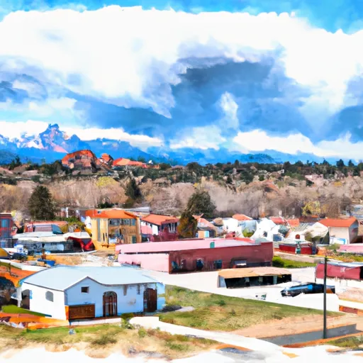
Located in southwestern Colorado, Sargents is a small unincorporated community nestled in a scenic valley at the edge of the Rocky Mountains. The climate in Sargents is classified as subalpine, characterized by mild summers and cold, snowy winters. The average high temperature in summer hovers around 80°F, while winter temperatures often drop below freezing, with significant snowfall.
Sargents is surrounded by an abundant hydrology system, with the Tomichi Creek flowing nearby. This creek is known for its clear waters and offers excellent fishing opportunities for anglers, especially for trout. Additionally, the nearby Gunnison River provides further hydrological diversity and offers activities such as rafting, kayaking, and paddleboarding.
For outdoor enthusiasts, Sargents offers a plethora of recreational opportunities. The region is a haven for hikers and backpackers, with numerous trails winding through the beautiful landscapes of the Gunnison National Forest and the nearby West Elk Wilderness. These areas boast breathtaking vistas, alpine lakes, and diverse wildlife. During the winter, Sargents turns into a winter wonderland, attracting snowshoers, cross-country skiers, and snowmobilers.
In summary, Sargents is a picturesque mountain community with a subalpine climate, featuring mild summers and snowy winters. The area boasts a rich hydrology system, including the Tomichi Creek and the Gunnison River. Outdoor enthusiasts can delight in various activities such as hiking, fishing, rafting, and snow sports amidst the stunning natural surroundings.
What is the Eden Index?
The Snoflo Eden Index serves as a comprehensive rating system for regions, evaluating their desirability through a holistic assessment of climate health, outdoor recreation opportunities, and natural disaster risk, acknowledging the profound impact of these factors on livability and well-being.
Climate Health Indicator (CHI): 5.8
Sargents receives approximately
370mm of rain per year,
with humidity levels near 58%
and air temperatures averaging around
3°C.
Sargents has a plant hardyness factor of
4, meaning
plants and agriculture in this region thrive during a short period during spring and early summer. Most
plants will die off during the colder winter months.
By considering the ideal temperature range, reliable water supplies, clean air, and stable seasonal rain or snowpacks, the Climate Health Indicator (CHI) underscores the significance of a healthy climate as the foundation for quality living.
A healthy climate is paramount for ensuring a high quality of life and livability in a region, fostering both physical well-being and environmental harmony. This can be characterized by ideal temperatures, reliable access to water supplies, clean air, and consistent seasonal rain or snowpacks.
Weather Forecast
Streamflow Conditions
Gunnison
Area Rivers
Gunnison
Snowpack Depths
Gunnison
Reservoir Storage Capacity
Gunnison
Groundwater Levels
Recreational Opportunity Index (ROI): 2.8
The Recreational Opportunity Index (ROI) recognizes the value of outdoor recreational options, such as parks, hiking trails, camping sites, and fishing spots, while acknowledging that climate plays a pivotal role in ensuring the comfort and consistency of these experiences.
Access to outdoor recreational opportunities, encompassing activities such as parks, hiking, camping, and fishing, is crucial for overall well-being, and the climate plays a pivotal role in enabling and enhancing these experiences, ensuring that individuals can engage in nature-based activities comfortably and consistently.
Camping Areas
| Campground | Campsites | Reservations | Toilets | Showers | Elevation |
|---|---|---|---|---|---|
| Lakeview - Twin Lakes | 27 | 9,511 ft | |||
| Rivers End | 15 | 9,356 ft | |||
| Dorchester | 10 | 9,925 ft | |||
| Portal | 5 | 10,576 ft | |||
| Twin Peaks | 37 | 9,615 ft | |||
| Parry Peak | 26 | 9,430 ft | |||
| Collegiate Peaks | 56 | 9,837 ft | |||
| Dexter | 24 | 9,271 ft | |||
| Lakeview - Almont | 35 | 9,556 ft | |||
| White Star | 66 | 9,256 ft |
Nearby Ski Areas
Catastrophe Safeguard Index (CSI):
The Catastrophe Safeguard Index (CSI) recognizes that natural disaster risk, encompassing floods, fires, hurricanes, and tornadoes, can drastically affect safety and the overall appeal of an area.
The level of natural disaster risk in a region significantly affects safety and the overall livability, with climate change amplifying these risks by potentially increasing the frequency and intensity of events like floods, fires, hurricanes, and tornadoes, thereby posing substantial challenges to community resilience and well-being.
Community Resilience Indicator (CRI):
The Community Resilience Indicator (CRI) recognizes that education, healthcare, and socioeconomics are crucial to the well-being of a region. The CRI acknowledges the profound impact of these elements on residents' overall quality of life. By evaluating educational resources, healthcare accessibility, and economic inclusivity, the index captures the essential aspects that contribute to a thriving community, fostering resident satisfaction, equity, and social cohesion.