Headwaters At Outlet Of Lower Canyon Creek Lake To Canyon Creek Trailhead At Ripstein Canyon Creek Trailhead At Ripstein River Run
Community Reviews
Been here? Share the conditions.
Reviews, ratings & photos are added in the free Snoflo iOS app — rate a spot, tag the conditions, and your visit is verified by location. Add or manage your reviews from the app.
Headwaters At Outlet Of Lower Canyon Creek Lake To Canyon Creek Trailhead At Ripstein Canyon Creek Trailhead At Ripstein
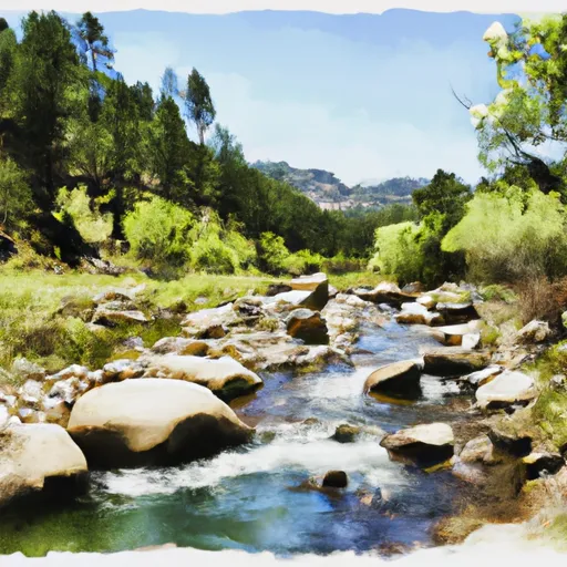
This segment of the river is rated as Class III, with some Class IV rapids, making it suitable for intermediate and advanced paddlers. The total segment mileage is approximately 8 miles, with plenty of opportunities for challenging rapids and obstacles such as boulders and drops.
One of the most challenging rapids on this section of the river is known as "Screaming Left," which includes a steep drop followed by a sharp left turn. Other notable rapids include "The Narrows," "The Squeeze," and "The Chute."
There are specific regulations in place for this area, including a limit of 15 people per group, a requirement for a California Fire Permit, and restrictions on camping and fires. It is important to check with local authorities for the most up-to-date regulations before planning a trip.
Overall, the Whitewater River Run from the Headwaters at Outlet of Lower Canyon Creek Lake to Canyon Creek Trailhead at Ripstein is a thrilling and challenging destination for experienced paddlers. With the right streamflow, it provides a fun and exciting ride with plenty of obstacles and rapids to navigate.
Plan your run down to the hour
Same weather feed Snoflo's iOS app uses -- updated continuously from NOAA / yr.no. Watch the precipitation column on the meteogram; rain ahead of a run typically lifts flows 12-48 hours later depending on the basin.
Next 5 days, hour by hour
Temperature line with weather symbols on top, snow + rain accumulation as columns, humidity as a dotted line.
5-day forecast table
Every 3 hours, broken out across temperature, snow, rain, humidity, and wind. Each cell is colour-coded relative to the column min/max.
| Time | Condition | Temp (°F) | Snow (in) | Rain (in) | Humidity (%) | Wind (mps) | Wind dir |
|---|---|---|---|---|---|---|---|
| Loading detailed forecast… | |||||||
15-day temperature & precipitation
Daily temperatures, snow, and rain projected over the next two weeks -- the upstream story that drives next week's flows.
Regional streamflow levels
USGS streamgauges around Headwaters At Outlet Of Lower Canyon Creek Lake To Canyon Creek Trailhead At Ripstein Canyon Creek Trailhead At Ripstein -- useful for spotting upstream pulses and gauging which tributary is contributing what.
| Streamgauge | Discharge | View |
|---|---|---|
| Nf Trinity R A Helena Ca | 47 cfs | → |
| Trinity R Ab Nf Trinity R Nr Helena Ca | 455 cfs | → |
| Trinity R A Junction City Ca | 494 cfs | → |
| Trinity R Ab Coffee C Nr Trinity Ctr Ca | 26 cfs | → |
| Rush C Nr Lewiston Ca | 2 cfs | → |
| Trinity R A Lewiston Ca | 450 cfs | → |
Plan a longer trip
The closest boat launches, other paddle runs, and campgrounds so a day on the water can grow into a full weekend.
Boat launches
- Pinewood Cove Resort
- Trinity Lake National Recreation Area (Stuart's Fork )
- Cedar Stock Marina
- Trinity Lake National Recreation Area (Clark Springs )
- Granite Peak Road, Trinity Center
- Trinity Lake National Recreation Area (Minersville Campground)
Other river runs
- Canyon Creek Trailhead To Confluence With Mainstream Trinity River
- Confluence Of Tributaries In Sec 6 Near Black Mtn. To Confluence With Blind Horse Creek
- Headwaters In Sw 1/4, Sec 24, T8n, R12w To Trinity Wsr (At Hobo Gulch Trailhead And Campground)
- Confluence With Blind Horse Creek To Cecilville Bridge
- Confluence With Sixmile Creek To Confluence With South Fork Salmon River
Campgrounds
Fishing spots
Whitewater safety
- Check the flow before you run
- Use the linked-gauge card and Regional Flow panel above. Class ratings change with flow -- a Class III at low water can become Class IV+ at high water.
- Know your skill ceiling
- Pick runs comfortably below your ceiling. Cold-water and big-water runs raise the consequences of any mistake.
- Wear the right gear
- Helmet, PFD, drysuit / wetsuit when water is below 60°F. Throw bag, knife, and whistle on your person, not in the boat.
- Scout, set safety, and run with a team
- Scout new rapids on foot, set safety with throw bags above the consequence pool, and run with at least one other competent paddler.
- Respect the river
- Strainers, undercuts, low-head dams, and wood can kill at any class rating. When in doubt, portage.
Set push alerts in the Snoflo app
Save Headwaters At Outlet Of Lower Canyon Creek Lake To Canyon Creek Trailhead At Ripstein Canyon Creek Trailhead At Ripstein as a favorite, set a discharge threshold (e.g. "alert me when flow hits 600 cfs"), and the iOS app pushes the moment the linked gauge crosses.
About Headwaters At Outlet Of Lower Canyon Creek Lake To Canyon Creek Trailhead At Ripstein Canyon Creek Trailhead At Ripstein
What's the optimal flow for Headwaters At Outlet Of Lower Canyon Creek Lake To Canyon Creek Trailhead At Ripstein Canyon Creek Trailhead At Ripstein?
The optimal flow depends on the section and the craft. Check the Run Details panel for the linked gauge and current status.
How fresh is the cfs reading on this page?
The linked USGS streamgauge reports continuously (every 15 minutes); Snoflo refreshes throughout the day. Hover the streamflow sparkline to read individual datapoints.
What's the whitewater class?
See the Run Details panel for the class rating Snoflo tracks for this run. Class ratings change with flow -- a Class III at low water can become Class IV in high water.
Where do I put in / take out?
Tap Directions in the hero above to open driving directions to the put-in. For shuttle planning, check the Nearby Boat Launches panel and the river run operator's site.
Can I get alerts when flows hit the optimal range?
Yes -- alerts are managed in the Snoflo iOS app. Favorite this run, set a discharge threshold, and you'll get a push the moment the gauge crosses.
Other runs near here
Snoflo-tracked paddle runs within driving distance of Headwaters At Outlet Of Lower Canyon Creek Lake To Canyon Creek Trailhead At Ripstein Canyon Creek Trailhead At Ripstein.